About GIST at UT
Geographic Information Science and Technology (GIST) uses the power of location to answer questions and solve problems. GIST combines data management, data science, data visualization, and geography all in one. This GIST program provides a core foundation in spatial thinking, while giving students the practical, hands-on experience to become adept spatial science practitioners across business in public, private, and nonprofit organizations, as well as academic research.
What can I do with a GIST degree?
Across the US and the world, there is a demand for well‐trained GIST professionals that exceeds the supply of graduates in this discipline. Trained individuals in GIST are needed at multiple levels for high-paying jobs, ranging from certified entry‐level technicians (e.g. GIS technician) to mid-level analysts (e.g. Cartographer) to high-level positions (e.g. Remote Sensing Analyst) to senior management (e.g. GIS Project Manager). In Tennessee, local, state, and federal government agencies, as well as various other organizations, seek skilled GIST professionals. According to the US Bureau of Labor Statistics, the median pay of someone with these skills is $81,540/year.
Exploration
The GIST major within the Department of Geography explores a wide range of sub-disciplines including transportation logistics, remote sensing (including satellites and drones) emergency management, urban planning, public health, and resource and environmental management, amongst others.
Skill Aquisition
The GIST program will teach you to bridge the gap between advanced geographic information technology and real-world problems / applications and to use spatial mapping, modeling, and analytics to make informed decisions. Foundational training in spatial, statistical, and mathematical analysis, as well as computer science, spatial data structures, algorithms, and information visualization will occur. The technical skills needed to retrieve and cleanse big spatial data for real-world applications will also be taught. You will learn to start by understanding the question at hand, then using it to look for data relevant to the issue. Additionally, you will learn the skills necessary to prepare and display data as you model, analyze, and evaluate the issue at hand. You will conclude your time in the GIST program with either a capstone project or an internship, which will demonstrate to potential employers that you are more than capable of following the process of utilizing geospatial science in a real-world setting!
AVAILABLE PROGRAMS
Geography Major, BA – Geospatial Science and Technology Concentration
The Geospatial Science and Technology concentration provides a practical understanding of GIS technology and its application in various fields, such as natural resource management, marketing, disaster response, social welfare, etc. Students explore a range of GIS topics and gain hands-on experience in this concentration. The Geospatial Science and Technology concentration will help Geography majors pursue jobs in many different career paths that require more technical expertise.
Geographic Information Science and Technology, BS
The GIST major explores a wide range of sub-disciplines including transportation logistics, remote sensing (including satellites and drones) emergency management, urban planning, public health, and resource and environmental management, among others. The GIST program will teach students to use spatial mapping, modeling, and analytics to make informed decisions. Foundational training in spatial, statistical, and mathematical analysis, as well as computer science, spatial data structures, algorithms, and information visualization will occur. The technical skills needed to retrieve and cleanse big spatial data for real-world applications will also be taught. Additionally, students learn the skills to prepare and display data to model, analyze, and evaluate issues at hand.
Geographic Information Science and Technology Minor
Geographic Information Science Minors develop knowledge of geographic data processing, analysis, and visualization skills to complement their chosen Major discipline. Students learn to analyze and visualize spatial data and develop skills that can be applied to the development, understanding and processing of spatial data. The GIScience minor can improve job prospects and widen students’ intellectual and professional development.
“The thing that stuck out…is how dynamic GIS knowledge and capabilities can be. I was able to fuse two of my passions, GIS and sports, to create a meaningful resource for the [UT Center for Sport, Peace and Society]…Dr. Tran and Michael Campanovo consistently provided advice and guidance.”
—Veronica Allen
GIS Outreach and Engagement Laboratory
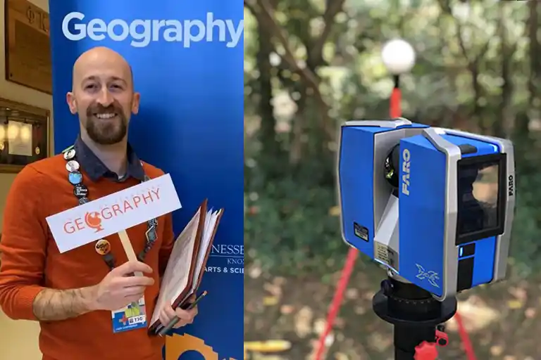
Michael Camponovo is Director of GIST Program and manages the GIS Outreach and Engagement Laboratory. This lab promotes GIS and geospatial technologies and encourages people to pursue a career in geography. Contact the lab if you want to know how GIS and geospatial analysis can help you, or provide training opportunities or student internship experience for your organization.
GIST Faculty

Nicholas Nagle
Professor and Department Head
Specialties: Spatial statistics, spatial data science and demography.

Melissa Hinten
Senior Lecturer and Director of Sustainability Program
Specialties: Biogeography, land use and land cover change, GIS, geography education.

Liem Tran
Professor and Associate Dean for Academic Programs
Specialties: Physical and environmental geography; spatial data science; GIS/geospatial analysis; decision-making science (focus on human-environment interactions); artificial intelligence techniques.

Dingfan Xing
PostDoc Research Associate
Specialties: Applied Statistics; Area Estimation; Environmental Sampling; Uncertainty

Hannah Herrero
Assistant Professor
Specialties: Remote Sensing, Human-Environment Interactions, Conservation, Savanna Science, Africa, Land Change Science, Physical Geography

Devyn Kelly
Lecturer
Specialties: Queer Geographies, GIS, Geographies of the American South.

Hyun Kim
Professor
Specialties: Transportation, Telecommunications, GIS, Spatial Data Science, Spatial Optimization and Modeling
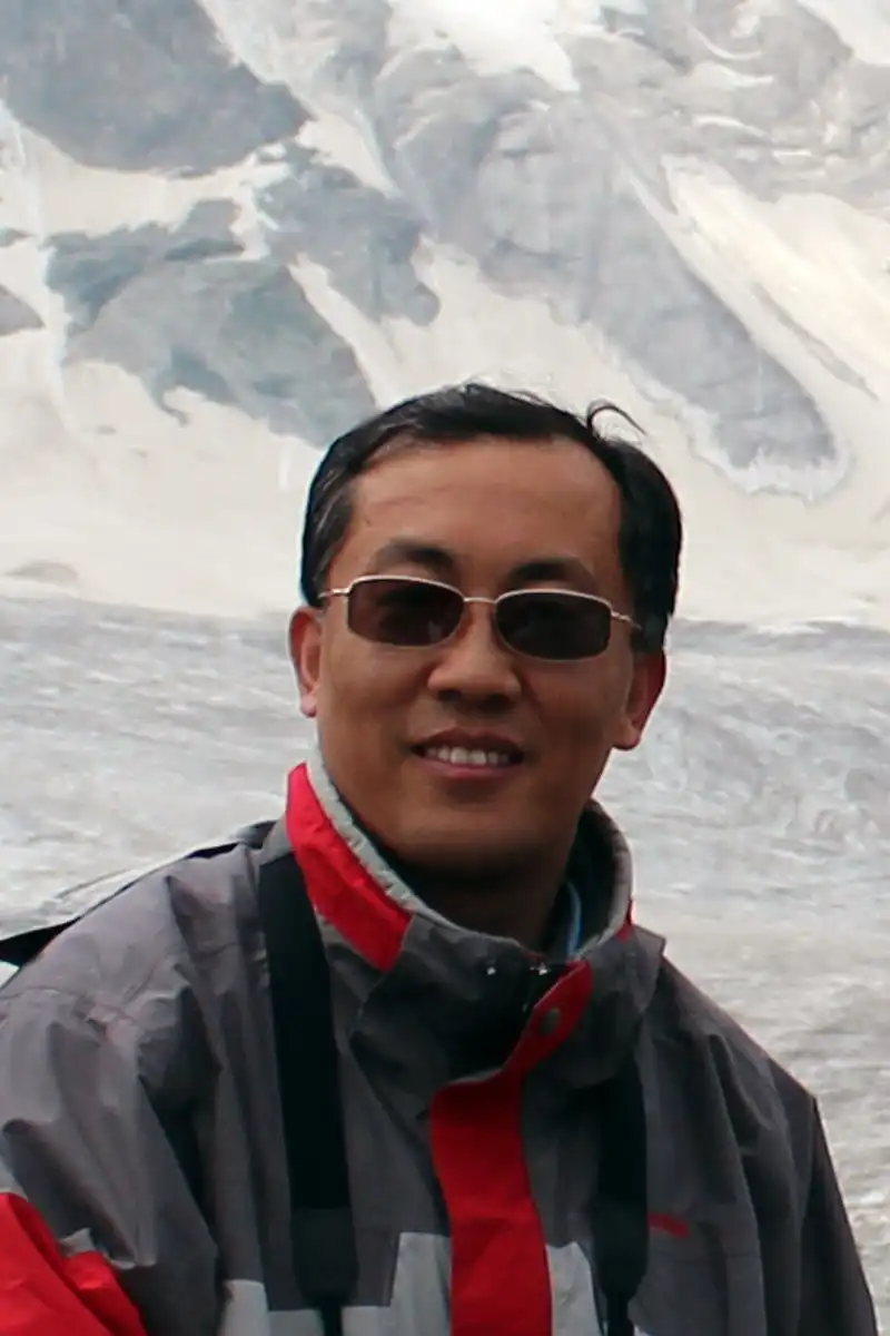
Yingkui Li
Professor
Specialties: Geomorphology and paleo-climate reconstruction, Cosmogenic nuclides, LiDAR, GIS/spatial analysis, Tibetan Plateau and Tian Shan

Mayra Román-Rivera
Lecturer
Specialties: Coastal Geomorphology, Coastal Management, Remote Sensing and GIS Applications of Coastal Environments

Shih-Lung Shaw
Professor
Specialties: Transportation, geographic information science, space-time analytics, human dynamics, spatial data science.

Qiusheng Wu
Associate Professor
Specialties: Geographic Information Science, Remote Sensing, LiDAR, Wetland Hydrology, Spatial Data Science, Cloud Computing
Publication Board
International Journal of Geographical Information Science
Yin, L., Shaw, S-L., Wang, D., Carr, E., Berry, M., Gross, L. and Comiskey, J. 2012. A framework of integrating GIS and parallel computing for spatial control problems – a case study of wildfire control. International Journal of Geographical Information Science 26(4), 621-641.
International Journal of Geographical Information Science
Fang, Z., Tu, W., Li, Q., Shaw, S-L, Chen, S. and Chen, B., 2013. A Voronoi neighborhood based search heuristic for distance/capacity constrained very large vehicle routing problems. International Journal of Geographical Information Science 27(4), 741-764.
Journal of Cleaner Production
Ryerson, M. S, Kim, H. 2014. The impact of airline mergers and hub reorganization on aviation fuel consumption. Journal of Cleaner Production (doi: 10.1016/j.jclepro.2013.12.032).
International Journal of Applied Geospatial Research
Kim, C, Kim, H. 2013. Spatial-temporal analysis of recent air passenger flows. International Journal of Applied Geospatial Research 4(4), 37-57.
Journal of Transport Geography
Ryerson, M, Kim, H. 2013. Integrating airline operational practices into passenger airline hub definition. Journal of Transport Geography, 84-93 (doi: 10.1016/j.jtrangeo.2013.05.013).
Journal of Coastal Research
Feagin, R.A., Williams, A.M., Popescu, S., Stukey, J., and R.A. Washington-Allen. 2012. The use of Terrestrial Lidar Scanning (TLS) in dune ecosystems: The lessons learned. Journal of Coastal Research DOI: 10.2112/JCOASTRES-D-11-00223.1.
Ecology and Society
Washington-Allen, R. A., R. D. Ramsey, N. E. West, and B. E. Norton. 2008. Quantification of the ecological resilience of drylands using digital remote sensing. Ecology and Society 13(1), 33.
Cartography and Geographic Information Science
Stefan, L., Buttenfield, B.P., Nagle, N.N., Stum, A., 2013. Establishing Relationships Between Parcel Data and Landcover for Demographic Small Area Estimation. Cartography and Geographic Information Science. Available online at http://www.tandfonline.com/doi/abs/10.1080/15230406.2013.782682#.UbnMheuBRUM
Geographical Analysis
Nagle, N.N., Sweeney, S.H., Kyriakidis, P.C., 2011. A geostatistical linear regression model for small area data. Geographical Analysis. 43(1), 38-60.