• Request Info
  • Visit
  • Apply
  • Give
  • Request More Info
  • Visit
  • Apply
  • Give

Search

  • A-Z Index
  • Map

Geography and Sustainability

  • About
    • Facilities
    • Alumni
    • Research & Community Partners
    • Geographic Links
  • Areas of Study
    • Physical Geography
    • GIST
    • Human Geography
    • Sustainability
  • People
    • Faculty
    • Staff
    • Graduate Students
    • Adjunct & Affliated Faculty
    • Alumni
    • Emeritus
  • Undergraduate
    • Where Can a Geography Degree Take You?
    • Majors
    • Minors
    • Certificates
    • Advising
    • Forms
    • Apply
  • Graduate
    • MS Program
    • PhD Program
    • Apply
    • Graduate Handbook
    • Forms
  • Student Engagement
    • Clubs
    • Community Engagement
    • Awards
    • Internship and Employment
    • Study Abroad
  • News & Events
    • Statements
    • Share Your News
    • Newsletters
    • News
    • Events
    • Geography Awareness Week
    • GeoSym
topography background

News

Human Geography

A family sitting outside and talking

The Conversation: ‘Trump moves to gut low-income energy assistance as summer heat descends and electricity prices rise’

May 14, 2025

Cities like Houston get high humidity in addition to the heat, making summer almost unbearable without cooling. Brandon Bell/Getty Images
Conor Harrison, University of South Carolina; Elena Louder, University of South Carolina; Nikki Luke, University of Tennessee, and Shelley Welton, University of Pennsylvania

The U.S. is headed into what forecasters expect to be one of the hottest summers on record, and millions of people across the country will struggle to pay their power bills as temperatures and energy costs rise.

A 2023 national survey found that nearly 1 in 4 Americans were unable to pay their full energy bill for at least one month, and nearly 1 in 4 reported that they kept their homes at unsafe temperatures to save money. By 2025, updated polling indicated nearly 3 in 4 Americans are worried about rising energy costs.

Conservative estimates suggest that utilities shut off power to over 3 million U.S. households each year because the residents cannot pay their bills.

This problem of high energy prices isn’t lost on the Trump administration.

On the first day of his second term in 2025, President Donald Trump declared a national energy emergency by executive order, saying that “high energy prices … devastate Americans, particularly those living on low- and fixed incomes.”

Secretary of Energy Christopher Wright raised concerns about utility disconnections and outlined a mission to “shrink that number, with the target of zero.”

Yet, the administration’s 2026 budget proposal zeros out funding for the Low Income Home Energy Assistance Program, or LIHEAP, the federal program that administers funding to help low-income households pay their utility bills. And on April 1, 2025, the administration laid off the entire staff of the LIHEAP office.

A billboard in Phoenix reads 118 degrees at 5:13 p.m. on July 19, 2023.
During the hottest periods, even nighttime temperatures might not drop below 90 in Phoenix. Without air conditioning, homes can become dangerously hot. Patrick T. Fallon/AFP via Getty Images

Many people already struggle to cobble together enough help from various sources to pay their power bills. As researchers who study energy insecurity, we believe gutting the federal office responsible for administering energy bill assistance will make it even harder for Americans to make ends meet.

The high stakes of energy affordability

We work with communities in South Carolina and Tennessee where many residents struggle to heat and cool their homes.

We see how high energy prices force people to make dangerous trade-offs. Low-income households often find themselves choosing whether to buy necessities, pay for child care or pay their utility bills.

One elderly person we spoke with for our research, Sarah, explained that she routinely forgoes buying medications in order to pay her utility bill. Another research participant who connects low-income families to energy bill assistance in Tennessee said: “I’ve gone into these homes, and it’s so hot. Your eyes roll in the back of your head. It’s like you can’t breathe. How do you sit in here? It’s just unreal.”

Unfortunately, these stories are increasingly common, especially in low-income communities and communities of color.

Electricity prices are predicted to rise with worsening climate change: More frequent heat waves and extreme weather events drive up demand and put pressure on the grid. Furthermore, rising energy demand from data centers – supercharged by the increasing energy use by artificial intelligence – is accelerating price increases.

Shrinking resources for assistance

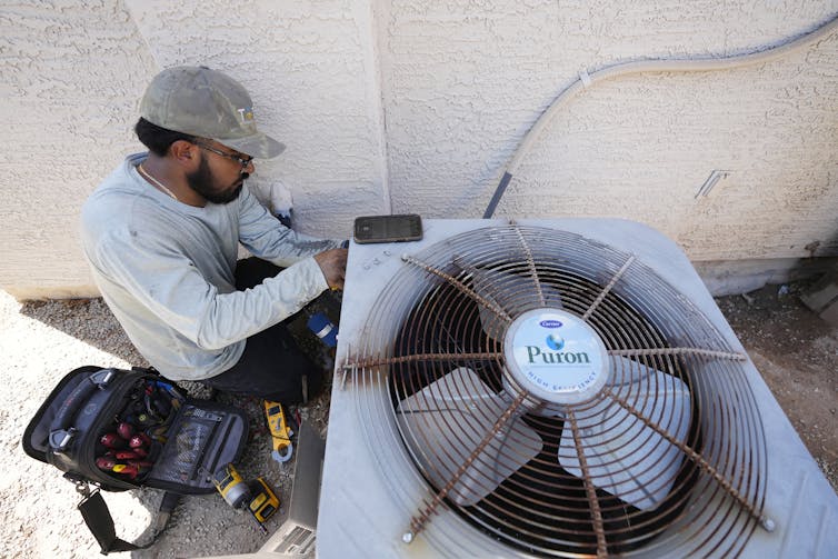
LIHEAP, created in 1981, provides funding to states as block grants to help low-income families pay their utility bills. In fiscal year 2023, the program distributed US$6.1 billion in energy assistance, helping some 5.9 million households avoid losing power connections.

The program’s small staff played critical roles in disbursing this money, providing implementation guidelines, monitoring state-level fund management and tracking and evaluating program effectiveness.

People wait in a line going around a building. Some have umbrellas.
A long line of utility customers wait to apply for help from the Low-Income Energy Assistance Program in Trenton, N.J., in 2011. In 2023, around 6 million households benefited from LIHEAP. AP Photo/Mel Evans

LIHEAP has historically prioritized heating assistance in cold-weather states over cooling assistance in warmer states. However, recent research shows a need to revisit the allocation formula to address the increasing need for air conditioning. The layoffs removed staff who could direct this work.

It is unlikely that other sources of funding can fill in the gaps if states do not receive LIHEAP funds from the federal government. The program’s funding has never been high enough to meet the need. In 2020, LIHEAP provided assistance to just 16% of eligible households.

Our research has found that, in practice, many households rely on a range of local nonprofits, faith-based organizations and informal networks of family and friends to help them pay their bills and keep the power on.

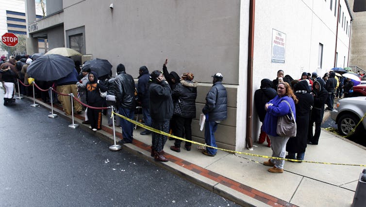
For example, a research participant named Deborah reported that when faced with a utility shut-off, she “drove from church to church to church” in search of assistance. United Way in South Carolina received over 16,000 calls from people seeking help to pay their utility bills in 2023.

These charitable services are an important lifeline for many, especially in the communities we study in the South. However, research has shown that faith-based programs do not have the reach of public programs.

Without LIHEAP, the limited funds provided by nonprofits and the personal connections that people patch together will be stretched even thinner, especially as other charitable services, such as food banks, also face funding cuts.

What’s ahead

The $4.1 billion that Congress allocated to LIHEAP for the 2025 fiscal year, which ends Sept. 30, has already been disbursed. Going forward, however, cuts to LIHEAP staff affect its ability to respond to growing need. Congress now has to decide if it will kill the program’s future funding as well.

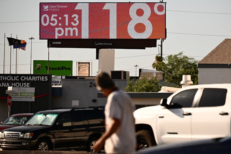
Maricopa County in Arizona, home to Phoenix, illustrates what’s at stake. Annual heat-related deaths have risen 1,000% there in the past decade, from 61 to 602. Hundreds of these deaths occurred indoors.

A workman fixes an air conditioning unit
Cooling becomes essential during Arizona’s extreme summers. Maricopa County, home to Phoenix, reported more than 600 heat-related deaths in 2024. AP Photo/Ross D. Franklin

We believe gutting LIHEAP puts the goal of energy affordability for all Americans – and Americans’ lives – in jeopardy. Until more affordable energy sources, such as solar and wind power, can be scaled up, an expansion of federal assistance programs is needed, not a contraction.

Increasing the reach and funding of LIHEAP is one option. Making home weatherization programs more effective is another.

Governments could also require utilities to forgive past-due bills and end utility shut-offs during the hottest and coldest months. About two dozen states currently have rules to prevent shut-offs during the worst summer heat.

For now, the cuts mean more pressure on nonprofits, faith-based organizations and informal networks. Looking ahead to another exceptionally hot summer, we can only hope that cuts to LIHEAP staff don’t foreshadow a growing yet preventable death toll.

Etienne Toussaint, a law professor at the University of South Carolina, and Ann Eisenberg, a law professor at West Virginia University, contributed to this article.The Conversation

Conor Harrison, Associate Professor of Economic Geography, University of South Carolina; Elena Louder, Postdoctoral Researcher in Geography, University of South Carolina; Nikki Luke, Assistant Professor of Human Geography, University of Tennessee, and Shelley Welton, Professor of Law and Energy Policy, University of Pennsylvania

This article is republished from The Conversation under a Creative Commons license. Read the original article.

Filed Under: Department News, Featured News, Human Geography

Torchbearer statue

Derek Alderman in ‘The Conversation’: Offensive names dot the American street map − a new app provides a way to track them

August 16, 2024

Clear County, Colo., had three roads using the word ‘sq—’ until May 2024, when officials renamed them. Tom Hellauer/Denver Gazette
Derek H. Alderman, University of Tennessee; Daniel Oto-Peralías, Universidad Pablo de Olavide, and Joshua F.J. Inwood, Penn State

The racially motivated tragedy in Charleston, South Carolina, in 2015, when a white supremacist murdered nine Black worshippers, and the deadly white nationalist rally in Charlottesville, Virginia, two years later compelled Americans to confront the role played by memorials, monuments and other symbols in glorifying racist ideologies.

George Floyd’s murder at the hands of a white Minneapolis police officer in 2020 only lent urgency to that challenge.

Part of the racial reckoning in the wake of Floyd’s death is a movement to remove offensive names from public places. Some names perpetuate demeaning slurs and stereotypes against people of color. Others honor historical figures linked to racism and colonization. This movement is what we geographers call America’s “renaming moment.”

Government officials, activists and other people have called for a renaming of certain places and institutions. Examples include removing Christopher Columbus’ name from a Chicago public school and erasing the name of former KKK leader and governor Bibb Graves from a University of Alabama building. The elimination of names of Confederate generals from several U.S. military bases provides another example.

These changes have become flash points of community activism and debate, both in support of and in resistance to name revisions.

A widespread element in this renaming moment are offensive street names. We believe discussions and decisions about removing these names may benefit from comprehensive sources of information that allow the public to know how pervasive a problem the country might be confronting.

The recent release of an app developed by STNAMES LAB, an international team of scholars of place names, allows users to conduct nationwide inventories of discriminatory roadway names, revealing how often and where they are found.

We believe the app is an important educational tool. It will help communities understand how discriminatory beliefs are woven into everyday spaces and the harm caused by offensive names.

After tracking a few of America’s most contested place and institution names, we believe the app will help people see the changes necessary to recognize and repair past wrongs in street naming.

Recognizing that names can harm and heal

There is growing public recognition that place names are not neutral identifiers of locations. Rather, place names can transmit harmful messages that misrepresent the history and identity of minority communities. As a result, they work against the possibility of a more equal society.

One highly publicized effort at identifying and replacing offensive place names happened in November 2021.

U.S. Interior Secretary Deb Haaland, the first Native American to hold that post, ordered the removal of the word “squaw,” hereafter called “sq—,” from the names of 650 mountains, rivers and other sites on federal lands. Haaland’s order capped many years of demands from Native American groups to eradicate the racist and sexist label.

Then, in 2022, Haaland established the Advisory Committee on Reconciliation in Place Names, comprising members from tribal nations, Native Hawaiian organizations and scholars. Its guiding principles call on the U.S. to recognize the historical role of racism and sexism in naming places. They also highlight how those in power have used names to disrespect, misrepresent and control certain groups that have been historically discriminated against.

Drawing from public comments over two years, the committee found that derogatory place names are a source of recurring trauma for groups that have been historically discriminated against. As one Native American community leader told the committee, “Names matter, as they can build or break a relationship with the land and have the power to uplift or marginalize communities.”

Similarly, a 2022 report by the National Association of Tribal Historic Preservation Officers and the Wilderness Society found derogatory place names can create an unwelcoming environment that some people avoid. Additionally, a 2022 study by Emory University found that homes on streets named for pro-slavery Confederate figures sell for less and take longer to sell than comparable houses on nearby roads.

Renaming roads serves as an important moment of community reconciliation. That’s because the frequent use of offensive street names exacts a hefty social and psychological toll on marginalized communities, according to the cultural historian Deirdre Mask.

When hurtful names are removed from roads, some members of oppressed communities describe how the spirit or feeling of places can change and allow healing to begin.

The difference an audit makes

The Interior Department committee suggests that efforts to change offensive names should be driven by research. It encourages local residents to identify where derogatory place names exist, when and how they were named, and how those names can harm the well-being of community members.

Data scientist Catherine D’Ignazio and her team at the Data + Feminism Lab agree. They call for conducting audits that collect and visualize data on unjust names, to challenge the damaging effects and abuses of power behind these symbols.

The newly released street names app from STNAMES LAB allows people to do that. Fed with Open Street Map data, it lets users carry out queries, as well as map and download streets containing certain terms.

Once users enter a name, they can check the specific location of named roads on a map. They can also download query results as a spreadsheet to get the full list of streets.

The app offers an easy visualization of the frequency and geographic distribution of names. You can see whether the name is found across the nation or concentrated in a specific region.

Demonstrating the app

To illustrate the app’s capabilities, we searched for names that have sparked public controversy.

Federal condemnation of “sq—” as a place name does not mean that local authorities will follow suit, even if some cities and states are already doing so. We found 429 streets scattered across 47 states with a name containing the word “sq—.”

Although “sq—” originated in the Algonquian language, European settlers corrupted and misused the word in reducing Native American women to a simplistic and sexualized image. Being called “sq—” is still a painful daily reality for Indigenous women. Many of them say the term injures their self-image and sense of belonging.

Map of offensive street names in the U.S.
Map of U.S. roads named ‘sq—’ from the street names app. https://en.stnameslab.com/the-project/

The street name app exposes other racist Native American stereotypes. Variations of “redman/men” and “redskin” appear on 211 roads.

“Redskin” is a portrayal of Native Americans as warlike and dangerous. According to Native writer Angelina Newsome, colonialists often used it interchangeably with “savage.”

We found 415 roads in 46 states using the word “savage” in their name.

Though references to “redman” and “redskin” have long shown up in consumer products and sports team mascots, many Native groups challenge these stereotypes as demeaning.

Map of offensive street signs in U.S.
Map of roads named ‘redman,’ ‘redmen’ or ‘redskin’ from the street names app. https://en.stnameslab.com/the-project/

Searching for offensive street names across the country is about more than simply collecting information. Data and maps can be part of the process of expanding one’s sphere of awareness and caring for people living with unjust naming practices.

Tracking and visualizing these inequalities is key to developing the “civic imagination” that scholar Catherine D’Ignazio believes is necessary to imagine and call for more inclusive alternatives to the current American landscape of names.

What is at stake is not just removing insulting names in and of themselves, but ensuring that the places marked by these names feel more welcoming and respectful of all Americans.The Conversation

Derek H. Alderman, Professor of Geography, University of Tennessee; Daniel Oto-Peralías, Associate Professor of Economics, Profesor Titular de Economía, Universidad Pablo de Olavide, and Joshua F.J. Inwood, Professor of Geography and Senior Research Associate in the Rock Ethics Institute, Penn State

This article is republished from The Conversation under a Creative Commons license. Read the original article.

Filed Under: Department News, Featured News, Human Geography

A man standing on steps with a megaphone with a sign beside him with the text Hind Hall on it

Derek Alderman in ‘The Conversation’: “The renaming of universities and campus buildings reflects changing attitudes and values”

June 21, 2024

A student protester with a banner reading ‘Hind Hall’ at a Harvard University building. Student protesters at several universities have unofficially renamed campus buildings in response to the war in Gaza. (Frank S. Zhou/The Harvard Crimson)
Reuben Rose-Redwood, University of Victoria; CindyAnn Rose-Redwood, University of Victoria, and Derek H. Alderman, University of Tennessee

As protests have swept across university campuses calling on higher education institutions to break ties with Israel over the war in Gaza, one tactic that protesters used to raise awareness of the war’s devastating human cost has been renaming campus buildings.

When protesters occupied Hamilton Hall at Columbia University in April, they displayed a banner renaming the building “Hind’s Hall,” which is also referenced in rapper Macklemore’s protest song of the same name. This name recognizes Hind Rajab, a Palestinian child whose story went viral after her killing in Gaza. Israel denied responsibility, but the death sparked international outcry after Palestinian paramedics released audio of a desperate phone call as gunfire erupted.

Student protesters at Harvard University, the University of California at Berkeley, McGill University and the University of Melbourne also unofficially renamed campus buildings in response to the war in Gaza.

These fleeting symbolic name changes follow years of campus renaming efforts. Students have led many of these movements calling on universities to permanently rename places and remove monuments honouring racist historical figures.

CBC News video about the renaming of the former Ryerson University to Toronto Metropolitan University.

Many universities have developed policies to govern the place naming process on their campuses.

In a recent study, our research team examined naming policies at 620 liberal arts colleges and universities in Canada and the United States.

How inclusive are university naming policies?

Place names and other memorials contribute to the making of a campus’s cultural landscape. As elements of daily campus life, they are part of the “hidden curriculum” that expresses and teaches the values of the university community beyond the confines of the classroom.

To assess how inclusive university naming policies are, we considered several key metrics: faculty and student representation, public consultation and any reference to “diversity” (however defined) in naming policies.

Our study found that 19 per cent of university naming committees include a faculty representative and only 11 per cent have a student representative.

However, faculty and student representation are more prevalent at Canadian universities than their U.S. counterparts.

We calculated that half of all Canadian universities with naming policies have faculty representation on their naming committees, compared to only 16 per cent of U.S. higher education institutions. Student representation on naming committees is also higher in Canada (21 per cent) than the U.S. (10 per cent).

Additionally, our research findings indicate that five per cent of university naming policies mention public consultation (18 per cent in Canada and four per cent in the U.S.).

The proportion is even lower for naming policies that refer to “diversity” broadly conceived (two per cent total, with three per cent in Canada and two per cent in the U.S.). An example of such a diversity statement can be found in the naming policy at California State University at East Bay. One of its naming principles is “the desirability of achieving over the long run a pattern of names that will reflect the ethnic and gender diversity” in the broader society.

Racial and gender imbalances in campus names

Few universities have adopted a systemic approach to place naming that strives for diversity in the pattern of names on campus. Instead, name changes are commonly considered on a case-by-case basis to recognize wealthy donors or past university presidents, most of whom are white men.

These conventional approaches to place naming have resulted in significant racial and gender imbalances in the names on university campuses. Addressing these imbalances is an important action that universities can take to create more inclusive campus environments.

In many cases, students have led the way in pressing for change. By 2020, our study found that naming controversies were documented at 165 universities in Canada and the U.S., and this number has continued to grow.

Some universities have updated their naming policies in light of recent controversies and to repair relationships with Indigenous communities.

More inclusive naming policies needed

University naming policies play an important role in the process of campus place naming. However, many naming policies have proved inadequate to address the challenges posed by systemic inequalities in campus place names.

Here we propose three key recommendations to inform best practices for university naming policies.

Recommendation 1: University naming policies should ensure that key stakeholders – such as faculty and students – have formal representation on university naming committees.

Recommendation 2: Meaningful opportunities for public consultation should be incorporated into the campus place naming process.

Recommendation 3: University naming committees should conduct campus place name audits and develop systemic approaches to reviewing how individual naming proposals relate to the broader campus “namescape.”

These recommendations can help university leaders become more responsive to the needs of university communities. Treating place names as meaningful symbols can foster a sense of belonging in contrast to primarily viewing naming rights as assets to be exchanged for donor support.

If universities are truly committed to creating inclusive campus environments, developing policy frameworks that work toward addressing systemic imbalances in the campus landscape is a step in the right direction.The Conversation

Reuben Rose-Redwood, Professor of Geography and Associate Dean Academic, Faculty of Social Sciences, University of Victoria; CindyAnn Rose-Redwood, Associate Teaching Professor, Geography, University of Victoria, and Derek H. Alderman, Professor of Geography, University of Tennessee

This article is republished from The Conversation under a Creative Commons license. Read the original article.

Filed Under: Department News, Human Geography

Two men smiling by a conference booth with the UT Geography & Sustainability department name on it

UT Geographers Put GIS on the Map at Statewide Meeting

June 4, 2024

UT Department of Geography and Sustainability faculty, students, and staff represented Vol geography in a huge way at the annual Tennessee Geographic Information Council (TNGIC) Conference for geospatial professionals April 9–11, 2024, at Montgomery Bell State Park, in Burns, Tennessee, west of Nashville. 

Michael Camponovo, director of both UT’s GIS outreach and the GIST Program, was conference chair. A host of Vol geographers led workshops, gave presentations, and earned awards during the conference.

“As a student, TNGIC gave me the opportunity to create and share maps, give presentations, and build the professional network that eventually led to my job here at UT,” said Camponovo. “As a GIS professional, I want my students and alumni to have these same opportunities to launch their careers. That’s why I’m so passionate about getting involved with TNGIC.”

The TNGIC works to improve connections among agencies working with geographic information systems (GIS) in Tennessee. Their annual conference offers opportunities for GIS professionals and students to network, learn, and share their work and new ideas in the field. Keynote addresses at the conference were delivered by Budhendra Bhaduri, director of the Geospatial Science and Human Security Division at Oak Ridge National Laboratory, and Nikolas Smilovsky, geospatial solutions director at Bad Elf, a global navigation satellite systems company.

Budhu Bhaduri, Director of the Geospatial Science and Human Security Division of ORNL, gives a keynote on GeoAI. Photo by Michael Camponovo.
Qiusheng Wu presents his research as part of the open source special interest group. Photo by Mayra Roman-Rivera.

Associate Professor Qiusheng Wu led a workshop focused on cloud computing with Google Earth Engine and Geemap and presented with the FOSS (open-source GIS) community on Leafmap and data visualization. Wu also organized the inaugural TNView Remote Sensing Presentation Contest for students.

Lecturer Mayra Roman-Rivera and Professor Derek Alderman shared the work their students are doing as part of the GEOG 420—GIS in the Community class.

UT’s GIS Lab Manager Tim Kane volunteered with the UT cemetery mapping team to collect terrestrial lidar as part of a service project at Montgomery Bell State Park.

Student Caroline Petersen earned first place in the conference mapping contest, best analysis category, for her research using MaxEnt for pollinator prediction in Davidson County. She and fellow Vol Josiah Cubol were selected to join the TNGIC Outreach committee.

Emma Blanks and her team from GEOG 420 earned the Viewer’s Choice award in the map gallery for their work on the revised Tennessee Atlas. Blanks also gave a presentation highlighting how she and her team used ESRI’s Experience Builder to create the interactive Tennessee Atlas.

Mahnaz Meem won third place in the inaugural TNView Student Remote Sensing Presentation Contest. Cam Corsino presented a fascinating, in-depth storymap focusing on Knoxville’s Red Summer.

In a less GIS-specific activity at the conference, Ben Pedersen and recent alumnus Robby Lape won first place out of 32 teams at the 2024 cornhole tournament. They took home brand new cornhole boards as prizes.

“I hope anyone interested in learning more about GIS and geospatial technology will join us for future TNGIC events,” said Camponovo. “It’s a great way to learn about new technologies and workflows, meet alumni and network, and learn about jobs. Between presenting, submitting maps and posters, leading workshops, serving as business partners, and more, there are many ways for students and alumni to engage with the organization.”

Interested geographers can participate in the free, one-day East Regional Fall Forum in Johnson City (ETSU) on Tuesday October 15, 2024. The next annual meeting will be at the Embassy Suites in Murfreesboro April 15–17, 2025.

The geography department thanks the dozens of Vol alumni who attended the conference and made current students feel welcome within the organization:

  • Danielle (Dami) McClanahan organized the cornhole tournament and was elected to the TNGIC board of directors.
  • Tracy Homer shared her expertise with the FOSS community on creating art from digital mapping products.
  • Caitlyn Mills presented her work with Stantec for the Tennessee Department of Transportation.
  • Paul Dudley served as the TNGIC president over the last year and presented on his project of mapping all the trails in Tennessee. He was also instrumental in organizing our very first “Nerf war.”
  • Kurt Butefish of the Tennessee Geographic Alliance provided an update on K–12 geography education in Tennessee and was a business partner for the conference.
  • Danielle McClanahan, Caitlyn Mills, and Bass Neal from Stantec were also business partners at this year’s conference.
  • Tracy Homer designed and created the Tennessee Rivers laser cut map that was the grand prize for our door prizes.
  • Sam McCloud, Caelan Evans, and Danielle McClanahan were instrumental in organizing the conference.
Two men smiling by a conference booth with the UT Geography & Sustainability department name on it
Recent alumni Will Nelson (left) and Robby Lape (right) at the UT Department of Geography and Sustainability table. Photo by Mayra Roman-Rivera.

Filed Under: Department News, Featured News, Human Geography, Physical Geography

Overhead view of a city

The Conversation: ‘Excessively high rents are a major burden for immigrants in US cities’

March 26, 2024

Nashville is one of the fastest-growing U.S. cities and increasingly a destination for immigrants. Joe Sohm/Visions of America/Universal Images Group via Getty Images
Madhuri Sharma, University of Tennessee and Mikhail Samarin, University of Tennessee

Rents across the U.S. have climbed to staggering levels in recent years. Millions of renters spend more than 30% of their income on rent and utilities, a situation that housing experts call being cost burdened.

High rents affect almost all segments of the population but are an especially heavy burden for immigrants, particularly those who have not yet become U.S. citizens. Immigrants, both documented and undocumented, play important roles in the U.S. economy. They often provide the cheapest labor in the riskiest of industries. Yet they are still not broadly accepted or supported in many U.S. cities.

We are geographers who study housing market issues, including racial-ethnic diversity and housing affordability. Our research on Nashville, which has emerged as an immigrant metropolis in the Southern U.S., suggests that foreign-born residents who are not yet citizens are far more burdened by high rents than other groups.

Many immigrant workers in Nashville spend more than 50% of their incomes on rent. This makes it hard for them to afford education and job training, healthy food, health care and other necessities that can help them participate as productive residents. Heavy rent burdens undermine their ability to have a higher standard of living and to be included in mainstream society.

As immigrants increasingly fan out across the U.S., we believe cities receiving new foreign-born residents should anticipate a growing need for affordable housing.

A 2022 study found that immigrant families in San Diego faced some of the highest rent burdens in the surrounding county.

Hard times for renters

The past 15 years have been challenging for renters across the country. In the 2008-09 recession, which was triggered by a collapse in the housing market, millions lost their homes to foreclosure and became renters. Tighter financing made it harder for others to buy homes. By 2015, almost 43 million households had been pushed into renting.

Today about 37% of U.S. homes are occupied by renters. By 2020, almost 46% of U.S. renters paid more than 30% of their household income toward rent. As of June 2021, the median monthly rent in the 50 largest U.S. cities was $1,575 – an 8.1% increase from June 2020.

The heaviest rent burdens fall disproportionately on minorities. Almost 46% of African American-led renter households are rent burdened, compared with 34% of white households.

The COVID-19 pandemic worsened housing insecurity for people of color because of longstanding racially targeted policies and widespread health and economic disparities. Renters of color faced higher cost burdens and eviction rates. In Nashville, this was especially true in Latino and Somali communities.

Why immigrant housing matters

Immigration is the main driver of population growth in the U.S., which is important for filling jobs and boosting tax revenues. After dipping because of pandemic-era restrictions in 2020-22, immigration to the U.S. started growing again, adding 1.1 million new residents in 2023.

Foreign-born residents make up 7.15% of the U.S. population today. Most of these immigrants are not citizens, although more than 878,000 people became citizens in 2023. The median length of time these new citizens spent in the U.S. before becoming naturalized was seven years.

Nashville is the largest metropolis in Tennessee and one of the fastest-growing immigrant gateways in the South. It is home to over 37% of Tennessee’s Latino population and has been a major destination for Latinos and other foreign-born residents since the early 2000s.

For our research, we used census data estimates for 2015-19 from the National Historical Geographic Information System covering metro Nashville’s 13 counties, which contain 372 census tracts. We found that Nashville’s most racially and ethnically diverse neighborhoods had the highest levels of rent burden.

This includes census tracts with high shares of foreign-born residents who are not yet citizens, especially if those residents are Black or Latino. Our analysis of the 37 census tracts (10% of the region’s total) with the largest shares of foreign-born residents who are not yet citizens shows that the average monthly rent paid by a household in these tracts was $1,306.20, compared with $1,288.70 metrowide.

In the 37 tracts with the largest shares of Latino residents and Black residents, we found that about 21% of households spent more than 50% of their household income on rent.

Our findings corroborate other scholarly analyses of Nashville’s Somali refugees, who tend to be clustered in communities that also house other diverse groups, including Egyptians and other African immigrants. In these areas, gentrification and urban renewal have forced several Black and Somali communities from ownership into renting.

We believe specific groups of foreign-born residents may either have been ineligible or didn’t know how to apply for government-funded housing and rental assistance programs and may have had to rent from predatory landlords as a result. Some Muslim immigrants also avoid applying for bank loans because of a concept in Islamic banking called ribā, which views charging interest on loans as unjust and exploitative.

More encouragingly, we found that tracts with newer housing stock, built since 2000, have relatively lower rent burdens even though those tracts are home to many Black and non-Asian minority residents. This suggests that newer development has an important role to play in mitigating rent, especially in suburban, relatively affordable locations. In the 37 census tracts with the most foreign-born residents who are not yet citizens, about 28% of the total housing stock was built in 2000 or later, compared with 23% across Nashville.

A row of men in hard hats, shoveling dirt.
Federal, state and city officials break ground in 2022 on a mixed-income residential development at Cayce Place, Nashville’s largest subsidized housing property. The city is replacing aging structures on the site, built between 1941 and 1954. Metropolitan Development and Housing Agency, CC BY-ND

Easing rent burdens

One of the best ways to mitigate rent burdens is to build more housing and create affordable housing. However, communities sometimes oppose affordable housing projects and pro-development zoning because of fears of crime, traffic congestion or populations viewed as undesirable. Nashville is not immune to this syndrome.

The cost of housing has been a heated topic in the Nashville region since the mid-2010s. A 2023 Urban Institute report recommended creating more affordable housing in Nashville by promoting partnerships among academic, faith-based and health care institutions that own land that could be developed for housing. And the Metropolitan Council for the Nashville region plans to substantially revamp building codes to promote new housing construction.

However, critics argue that the council gives too much weight to anti-development arguments. And there is little discussion of specific ways to help groups that are ineligible for benefits and assistance that are available to U.S. citizens.

A crowded meeting room with speakers clustered at a podium.
Members of the Tennessee Immigrant & Refugee Rights Coalition celebrate on March 26, 2019, after the defeat of a state bill that would have barred most landlords from renting housing to people in the U.S. illegally. AP Photo/Jonathan Mattise

A priority for cities

Our research shows that creating more rental opportunities can help reduce rent burdens for all. We see great potential to take this research further through community-based investigations of local nuances that may add to rent burdens, especially factors and processes that can’t be adequately captured in quantitative data analysis. Many local actors have important roles to play, including elected officials and local nonprofits and community organizations that work to promote rights for immigrants and refugees.

Given the important role that immigrants play in filling jobs and contributing to local economies, we believe that helping them afford housing is a smart strategy, especially for growth-oriented cities.The Conversation

Madhuri Sharma, Associate Professor of Geography, University of Tennessee and Mikhail Samarin, Lecturer in Geography and Sustainability, University of Tennessee

This article is republished from The Conversation under a Creative Commons license. Read the original article.

Filed Under: Department News, Featured News, Human Geography, Sustainability

Headshot photo

Derek Alderman Published in ‘The Conversation’:

February 23, 2024

Black communities are using mapping to document and restore a sense of place

These highways displaced many Black communities. Some Black activists are using mapping to do the opposite: highlight hidden parts of history. Library of Congress, Geography and Map Division
Joshua F.J. Inwood, Penn State and Derek H. Alderman, University of Tennessee

When historian Carter Woodson created “Negro History Week” in 1926, which became “Black History Month” in 1976, he sought not to just celebrate prominent Black historical figures but to transform how white America saw and valued all African Americans.

However, many issues in the history of Black Americans can get lost in a focus on well-known historical figures or other important events.

Our research looks at how African American communities struggling for freedom have long used maps to protest and survive racism while affirming the value of Black life.

We have been working on the “Living Black Atlas,” an educational initiative that highlights the neglected history of Black mapmaking in America. It shows the creative ways in which Black people have historically used mapping to document their stories. Today, communities are using “restorative mapping” as a way to tell stories of Black Americans.

Maps as a visual storytelling technique

While most people think of maps as a useful tool to get from point A to point B, or use maps to look up places or plan trips, the reality is all maps tell stories. Traditionally, most maps did not accurately reflect the stories of Black people and places: Interstate highway maps, for example, do not reflect the realities that in most U.S. cities the building of major roads was accompanied by the displacement of thousands of Black people from cities.

Like many marginalized groups, Black people have used maps as a visual story-telling technique for “talking back” against their oppression. They have also used maps for enlivening and giving dignity to Black experiences and histories.

An example of this is the NAACP’s campaign to lobby for anti-lynching federal legislation in the early 20th century. The NAACP mapped the location and frequency of lynching to show how widespread racial terror was to the American public.

Another example is the Student Nonviolent Coordinating Committee’s efforts to document racism in the American South in the 1960s. The SNCC research department’s maps and research on racism played a pivotal role in planning civil rights protests. SNCC produced conventional-looking county-level maps of income and education inequalities, which were issued to activists in the field. The organization also developed creative “network maps,” which exposed how power structures and institutions supported racial discrimination in economic and political ways. These maps and reports could then identify urgent areas of protest.

More recently, artist-activist Tonika Lewis Johnson created the “Folded Map Project,” in which she brought together corresponding addresses on racially separated sides of the same street, to show how racism remade the city of Chicago. She photographed the “map twins” and interviewed individuals living at paired addresses to show the disparities. The project brought residents from north and south sides of Chicago to meet and talk to each other.

Maps for restorative justice

Restorative mapping is an important part of the Living Black Atlas: It helps bring visibility to Black experiences that have been marginalized or forgotten.

An important example of restorative mapping work comes from the Honey Pot Performance, a collective of Black feminists who helped create the Chicago Black Social Culture Map, or the CBSCM. This digital map traces Black Chicagoans’ experiences from the Great Migration to the rise of electronic dance music in the city. The map includes historical records and music posters as well as descriptions of important people and venues for that music.

Five Black young men, dressed in suits, sit atop a white car with an Illinois number plate.
Millions of African Americans migrated from the Deep South to the industrial North between 1942 and 1970. In this photo, Black youngsters are dressed for Easter on the South Side of Chicago, April 13, 1941. AP Photo/Library of Congress/FSA/Russell Lee

While engaging Black Americans in the effort, the CBSCM map tells the story of Chicago through a series of artistic movements that highlight African Americans’ connection with the city.

After years of gentrification and urban renewal programs that displaced Black people from the city, this project is helping remember those neighborhoods digitally. It is also inviting a broader discussion about the history of Black Chicago.

Restoring a sense of place

An important idea behind restorative mapping is the act of returning something to a former owner or condition. This connects with the broader restorative justice movement that seeks to address historic wrongs by documenting past and present injustices through perspectives that are often ignored or forgotten.

The CBSCM map is not a conventional paper map. While it includes many things you would find in such a map, such as road networks and political boundaries, the map also includes links to fiction writing and the Chicago Renaissance, art and music, as well as expressions of food, family life, education and politics that document a hidden history of Black life in the city. The map provides links to specific historic documents, socially meaningful sites, and to the lives of people that tell the story of Black Chicago.

Thus, the map helps highlight how this geography is still present in Chicago in archives and people’s memories. Through this digital representation of Black Chicagoans’ deep cultural roots in the city, the mapping aims to restore a sense of place. Such work embodies what Black History Month is about.The Conversation

Joshua F.J. Inwood, Professor of Geography and Senior Research Associate in the Rock Ethics Institute, Penn State and Derek H. Alderman, Professor of Geography, University of Tennessee

This article is republished from The Conversation under a Creative Commons license. Read the original article.

Filed Under: Featured News, Human Geography

Photo of train tracks

Gabe Schwartzman Published in ‘The Conversation’

February 23, 2024

Carbon offsets bring new investment to Appalachia’s coal fields, but most Appalachians aren’t benefiting

For decades, railroad tracks carried coal from eastern Tennessee to power plants in the eastern U.S. Appalachian Voices, CC BY
Gabe Schwartzman, University of Tennessee

Central Appalachia is home to the third-largest concentration of forest carbon offsets traded on the California carbon market. But while these projects bring new investments to Appalachia, most people in Appalachia are not benefiting.

The effect of this new economic activity is evident in the Clearfork Valley, a forested region of steep hills and meandering creeks on the Kentucky-Tennessee border.

Rural communities here once relied on coal mining jobs. As the mines shut down, with the last closing in 2022, the valley was left with thousands of acres of forests and strip-mined land but fewer ways to make a good living.

Today, corporate landowners and investment funds have placed most of that forest land into carbon offset projects – valuing the trees for their ability to absorb carbon dioxide emissions to help protect the climate.

These carbon offset projects can be lucrative for the landowner, with proceeds that can run into the millions of dollars. Companies subject to California’s carbon emissions rules are willing to pay projects like these to essentially cancel out, or offset, the companies’ carbon emissions. However, my research shows that few local residents are benefiting.

The projects are part of a wider and growing trend of investor-owners of rural land making money but providing little local employment, local investment or community involvement in return.

Few local jobs, little economic benefit

The rise of carbon forest offset projects in Appalachia has coincided with the historic decline of the coal economy.

Central Appalachia lost 70% of its coal jobs from 2011 to 2023 as its coal production fell by 75% in that same period. As corporate landowners looked for new revenue streams, they found a burgeoning forest carbon offset market after California instituted a forest carbon offset protocol in 2011.

Much of the Clearfork Valley was originally owned by the American Association, a British coal corporation that accumulated the land in the 1880s. That property passed between other coal companies before NatureVest, a climate change-driven investment firm owned by The Nature Conservancy, created an investment fund to purchase the land in 2019.

The previous owner, a forestland investment company, had established carbon offsets on that land in 2015, making a 125-year commitment to retain or grow the forest carbon stock. When NatureVest purchased the land in 2019, it generated at least US$20 million in proceeds from the sale of additional offsets. The details of such transactions are typically private, but offset sales can be structured in a number of ways. They might be one-time payments for existing credits, for example, or futures contracts for the potential of additional credits.

A map shows large areas of forest in several states that are on the carbon market.
Forest carbon offset projects in Central Appalachia that are on the California carbon market. The Clearfork Valley is on the Kentucky-Tennessee border in the lower left. California Air Resources Board, ESRI

The investment fund is attempting to demonstrate that managing land to help protect the climate can also generate revenue for investors.

In Appalachia, offset projects largely involve “improved forestry management.” These offsets pay landowners to sequester carbon in trees – additional to what they would have pulled in without the offset payment – while still allowing them to produce timber for sale. In practice, this often means letting trees stand for longer rotations before cutting for timber.

Recent research, however, indicates that the carbon storage of improved forestry management projects may be getting overcounted on the California market, the largest compliance offset market in the Americas. Other approaches to carbon offsets could produce better outcomes for people and the climate.

And while the landowners and investors profit, my research, including dozens of interviews with residents, has also found that former mining communities in this valley have seen little return.

The Nature Conservancy has offered support to local communities. But while the organization operates a small grant program from coal mining and gas drilling royalties it receives from the land, the investment in the local economy has been relatively small – roughly $377,000 in the three states since 2019. Furthermore, while some communities have benefited, these investments have largely bypassed struggling former coal communities in the Clearfork Valley in Tennessee.

Looking for other revenue sources on these lands, by 2022, The Nature Conservancy had also leased access to nearly 150,000 acres of its Cumberland Forest Project, including parts of the Clearfork Valley, to state agencies and outdoor recreation groups. As a result, permits and fees are often now required to enter much of the forestland.

As one interviewee told my co-author for our forthcoming book, “For three generations my family has been able to walk and use that land, but now I could be arrested for entering it without a permit.”

The rise of TIMOs and climate ‘rentierism’

While a century ago many of the landowners in Appalachia were coal companies and timber companies, today they are predominantly financialized timber investment management organizations, or TIMOs. TIMOs are financial institutions that manage timberlands to generate returns for institutions, such as endowments and pension funds, and private investors. While NatureVest is more diversified than a TIMO, its timberland investments operate in a similar fashion.

The financial ownership of timberlands is part of the much wider trend of financialization of the United States economy. Wall Street-based investors have become major owners of all sectors of the U.S. economy since the 1970s, from agriculture and manufacturing to natural resources.

Financial profits, however, often do not entail job creation or investments in infrastructure in the surrounding communities. Yet the investor-owned timberlands in Central Appalachia do generate millions of dollars in revenue for their investors.

The hills above a home have been strip mined, where forests once stood.
Homes below a coal strip mine in Campbell County, Tennessee, home to part of the Clearfork Valley. Appalachian Voices via Flickr, CC BY

Political economists have diagnosed the trend of falling employment that accompanies increasing economic activity as partially the result of growing rentierism.

Rentierism is a term for generating income predominantly from rents as opposed to income from production that employs people. Rural communities have acutely felt the effects of increasing rentierism in various sectors since the 1970s.

Researchers have noted growing trends of rentierism in forestland management. Many TIMOs seek new revenue streams from timberlands outside of wood products and timbering, such as in conservation easements. As firms such as NatureVest seek to generate income from controlling carbon stocks or conservation resources, there is now a growing climate rentierism.

Rural resentment and a crisis of democracy

A robust body of research in sociology and political science shows how the hollowing out of rural North American economies has fed into a kind of rural resentment. Trust in government and democracy is particularly low in rural North America, and not only because of economic woes. As sociologist Loka Ashwood documents, it is also because many rural residents believe that the government helps corporations profit at the expense of people.

Carbon offsets in Appalachia, unfortunately, fit within these troubling trends. Government regulation in California generates sizable revenue for corporate landowners, while the rural communities see themselves locked out of the economy.The Conversation

Gabe Schwartzman, Assistant Professor of Geography and Sustainability, University of Tennessee

This article is republished from The Conversation under a Creative Commons license. Read the original article.

Filed Under: Featured News, Human Geography

Headshot photo

AAG Hardwick Award Honors Alderman’s Mentorship

January 10, 2024

Derek Alderman

Professor Derek Alderman’s scholarship in geography lives in tandem with a keen awareness of the way involved mentorship impacts education and professional development. His approach has now earned him the 2024 Susan Hardwick Excellence in Mentoring Award from the American Association of Geographers (AAG).

The Hardwick award recognizes AAG members who demonstrate extraordinary leadership, build supportive academic and professional environments in their institutions, and guide the academic and or professional growth of their students and junior colleagues.

“Derek’s mentoring of talented new geographers is at the heart of his work as an educator and researcher,” said Gary Langham, executive director of the AAG. “He has enriched his students’ lives and fundamentally shaped geography in the 21st century. It gives us great pleasure to present him with this award.”

The award will be formally bestowed at the annual AAG meeting April 16-20, 2024, in Honolulu, Hawaii. It is a deeply meaningful acknowledgement for Alderman, both professionally and personally.

“Within our discipline of geography, and within the AAG, it’s a major recognition,” said Alderman. “So, it’s obviously very humbling and flattering that my discipline is recognizing the work I’ve been doing.”

Alderman is a former president of the AAG, previously served as head of the Department of Geography and Sustainability, and is president-elect of the UT Faculty Senate. He sees the award as a mark of his successful contribution within an ongoing legacy of mentorship.

“On a more personal level, it means a great deal because, over the years, I’ve had tremendous mentors,” he said. “There’s no way I would have been able to get into my field and feel like I’ve succeeded without having that mentorship that they’ve given me. So as much as this recognizes my mentorship of other people, it is in many ways a recognition of the role that mentorship plays in my field.”

One former student is now a UT faculty member thanks to Alderman’s mentorship. He served as thesis chair for Stefanie Benjamin while on the faculty of East Carolina University. She now is an associate professor in the Department of Retail, Hospitality, and Tourism Management within the College of Education, Health, and Human Services.

“I can honestly share that he is the reason I continued on my academic path,” said Benjamin. “Derek has such an incredible heart and love for his students, and it is evident with everything he embodies—a mentor who truly centers empathy, patience, and joy.”

Alderman’s mentoring of early-career colleagues also contributed to this recognition. Solange Muñoz, associate professor and director of undergraduate studies in geography and sustainability, has appreciated Alderman’s collaboration since joining the department.

“Derek takes his role as mentor extremely seriously,” said Muñoz. “He isn’t simply available when you need him, but rather behind the scenes he is actively making sure that his mentees are being considered for awards, recognition, or some kind of professional development.”

Alderman keeps in touch with former graduate students like Jordan Brasher, who now works with ESRI, a leading developer for geographic information system (GIS) software. 

“His mentorship reaches beyond merely giving academic advice,” said Brasher. “It is also about building confidence and resilience in students so that we can thrive no matter where life takes us upon the completion of our studies. He regularly asks how my family is doing, how I’m healing or growing after a challenging life event, or what he can do to support my next endeavor.”

Katrina Stack, a current geography PhD candidate and research fellow, is one of the latest students supported by Alderman’s mentorship.

“A doctoral program is not an easy endeavor to navigate, but having Professor Alderman as my advisor has made this time truly enjoyable and beyond rewarding,” said Stack. “I know that if I need help or input—whether it be on a paper I am writing, a conference session, grant application, or just an idea I need to talk through—he is quick to take a call or make time for a meeting. He also challenges me, encouraging me to stretch my thinking and ideas in new ways. Professor Alderman inspires me to push myself in the work I do and become a positive force in the communities I am a part of, just like he is.”

As these connections show Alderman’s personal legacy of mentorship, he also appreciates sharing it with the geography and sustainability department as a whole.

“That collaborative relationship that develops between mentors and those who are being mentored is not just happening here with me, it is happening all across the hallways,” said Alderman. “One of the other reasons I’m very proud about getting this award is that it sheds important light on the really fantastic things that we do in this department.”

Filed Under: Department News, Featured News, Human Geography

Statue of soldiers

Katrina Stack Published in ‘The Conversation’

December 8, 2023

Gettysburg tells the story of more than a battle − the military park shows what national ‘reconciliation’ looked like for decades after the Civil War

The North Carolina memorial stands in Gettysburg National Military Park on Aug. 10, 2020. Bill Clark/CQ-Roll Call, Inc via Getty Images

Katrina Stack, University of Tennessee and Rebecca Sheehan, Oklahoma State University


On Nov. 19, 1863, President Abraham Lincoln traveled to Gettysburg, Pennsylvania, to dedicate a cemetery at the site of the bloodiest battle of the Civil War. Four months before, about 50,000 soldiers had been killed, wounded or captured at the Battle of Gettysburg, later seen as a turning point in the war.

In his now-famous address, Lincoln described the site as “a final resting place for those who here gave their lives that (their) nation might live,” and called on “us the living” to finish their work. In the 160 years since, 1,328 monuments and memorials have been erected at Gettysburg National Military Park – including one for each of the 11 Confederate states.

A black and white photo of a crowd of men in coats and stovepipe hats.
Abraham Lincoln, seated at center, before delivering the Gettysburg Address. Library of Congress/Getty Images

Confederate memorials in the American South have attracted scrutiny for years. In October 2023, a statue of Gen. Robert E. Lee was melted down in Charlottesville, Virginia, six years after plans to remove it spurred the violent “Unite the Right” rally.

Gettysburg has received relatively little attention, yet it occupies a unique space in these debates. The battlefield is one of the most hallowed historic sites in the country, and, unlike other areas with memorials to Confederate soldiers, is located in the North. The military park’s history offers a window into the United States’ attitude toward postwar reconciliation – one often willing to overlook racial equality in the name of national and political unity.

The ‘Mecca of Reconciliation’

Today, Gettysburg draws nearly a million visitors each year. In addition to visiting the museum, visitors can drive or walk among the monuments and plaques that cover the landscape, dedicated to both Union and Confederate troops. There are markers that explain the events of the battle, as well as monuments dedicated to individual people, military units and states.

As with any war memorial, particularly for a civil war, Gettysburg commemorates an event whose survivors held dramatically different views of its meaning. In his book “Race and Reunion,” historian David Blight identifies three main narratives of the Civil War. One emphasizes the “nobility of the Confederate soldier” and cause, while another focuses on the emancipation of slaves. The third is the “reconciliationist” view, with the notion that “all in the war were brave and true,” regardless of which side they fought for.

We are cultural geographers who study commemorative landscapes, with a focus on issues of race and memory. In our view, Gettysburg is a prime example of that reconciliation narrative: a site that aims to reconcile the North and the South more than it addresses the racial motivations of the conflict. The park’s own administrative history refers to Gettysburg as an “American Mecca of Reconciliation.”

No praise, no blame

From 1864 until 1895, the battlefield was under the administration of the Gettysburg Battlefield Memorial Association, which placed markers along military units’ battle lines.

Starting in 1890, the U.S. War Department began actively preserving Civil War battlefields. Congress approved the creation of a commission of Union and Confederate veterans to mark the armies’ positions at Gettysburg with tablets that each bore “a brief historical legend, compiled without praise and without censure.” These policies were also included in the Regulations for the National Military Parks, published in 1915.

This guiding idea – “without praise and without censure” – was also evident at ceremonies for the battle’s 50th anniversary in 1913. Reconciliation was central in speeches and formal photographs, many featuring elderly veterans from both sides shaking hands.

A black and white photo shows two rows of elderly men in suits -- one row in black, the other in light-colored fabric -- shaking hands.
Union and Confederate veterans pictured at 50th anniversary events in Gettysburg, Pa. Liljenquist Family Collection of Civil War Photographs/Library of Congress

At the time, there were no monuments to Confederate states; most markers, both for Union and Confederate troops, were for individual battle units.

State memorials

In 1912, the Virginia Gettysburg Commission had submitted plans for an equestrian statue of General Lee and other figures, with an inscription saying the state’s sons “fought for the faith of their fathers.” The chairman of the Gettysburg National Park Commission, however, had warned that such a statue would likely not be approved by the War Department because “inscriptions should be without ‘censure, praise or blame.‘” The chairman said that while “they fought for the faith of their fathers” might be true for Virginians, “it certainly opens the inscription to not a little adverse criticism.”

Eventually, the state commission agreed to inscribe simply, “Virginia to her sons at Gettysburg” – creating the first Confederate state monument.

But enforcement of the no praise, no blame policy was uneven.

Efforts to erect a monument for Mississippi, for example, began in the early 1960s. The state commission’s intended inscription read:

On this ground our brave sires fought for their righteous cause
Here, in glory, sleep those who gave to it their lives
To valor they gave new dimensions of courage
To duty, its noblest fulfillment
To posterity, the sacred heritage of honor.

The park superintendent pointed to two objections, however: first to the use of “righteous” and second to “here,” since Southern soldiers’ bodies were mostly relocated after the battle.

Mississippi Supreme Court Judge Thomas Brady, who collaborated on the inscription, wrote to the monument commission expressing his frustration over the objection to the “righteous cause” language. Even the “South’s most bitter critics … never questioned that the South felt that its cause was righteous,” he noted.

“The South has had the most to forgive in this matter and the South has forgiven,” Brady wrote. “Let us hope that the North has done likewise.”

In late 1970, a new superintendent was put in place at Gettysburg. Mississippi’s commission asked him to revisit the “righteous cause” wording – and expressed “genuine pleasure” that the new superintendent was a fellow Mississippian.

The monument was dedicated in 1973, with the “righteous cause” language included in its inscription.

Two side-by-side photos of a statue on a pedestal, showing one man swinging a rifle as he steps over the other one.
The Mississippi state monument at Gettysburg today. Katrina Stack Finkelstein, CC BY-ND

‘Unfinished work’

From the start, the policies for monuments at Gettysburg called for a commemorative landscape that would recall the actions of those who fought and died on the battlefield. In reality, several monuments scattered over the landscape perpetuate the Lost Cause myth, which argues that the Confederate states’ chief goal was simply to protect the sanctity of state rights – whitewashing the atrocities of slavery and romanticizing the antebellum South.

In recent decades, however, the park has begun to do more to emphasize slavery in its historical exhibits and descriptions.

National Park management policy treats commemorative works as historic features reflecting “the knowledge, attitudes, and tastes of the persons who designed and placed them.” As a result, the monuments cannot be “altered, relocated, obscured, or removed, even when they are deemed inaccurate or incompatible with prevailing present-day values.”

The Gettysburg website notes that legislation and compliance with federal laws would be required to move many monuments.

When Lincoln traveled to Gettysburg, he called for Americans to dedicate themselves “to the unfinished work” of the Union dead, and to dedicate a portion of the battlefield to their memory. A century and a half later, however, the site also illustrates a messy postwar debate: the U.S.’s struggle to reconcile sharply opposed understandings of the Civil War.

This article has been updated to correct information about casualties at the Battle of Gettysburg.The Conversation

Katrina Stack, PhD Student, University of Tennessee and Rebecca Sheehan, Professor of Geography, Oklahoma State University

This article is republished from The Conversation under a Creative Commons license. Read the original article.

Filed Under: Department News, Featured News, Human Geography

Painting of a woman in a golden frame

Who Was Lillian Stimson?

October 21, 2023

Portrait of Lillian Stimson

For many in the Department of Geography and Sustainability, the name “Lillian Stimson” probably does not immediately ring a bell, although her portrait hangs in Burchfiel 406, the geography main conference area. Lillian Worley Stimson was a faculty member in the department of Geography for many years and an important female voice in the academic discipline.

Professor Stimson joined UT in 1948 after teaching at Alabama College. She received a MA from University of Wisconsin in 1933 and a PhD from the University of North Carolina in 1949. Stimson was hired at UT as a result of the dramatic increase in student enrollment following World War II. She served on the faculty until the late 1960s. On May 17 of 1968, she died of injuries suffered in a car accident she had near Franklin, Tennessee, in 1966.

Stimson’s interests included geographic education, the American South, conservation, politics, and urban studies. In 1965, she hosted a National Defense Education Act (NDEA) Institute at UT. Long-time Department Head Sid Jumper noted that Stimson “spearheaded” Tennessee’s ties with the NDEA Fellowship Program, which later funded many graduate students in the program. A memorial statement written about Stimson indicated that she “was active in promoting the involvement of women in education and gave considerably of her time in Delta Kappa Gamma, an international honor society for women educators, and to the American Association of University of Women.”

Stimson was able to claim some important “firsts” within geography. She was the first female Chair/President of the Southeastern Division of the Association of American Geographers (SEDAAG), holding that position in 1949. Not until the early 1990s would SEDAAG elect another woman as President. In 1964, Stimson became the first (and thus far, the only) female editor of The Southeastern Geographer, the official peer-reviewed journal of the Southeastern Division of the AAG.

The role of women in the history of UT geography is not limited to Stimson. Julia Shipman was the first female with a Ph.D. to teach geography at UT. A graduate of Clark University, she taught in the 1920s when we were the Department of Geology, Geography, and Mineralogy. Shipman was the beginning of a series of important women geographers at UT who included Stimson and, more recently, Lydia Pulsipher (now emeritus), Sally Horn, and Carol Harden. Pulsipher is the author of a widely read world regional textbook.

A Chancellor’s Professor since 2008, Horn is one of the most accomplished faculty members on campus. Former Department Head Carol Harden served as President of the Association of American Geographers, becoming in 2009 the 10th female to be elected to that prestigious position. More recently, Harden and Horn were joined in the department by Madhuri Sharma, LaToya Eaves, Hannah Herrero, Karen King, Nikki Luke, Solange Muñoz, Anna Marshall, Tracey Norrell, Mayra Román-Rivera and Kelsey Ellis–who represent a new generation of innovative female scholars in geography.

Filed Under: Department News, Human Geography

  • 1
  • 2
  • 3
  • …
  • 5
  • Next Page »

Recent Posts

  • Jack Swab, Derek Alderman in ‘The Conversation’: World maps get Africa’s size wrong: cartographers explain why fixing it matters
  • UT Professor Joins National Energy Workforce Board
  • Qiusheng Wu Earns Award for Workshop Collaboration
  • Geography Alumna Name Dean at Virginia Tech
  • The Conversation: ‘Trump moves to gut low-income energy assistance as summer heat descends and electricity prices rise’

Recent Comments

No comments to show.
an illustration of geographers engaged in research surrounding a globe

Geographers Engage With The World

Request More Information

Support The Department

Department of Geography and Sustainability

College of Arts and Sciences

Burchfiel Geography Building
1000 Phillip Fulmer Way
Room 304
Knoxville, TN 37996-0925
865-974-2418
utkgeog@utk.edu


Facebook Icon    X Icon    Instagram Icon    YouTube Icon

The University of Tennessee, Knoxville
Knoxville, Tennessee 37996
865-974-1000

The flagship campus of the University of Tennessee System and partner in the Tennessee Transfer Pathway.

ADA Privacy Safety Title IX