
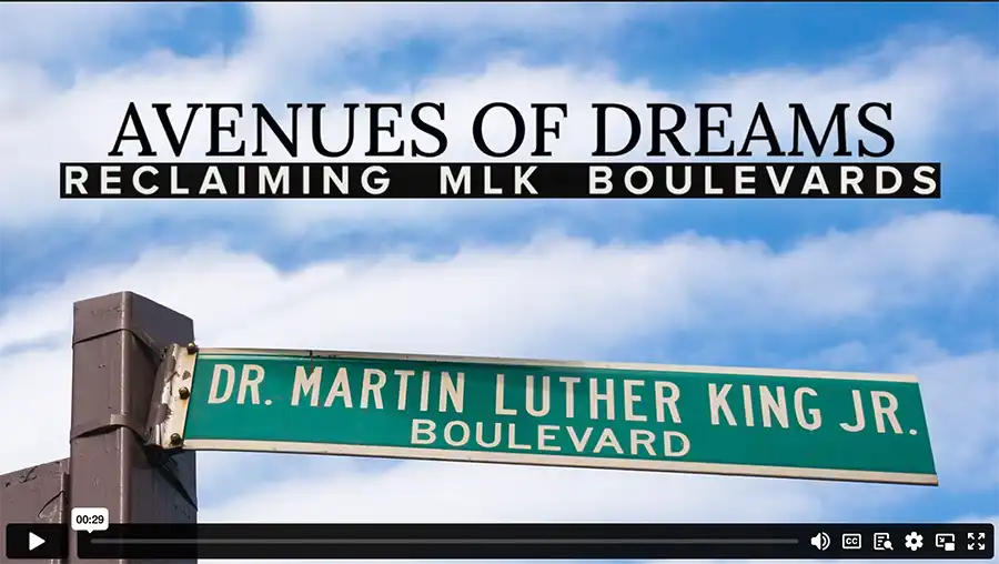
Alderman Featured in Documentary about MLK Streets
Alderman Featured in Documentary about MLK Streets
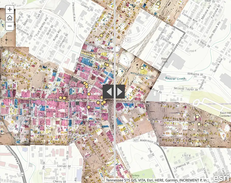
University of Tennessee, Knoxville, Professor of Geography Derek Alderman has spent over two decades researching the hundreds of streets, avenues, and boulevards that have been named after Martin Luther King Jr. and their significance in creating a shared public memory. “The use of place names for commemorative purposes is about creating psychological and emotional connections,” he said in a 2014 story in UT’s Quest magazine.

Two years ago, when film producers Amber Payne and Rayner Ramirez were planning a documentary about MLK streets, they reached out to Alderman, who suggested case studies and themes to help them develop their narrative. In October 2021, Alderman met with Payne and Ramirez in Baltimore and shared some of his thoughts about MLK streets on camera.
In Avenues of Dreams: Reclaiming MLK Boulevards, now showing on Xfinity’s Black Experience Channel, Alderman appears three times. In the opening minutes, he notes that street names are more than memorials to the past. “They are memorials for effecting social change,” he says, and are increasingly centers of Black activism and resilience.
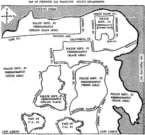
Later in the documentary, Alderman comments on the history of redlining, the longstanding policies of banks and the federal government to withhold mortgage loans from areas occupied largely by African Americans. “These policies suggested that the areas were not worthy of improvement and investment,” he says. “The stigmatizing of streets named for Dr. King is reflective of a legacy absolutely found in redlining.”
Near the end of the film, Alderman describes MLK streets as a litmus test for where the country is going and whether it is coming to terms with economic inequalities and systemic racism. Underlying King’s asphalt memorials, according to him, is a broader consideration of “whether the nation is being accountable to Black America or turning its back on Black America.”
Alderman watched Avenues of Dreams for the first time on January 25. “The producers were very generous to include me,” he said. “But I’m especially pleased that the film foregrounds and centers Black residents, community organizers, and development experts working to reclaim and restore MLK Boulevards, giving them the spotlight and amplifying their voices. It’s a chance for us to hear the people in those communities tell their stories in their own words.
“As a geographer, I am so pleased with the way Amber and Rayner framed the question of where we find these streets. They move beyond just seeing MLK Avenues as locational markers or memorials and situate these streets within the histories, development needs, and civil rights struggles of surrounding neighborhoods. Although the focus of the documentary is on Baltimore and St. Louis, the directors’ emphasis on place-based Black storytelling can help us understand the significance of many of the country’s MLK roadways.”
–Story by Brooks Clark


