• Request Info
  • Visit
  • Apply
  • Give
  • Request More Info
  • Visit
  • Apply
  • Give

Search

  • A-Z Index
  • Map

Geography and Sustainability

  • About
    • Facilities
    • Alumni
    • Research & Community Partners
    • Geographic Links
  • Areas of Study
    • Physical Geography
    • GIST
    • Human Geography
    • Sustainability
  • People
    • Faculty
    • Staff
    • Graduate Students
    • Adjunct & Affliated Faculty
    • Alumni
    • Emeritus
  • Undergraduate
    • Where Can a Geography Degree Take You?
    • Majors
    • Minors
    • Certificates
    • Advising
    • Forms
    • Apply
  • Graduate
    • MS Program
    • PhD Program
    • Apply
    • Graduate Handbook
    • Forms
  • Student Engagement
    • Clubs
    • Community Engagement
    • Awards
    • Internship and Employment
    • Study Abroad
  • News & Events
    • Statements
    • Share Your News
    • Newsletters
    • News
    • Events
    • Geography Awareness Week
    • GeoSym
topography background

News

GIST

Assistant Professor in Geographic Information Science

August 1, 2024

The Department of Geography & Sustainability at the University of Tennessee, Knoxville is seeking applicants for a tenure-track position in Geographic Information Science at the Assistant Professor level starting August 1, 2025. We are especially interested in scholars making theoretical advances in the areas of GeoAI, spatio-temporal modeling, or geospatial data science. Applicants who would contribute to existing department strengths in human dynamics, human-environment interaction, hazards, or environmental geography are strongly encouraged.

The successful candidate will be expected to establish and maintain a strong program of research and publication in Geographic Information Science and to develop a robust, externally funded research portfolio that advances the candidate’s research as well as the mission of the Department of Geography & Sustainability. The successful candidate will provide support to our degree programs by teaching engaged undergraduate and graduate courses (3–4 courses/year), and taking an active role in bringing currency and creativity to curriculum development. They will also provide service to the department, university, and discipline. The successful candidate will demonstrate an ability to mentor graduate and undergraduate students. UTK is a land-grant university and values engaged forms of research/scholarship/creative activity, teaching, and service, and considers evidence of these commitments in the records of applicants. The Knoxville campus of the University of Tennessee is seeking candidates who have the ability to contribute in meaningful ways to the diversity and intercultural goals of the University. Applicants must have a doctoral degree in Geography or related field at the time of appointment.

The Department of Geography & Sustainability occupies the Burchfiel Geography Building at the heart of the Knoxville campus. The department consists of 26 full-time faculty committed to maintaining teaching and research excellence in human geography, physical geography, sustainability, and GIScience. The department also has a student-centered, award-winning program of academic excellence supporting approximately 50 graduate students (MS and PhD), and 200 undergraduate students majoring and minoring in Geography (BA), Sustainability (BA), or Geographic Information Science and Technology (BS). To learn more about the department, visit: http://geography.utk.edu.

The University of Tennessee, Knoxville is the flagship educational institution in the State of Tennessee. The city of Knoxville is a hidden gem with a beautiful and walkable downtown, a diverse music scene, active neighborhoods, unique restaurants, and a robust offering of outdoor and cultural activities. Knoxville is located within easy driving distance to Asheville, Nashville, Atlanta, and the Great Smoky Mountains. Knoxville has a metropolitan population of 850,000 people, and the region houses many leading science agencies, including Oak Ridge National Laboratory, and the Tennessee Valley Authority.

Qualifications

Required Qualifications: The candidate must be a Geographic Information Scientist and have earned a PhD in Geography, Geospatial Science, or in a closely related discipline by the time of appointment.

Preferred Qualifications: Ability to teach courses related to GeoAI and geospatial programming.

Application Instructions

Candidates should apply through Interfolio at apply.interfolio.com/150230, providing a cover letter, curriculum vitae, and two separate statements on Research and Teaching. In addition to addressing their qualifications for the position in their application, candidates may describe how they would help promote students’ access to educational advancement and inclusion in the department and the University of Tennessee through their teaching and research/scholarship/creative activities. Candidates must also arrange to have three letters of reference sent by the deadline. All inquiries should be directed to Dr. Yingkui Li, Search Committee Chair, Department of Geography & Sustainability, University of Tennessee, Knoxville, TN 37996-0925 (yli32@utk.edu). To ensure full consideration, all materials, including references, should be submitted by September 6, 2024, at 5 PM EST. Review of applications will continue until the position is filled.

Equal Employment Opportunity Statement

All qualified applicants will receive equal consideration for employment and admission without regard to race, color, national origin, religion, sex, pregnancy, marital status, sexual orientation, gender identity, age, physical or mental disability, genetic information, veteran status, and parental status, or any other characteristic protected by federal or state law. In accordance with the requirements of Title VI of the Civil Rights Act of 1964, Title IX of the Education Amendments of 1972, Section 504 of the Rehabilitation Act of 1973, and the Americans with Disabilities Act of 1990, the University of Tennessee affirmatively states that it does not discriminate on the basis of race, sex, or disability in its education programs and activities, and this policy extends to employment by the university. Requests for accommodations of a disability should be directed to the Office of Equal Opportunity and Accessibility, 1840 Melrose Avenue Knoxville, Tennessee 37996-3560 or eoa@utk.edu or (865)974-2498. Inquiries and charges of violation of Title VI (race, color and national origin), Title IX (sex), Section 504 (disability), the ADA (disability), the Age Discrimination in Employment Act (age), sexual orientation, or veteran status should be directed to the Office of Investigation & Resolution 216 Business Incubator Building 2450 EJ. Chapman Drive Knoxville, Tennessee 37996 or (865)974-0717 or investigations@utk.edu.

Filed Under: Department News, GIST

Graceful introduction by Prof. Archana Roy, Dept. of Migration & Urban Studies, IIPS, Mumbai

Dr. Madhuri Sharma’s mapping of UTK’s Geography & Sustainability at a global platform

June 22, 2023

Dr. Madhuri Sharma’s mapping of UTK’s Geography & Sustainability at a global platform

I was honored to be invited by several highly prestigious institutes in India during my Spring 2023 sabbatical semester. These included the International Institute for Population Sciences (IIPS)-Mumbai, the Institute for Social and Economic Change (ISEC) at Bengaluru, the Center for Study of Science, Technology and Policy (C-STEP), Bengaluru, School of Planning and Architecture-Bhopal, and University of Delhi, among others. I was proud and happy to represent our Department of Geography & Sustainability and disseminate knowledge, share and learn from the academic audience in India through these research presentations and workshops. Some of the most interesting events and photos are shown below.

Event 1: Research presentation at the seminar co-organized and co-hosted by the IIPS and ISEC, at Bengaluru, India. The topic was: “Domestic Work, Livelihoods and COVID-19: An Analysis of 38 Domestic Workers in Titwala, Mumbai.” I also served as a Discussant for numerous sessions organized by the newly created South Asia Centre for Labour Mobility and Migrants (SALAM)-IIPS at this seminar.

Flyer for Domestic Work, Livelihoods, and COVID-19

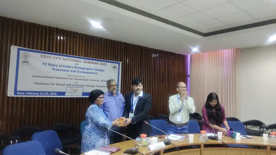
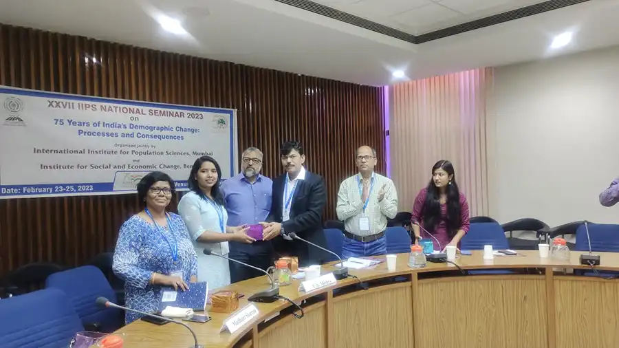
Few photos from this event where Dr. Sharma was honored to serve as a discussant for several sessions organized at this seminar, jointly co-organized by IIPS and ISEC at Bengaluru:

Receiving the memento from IIPS for serving as a Discussant on the sessions by the South Asia Centre for Labour Mobility and Migrants (SALAM) project (ISEC-IIPS jointly hosted Seminar, February 23-25, 2023)
Faculty and students from the South Asia Centre for Labour Mobility and Migrants (SALAM) project at the ISEC-IIPS jointly hosted Seminar, February 23-25, 2023

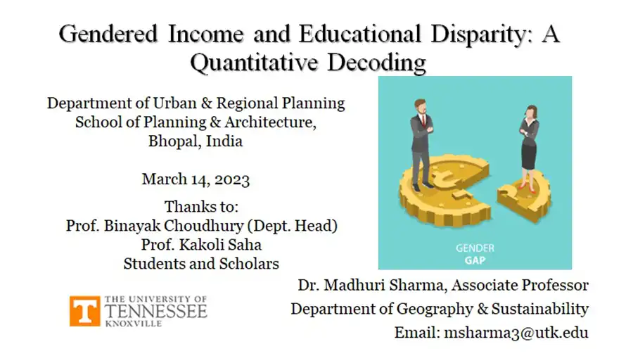
Event 2: School of Planning and Architecture, Bhopal, India: Honored to be invited by the School of Planning & Architecture, Bhopal, to demonstrate application of quantitative skills in social science research. I created a workshop-styled presentation for the MSs and B.Sc. students of SPA-Bhopal. This lecture was followed by an interactive SPSS demonstration for all participants. Proud of being a Vol abroad here in India.  

Gendered Income and Educational Disparity Flyer

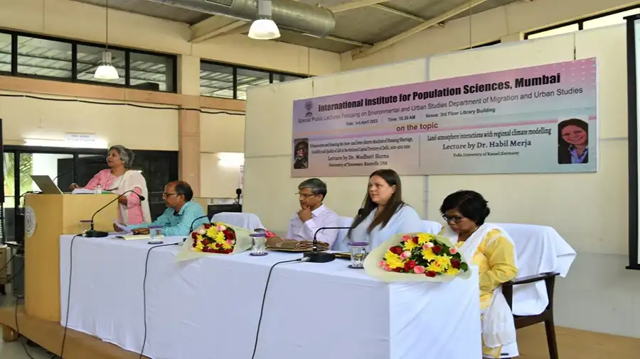
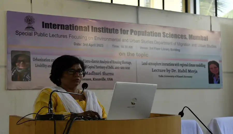
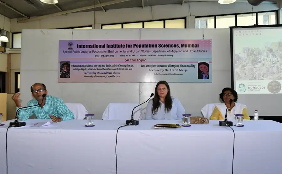
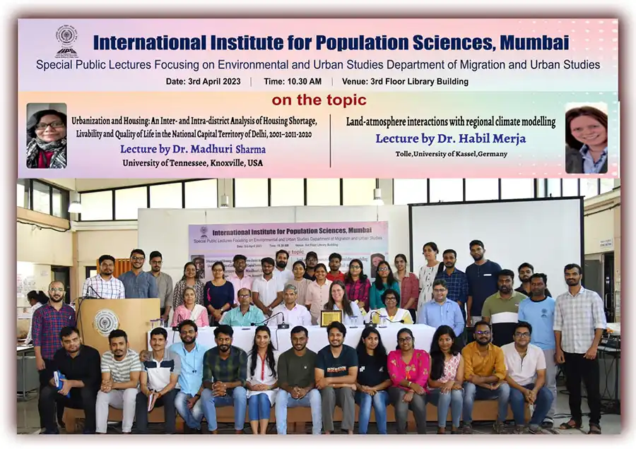
Event 3: Public Lecture at the International Institute for Population Sciences (IIPS), Mumbai: Honored to be invited to deliver a public lecture at the International Institute for Population Sciences (Mumbai) on 3rd April 2023. The topic was: Urbanization and Housing: An Inter- and Intra-district Analysis of Housing Shortage, Livability and Quality of Life in the National Capital Territory of Delhi, 2001–2011–2020. Few pics from this public event are below:

Graceful introduction by Prof. Archana Roy, Dept. of Migration & Urban Studies, IIPS, Mumbai
Dr. Sharma delivering the public lecture at IIPS, Mumbai, 3rd April 2023
Questions & Answers session after the public lecture on 3rd April 2023 at IIPS, Mumbai.
Faculty and Students of the Department of Migration and Urban Studies and SALAM, IIPS, Mumbai.

Event 4: Center for Study of Science, Technology and Policy (C-STEP), Bengaluru, India, 14 April 2023: I was very happy to deliver an invited research lecture at the C-STEP, Bengaluru. My topic was “Urbanization and Housing: Livability, Sustainability and Quality of Life in the National Capital Territory of Delhi, 2001–2011–2020.” This presentation was heard by a global audience of C-STEP from India and its branches in other countries of the world. This was a truly interactive long session wherein several new ideas emerged during the Q&A session.

A flyer for Urbanization and Housing

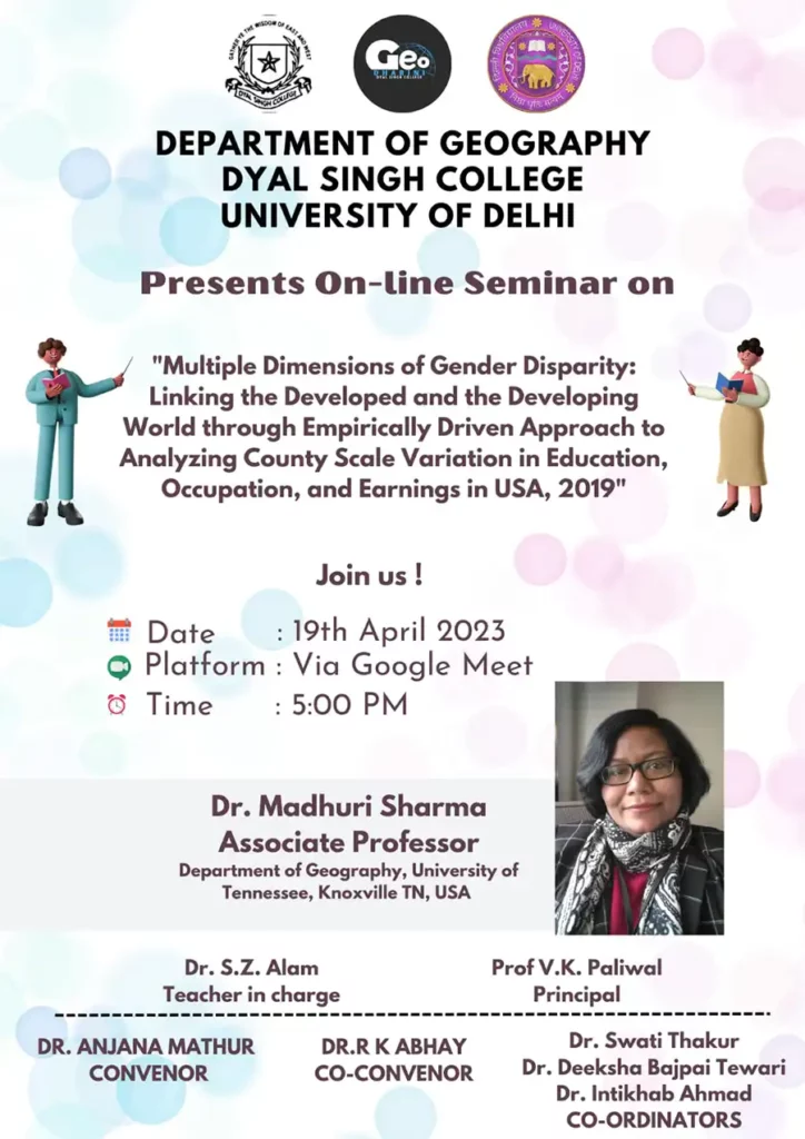
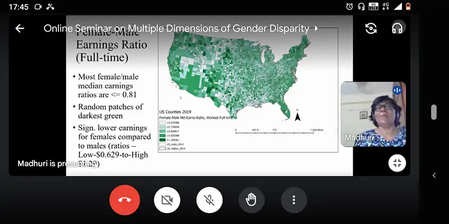
Event 4: An invited seminar for undergrads/grads at Univ. of Delhi. These students wanted to learn about my work on USA. So I presented about gender economic disparity and commonalities at global scale!!

A flyer for Multiple Dimensions of Gender Disparity

A flyer for Dimensions of Gender Disparity
Questions & Answers session after the conclusion of Madhuri Sharma's talk
Questions & Answers session after the conclusion of my talk

Filed Under: Department News, Featured News, GIST, Human Geography

Landsat satellite images showing a side-by-side comparison of southern Pakistan in August 2021 (one year before the floods) and August 2022 (right), Images from The Conversation

How to use free satellite data to monitor natural disasters and environmental changes

March 21, 2023

How to use free satellite data to monitor natural disasters and environmental changes

Satellite image of the Louisiana coast
Over 8,000 satellites are orbiting Earth today, capturing images like this, of the Louisiana coast.
NASA Earth Observatory

Qiusheng Wu, University of Tennessee

If you want to track changes in the Amazon rainforest, see the full expanse of a hurricane or figure out where people need help after a disaster, it’s much easier to do with the view from a satellite orbiting a few hundred miles above Earth.

Traditionally, access to satellite data has been limited to researchers and professionals with expertise in remote sensing and image processing. However, the increasing availability of open-access data from government satellites such as Landsat and Sentinel, and free cloud-computing resources such as Amazon Web Services, Google Earth Engine and Microsoft Planetary Computer, have made it possible for just about anyone to gain insight into environmental changes underway.

I work with geospatial big data as a professor. Here’s a quick tour of where you can find satellite images, plus some free, fairly simple tools that anyone can use to create time-lapse animations from satellite images.

For example, state and urban planners – or people considering a new home – can watch over time how rivers have moved, construction crept into wildland areas or a coastline eroded.

A squiggly river moves surprisingly quickly over time.
Landsat time-lapse animations show the river dynamics in Pucallpa, Peru.
Qiusheng Wu, NASA Landsat
Animation shows the shoreline shrinking.
A Landsat time-lapse shows the shoreline retreat in the Parc Natural del Delta, Spain.
Qiusheng Wu, NASA Landsat

Environmental groups can monitor deforestation, the effects of climate change on ecosystems, and how other human activities like irrigation are shrinking bodies of water like Central Asia’s Aral Sea. And disaster managers, aid groups, scientists and anyone interested can monitor natural disasters such as volcanic eruptions and wildfires.

The lake, created by damming the river, has shrunk over time.
GOES images show the decline of the crucial Colorado River reservoir Lake Mead since the 1980s and the growth of neighboring Las Vegas.
Qiusheng Wu, NOAA GOES
A volcanic eruption bursts into view.
A GOES satellite time-lapse shows the Hunga Tonga volcanic eruption on Jan. 15, 2022.
Qiusheng Wu, NOAA GOES

Putting Landsat and Sentinel to work

There are over 8,000 satellites orbiting the Earth today. You can see a live map of them at keeptrack.space.

Some transmit and receive radio signals for communications. Others provide global positioning system (GPS) services for navigation. The ones we’re interested in are Earth observation satellites, which collect images of the Earth, day and night.

Landsat: The longest-running Earth satellite mission, Landsat, has been collecting imagery of the Earth since 1972. The latest satellite in the series, Landsat 9, was launched by NASA in September 2021.

In general, Landsat satellite data has a spatial resolution of about 100 feet (about 30 meters). If you think of pixels on a zoomed-in photo, each pixel would be 100 feet by 100 feet. Landsat has a temporal resolution of 16 days, meaning the same location on Earth is imaged approximately once every 16 days. With both Landsat 8 and 9 in orbit, we can get a global coverage of the Earth once every eight days. That makes comparisons easier.

Landsat data has been freely available to the public since 2008. During the Pakistan flood of 2022, scientists used Landsat data and free cloud-computing resources to determine the flood extent and estimated the total flooded area.

Images show how the flood covered about a third of Pakistan.
Landsat satellite images showing a side-by-side comparison of southern Pakistan in August 2021 (one year before the floods) and August 2022 (right)
Qiusheng Wu, NASA Landsat

Sentinel: Sentinel Earth observation satellites were launched by the European Space Agency (ESA) as part of the Copernicus program. Sentinel-2 satellites have been collecting optical imagery of the Earth since 2015 at a spatial resolution of 10 meters (33 feet) and a temporal resolution of 10 days.

GOES: The images you’ll see most often in U.S. weather forecasting come from NOAA’s Geostationary Operational Environmental Satellites, or GOES. They orbit above the equator at the same speed Earth rotates, so they can provide continuous monitoring of Earth’s atmosphere and surface, giving detailed information on weather, climate, and other environmental conditions. GOES-16 and GOES-17 can image the Earth at a spatial resolution of about 1.2 miles (2 kilometers) and a temporal resolution of five to 10 minutes.

Animation showing swirling clouds off the coast and the long river of moisture headed for California.
A GOES satellite shows an atmospheric river arriving on the West Coast in 2021.
Qiusheng Wu, GOES

How to create your own visualizations

In the past, creating a Landsat time-lapse animation of a specific area required extensive data processing skills and several hours or even days of work. However, nowadays, free and user-friendly programs are available to enable anyone to create animations with just a few clicks in an internet browser.

For instance, I created an interactive web app for my students that anyone can use to generate time-lapse animations quickly. The user zooms in on the map to find an area of interest, then draws a rectangle around the area to save it as a GeoJSON file – a file that contains the geographic coordinates of the chosen region. Then the user uploads the GeoJSON file to the web app, chooses the satellite to view from and the dates and submits it. It takes the app about 60 seconds to then produce a time-lapse animation.

TUTORIAL

INTERACTIVE WEB APP

How to create satellite time-lapse animations.

There are several other useful tools for easily creating satellite animations. Others to try include Snazzy-EE-TS-GIF, an Earth Engine App for creating Landsat animations, and Planetary Computer Explorer, an explorer for searching and visualizing satellite imagery interactively.The Conversation

Qiusheng Wu, Assistant Professor of Geography and Sustainability, University of Tennessee

This article is republished from The Conversation under a Creative Commons license. Read the original article.

Filed Under: Department News, Featured News, GIST, Physical Geography

Headshot photo

Spring colloquium on Feb. 2, 2023

January 30, 2023

Spring colloquium on Feb. 2, 2023

Joe Tuccillo

UrbanPop: A Spatial Microsimulation Framework for Exploring Demographic Influences on Human Dynamics

Speaker: Joe Tuccillo, PhD, Geospatial Science and Human Security Division, Oak Ridge National Laboratory

DATE: THURSDAY, FEBRUARY 2, 2023 | TIME: 4:05-5:20 PM

AUDITORIUM: NURSING EDUCATION BUILDING (NEB) 302 (OPEN TO THE PUBLIC)

Abstract: Human dynamics models, which address how people live, move, and interact, are critical to promote effective and equitable public service delivery, develop policy interventions, and provide responses to natural and technological hazards at the neighborhood and community scales. The UrbanPop spatial microsimulation framework developed at Oak Ridge National Laboratory (ORNL) supports human dynamics modeling by generating high-fidelity representations of individual demographics during the nighttime and daytime using synthetic populations derived from public-use American Community Survey (ACS) data.

In this talk, Dr. Tuccillo will provide a survey of research highlights from various applications of UrbanPop, including estimating social vulnerability, understanding healthcare access among underserved populations during the COVID-19 pandemic, and assessing environmental justice issues related to urban extreme heat events. Additionally, Dr. Tuccillo will discuss efforts to develop Likeness, a new Python software stack for UrbanPop designed to increase the framework’s reproducibility for a variety of research aims, as well as expand modeling capabilities to real-world transportation networks and building occupancy characteristics.

Colloquium Flyer (PDF)

Filed Under: Department News, GIST, Human Geography

Headshot photo

New Department Members – 2022

November 14, 2022

New Department Members – 2022

Alexis Andershock
Alexis Andershock

Alexis Andershock, career coach with the Division of Student Success, provides support to undergraduate and graduate students within geography and sustainability to achieve their professional goals. Alexis meets one-on-one with students to review resumes and cover letters, find relevant internship opportunities, explore potential career paths, and guide students through the graduate school application process. Alexis has also been instrumental in many of the department’s recent career focused events such as the UT Department of Geography and Sustainability Virtual Career Mingle and organizing in-person and virtual guest speakers. 

Tommy Brown
Tommy Brown

Tommy Brown, academic advisor with the College of Arts and Sciences, provides academic support for undergraduate students within geography and sustainability. Tommy meets one-on-one with students to review their course of study, find suitable classes, and help students graduate on schedule. Tommy is also involved with many departmental outreach events such as the Big Orange Welcome.

Olusola Festus
Olusola Festus

Olusola Festus, lecturer specializing in geographic information systems (GIS) in urban terrestrial wetland landscapes and public health, joined the department in fall 2021. Festus is currently teaching several introductory and intermediate GIS courses with large positive feedback from students.

Mayra Román-Rivera
Mayra Román-Rivera

Mayra Román-Rivera, lecturer specializing in coastal geomorphology and remote sensing, also joined the department in fall 2021. She is a physical geographer specializing in coastal geomorphology of post-storm recovery, and she gave a department seminar on this research in fall 2021. She is currently teaching a suite of climate change, natural disaster and human dimensions, and GIS courses with excellent feedback.

Filed Under: Department News, GIST, Physical Geography

Headshot photo

Tran, Alderman Honored by College

November 14, 2022

Tran, Alderman Honored by College

Liem Tran
Liem Tran

Liem Tran, professor of geography, received a Faculty Academic Outreach Research Award from the College of Arts and Sciences. The award recognizes extraordinary contributions of faculty to the public that occur as an outgrowth of academic pursuits and are related to the university’s academic mission. It recognizes faculty whose research and creative activities advance knowledge through the pursuit of their scholarly interests while simultaneously addressing community problems and issues and benefiting the scholar, the discipline, the university, and society. 

Tran conducts research built on creating strategic collaborative networks with government agencies, major research labs, and other community stakeholders and leveraging innovative geospatial analysis. A number of Tran’s measures and spatial models are widely used by the EPA across the US. Recently, he has collaborated with the EPA to develop the EnviroAtlas, an interactive web-based platform used by states, communities, and citizens that provides geospatial data, easy-to-use tools, and other resources related to ecosystem services, their chemical and nonchemical stressors, and human health. Tran has used his expertise in geospatial analysis to develop a series transmission models posted on the Tennessee State Data Center’s COVID-19 dashboard that estimates coronavirus reproduction rates and hotspots in the state. 

Tran is also actively involved in meaningful public communication of science. For example, he has interacted with the media to explain the metrics to measure the spread of COVID-19 and authored a policy brief in partnership with the Baker Center to educate the public on COVID-19 modeling and forecasts. Well before engaging in important research outreach to COVID-19, Tran had begun focusing on state of the art geospatial technologies, including Geographic Information Systems (GIS) and web-based applications, to combat the opioid crisis. 

“The award is very important not only to myself, but also to my students and colleagues who have been working diligently alongside me in various research outreach activities,” Tran said. “It shows the commitment of faculty and students in the geography department to serve the great state of Tennessee and its people, especially during this difficult time due to the COVID-19 pandemic.”

Derek Alderman
Dr. Alderman

Derek Alderman, professor of geography, received the Lorayne W. Lester Award, which recognizes a faculty member or exempt staff member who has demonstrated outstanding service through research, outreach, and/or administrative, teaching, or advising services to the college, the state, our local community, or beyond. 

Alderman joined the geography department in 2012 as head and worked hard to advertise and modernize the curriculum for undergraduates, which allowed the department to increase in size dramatically. During his five years as head, he also worked successfully to diversify the faculty and student population. During these years he was also elected president of the American Association of Geographers, after successfully serving as a chair of the association’s publications committee, the regional southeast councilor, and president of the southeast region. 

Alderman’s research brings him many opportunities to inform the public about issues related to American Civil Rights movement and southern culture more broadly. Much of his work focuses on the histories, memory-work, commemorative activism, and place-making efforts of African Americans as they assert and claim civil rights, their right to belong with public spaces, and the power to remember the past and shape the American landscape on their own terms. In particular, his interests focus on critical place name studies and using cultural struggles over the naming and renaming of streets, schools, parks, and other public spaces as important lens for understanding the unresolved place of race, memory, and identity in America. 

“I am grateful and humbled to receive the Lorayne Lester award from our college, which is filled with many inspiring servant-leaders,” Alderman said. “Since coming to UT in 2012, I have been fortunate to have the opportunity to work with others to grow and maintain departmental health, advocate for national professional organizations, and engage in public outreach and partnership building. Service, for me, is about being responsive to the needs and well-being of other people—to think and act beyond oneself. More than simply a category of annual evaluation, service is the lifeblood of the university and key to the ethics of care we owe to ourselves and wider communities.”

He is a devoted scholar-teacher who enjoys working and publishing with students, both at the undergraduate and graduate levels. He is also committed to conducting critical public scholarship that engages, informs, and helps the news media, government officials, community activists and organizations, and the broader citizenry. Most recently, Alderman has been involved in three major research efforts funded by NSF that involved researchers from universities across the country collecting and analyzing data related to the struggle for freedom from several different perspectives. He continues to serve beyond expectations by agreeing to step back into the role of interim head for geography this year when there was a last minute change within the unit leadership.

Filed Under: Department News, GIST, Human Geography, Uncategorized

Headshot photo

Engaging Undergraduate Students

November 14, 2022

Engaging Undergraduate Students

Our alumni continue to find exciting ways to keep engaged with current students. In the middle of the pandemic, a small group of alumni were looking for ways to support current and recently graduating students at a time when the economy was suffering, so they created an alumni group on LinkedIn to build connections between the two groups.

Founding members are Hannah Gunderman (’18), Adam Alsamadisi (’15, ’19), Kelly Baar (’19), and Morgan Steckler (’20). Join the group by searching for “UTK Geography Alum” on LinkedIn. (https://www.linkedin.com/groups/12468218/).  

Headshot photo
Kelly Baar, ’19

“When you go on a tour of UT, one phrase really hits home: Tennessee is a big campus with a small community feel. This could not be truer than as a student in the geography department, which serves as a home away from home. It offers opportunities in research, leadership, and networking. It encourages students to excel academically and gives students the resources to do so. It houses a safe space for students to study, create friendships, and host events. We felt like everything this department works so hard to create shouldn’t end at graduation so, we created the LinkedIn group. Originally, the group was to house a space for students to transition to alumni with the help of other graduates. Now, it is actively used as a way to recognize alumni accomplishments, provide support for recent graduates, and networking. As membership grows, we hope to continue to foster meaningful conversations amongst UT geography alumni.”

–Kelly Baar

In addition to the LinkedIn group, alumni connect with our students through a capstone course, Geography 499: Practicing Geography. More than 30 alumni volunteered to serve as mentors during the fall 2021 semester. The goal of the program was to connect students and alumni to help share professional experiences and advice while building meaningful connections. 

“Being a mentor has been an invaluable experience,” said Kelly Baar, who graduated with a bachelor’s in geography in 2019. “I have thoroughly enjoyed giving back to a department that immensely shaped my experience as a student, and now continues to allow me to share my passion with likeminded people.”

Kelsey Roche will graduate this spring and is ready to explore her career options thanks to her experience with the program. Her mentor, Jeff Smith, is the regional business manager for Trimble Inc. and based in Florida. 

“I was lucky enough to be paired with a mentor to help me navigate the intimidating job-hunting world,” Kelsey said. “I have gained so much appreciation for Jeff as he’s helped me define my strengths as a future employee, strengthen my resume, written me a recommendation, and offered the help of his professional friends along my journey of finding a job out of college. Jeff has given me endless amounts of advice about the real world that I plan on taking with me beyond my professional life. He has not only made me prepared, but excited for the job-hunting experience. I couldn’t imagine being as ready as I am to start exploring my life after college without the help of my mentor.”

Bennett Meeks, who graduated in 2021 with a bachelor’s in geography, enjoyed the opportunity to get to know an alum during the program and speaks to her on a regular basis. 

“My mentor provides a wealth of knowledge,” Bennett said. “There is something special about getting advice from someone who has just gone through the same transitions as you – especially having it been so recently. The ability to speak with a friend in the professional field is also invaluable because I often get a lot of advice that is inferred and often overlooked, and I receive advice on the things that I have yet to do or have not done in my college experience and hear their perspective while learning from their ventures. As I started my new job this semester, my mentor was one of the first people to hear about it, and the advice she gave me was always spot on. I love the connection between my mentor and I, and I am really looking forward to doing the same for the next generation.”

If you are interested in being a mentor, contact Michael Camponovo, program coordinator, at mcampono@utk.edu.

Filed Under: Alumni News, Department News, GIST, Human Geography, Physical Geography, Sustainability

Headshot photo

Alumni Spotlight 2022

November 14, 2022

Alumni Spotlight 2022

Alex Webb headshot photo

While a student in the geography department, Alex Webb (’20) took Professor Micheline van Riemsdijk’s age of migration course – a study abroad course in Oslo and London. The experience provided Webb with a broader perspective and ignited her passion for international education.

“Not only did this course lay the groundwork for my academic, and now personal, interest in international migration, but it also gave me the opportunity to experience places, people and ideas that were literally foreign to me,” Alex said. 

After finding her academic passion for international migration, Alex pursued research opportunities within the department, such as working for a graduate student and presenting at conferences to hone the skills she would need to earn a graduate degree. She followed her passion to the Netherlands where she earned a Master’s degree from Erasmus University. 

Alex lives in Rotterdam and works as a teaching assistant for the School of Social and Behavioral Sciences at Erasmus. She is working on converting her thesis into a policy brief focused on advocacy.

“In my free time, I am writing essays and op-eds about issues that I am passionate about, including international migration, refugee resettlement, politics, and gender,” said Alex, who received a scholarship to attend an Op-Ed Project workshop, which facilitates access to publishing opinion pieces for women and minority groups.

Emily Craig

Emily Craig (’19) serves as the sole GIS staff member for the East Tennessee Development District, fulfilling all the organization’s map and data related needs. In 2020, TDOT requested Emily take the lead in mapping the Cumberland Historic Byway for a Federal Highway Administration application seeking National Scenic Byway status. Her responsibilities included provision of a statewide reference map and nine inventory maps displaying scenic features along the byway. 

In 2021 the application was deemed a success. As a result, counties and cities located along the byway now have access to federal grant funding and national marketing through the National Scenic Byways and America’s Byways programs. 

“Seven of the eight counties are economically-distressed or at-risk, so access to these resources have the potential to make a large impact on the region in the future,” Emily said. “Also, thanks to the designation, Tennessee is fourth in the country for its number of nationally recognized scenic byways.”

Explore Emily’s storymap to learn more about the project.

Filed Under: Alumni News, Department News, GIST, Human Geography

Headshot photo

Community Engagement and Outreach

November 14, 2022

Community Engagement and Outreach

Outreach and community engagement are key components to our curriculum in the department. Students have several opportunities to engage with our community while applying what they learn in the classroom to real-world situations. During the past year, students worked with the Statewide Organizing for Community eMpowerment (SOCM), Adelante, and others to solve local problems with geography. 

Evictions Mapping

Professor Nikki Luke

On September 4, 2020, the CDC issued a nationwide moratorium on evictions and foreclosures due to non-payment to slow the spread of COVID-19. Despite this federal action, evictions continued in the Knox County Circuit Court. A small group of volunteers working with Statewide Organizing for Community eMpowerment (SOCM) responded to share information about the moratorium with tenants facing upcoming court dates. Adam Hughes, the SOCM East Tennessee community organizer, approached Nikki Luke, assistant professor of geography, to see if she could help. Luke worked with geography students Sam Myers-Miller and Maya Rao to map where evictions were occurring so SOCM could continue their outreach efforts. 

The moratorium ended in July 2021, but it was never a permanent solution to housing insecurity in Knoxville. Students and faculty in the geography department have continued to work with SOCM and the East Knoxville-based organization Socially Equal Energy Efficient Development (SEEED) to collect information about housing and energy access in Knoxville through a door-to-door survey in impacted neighborhoods. 

In the spring 2022 semester, students in GEOG 420 and GEOG 446 will continue this work to identify changes in the geographies and frequencies of eviction in Knoxville during the pandemic and analyze whether these changes might influence housing affordability for renters. This engaged research puts the methods of geography to use to support the objectives of community-based organizations while working to understand processes of urban change in Knoxville.

Impacts of Urban Renewal

To preserve, revitalize, and transform the urban communities of cities across America, the federal government passed Title I of the Housing Act in 1949 and Title III of the Housing Act in 1954. Although framed as a project for redevelopment and revitalization of downtown areas, urban renewal targeted African American communities for demolition. The goal was to clear the “blight and slums” of downtown areas in the form of large-scale clearance to make room for new infrastructure. These policies and actions became known nationwide as urban renewal.

Luke Brice

Luke Brice created an interactive map of what Knoxville looked like before the urban renewal policies removed a large history of Knoxville’s African American population and displaced them elsewhere.

“The effects of urban renewal are still felt today. People who lived through these policies still remember and share their experiences. Living memory allows us to understand the present landscape of our city today,” Luke said. “Urban renewal continues to affect the African American community in Knoxville today, not only by a broken and displaced community, but also through continuing urban clean-up legislation.”

According to Luke, urban renewal teaches us to look at society with a different eye.

“What looks like slum and blight to one group is the home and loved community of another,” Luke said. “Place and space are defined by those who live in it and shouldn’t be a target of those who don’t experience it.”

Learn more about his project and see an interactive story map.

Mapping the Migrant Journey

Geography students Maya Rao and Annie Liu spent the spring 2021 semester helping Meghan Conley, assistant professor of practice in the UT Department of Sociology, with an ArcGIS StoryMap project in collaboration with Adelante, a local immigration legal nonprofit, to look at the various impacts detention has on immigrants in Knox County. 

Sociology 433R is a research-based class, with students from different majors participating in and learning about participatory action research and its methods. Students began the semester working in teams researching the impacts detention has on different parts of life, including social, financial, physical, and mental. Each group wrote a paper that would then inform the next aspect of the research project.

“I looked at the physical impacts of detention by researching the locations of detention facilities and discovered that many detention facilities are built on toxic superfund sites,” Maya said.

Annie was on the financial impacts team and looked at the negative effects that detention has on family finances of the detained. 

“We also examined the economic reasons behind the detention and deportation machine and found that the immigration landscape of this country is extremely profit-driven and commodified, thus leading to the dehumanization of immigrants,” Annie said. 

Next, students conducted interviews with different people involved in the detention process. Maya interviewed a local Knox County Schools teacher who has experiences with students who have parents who have gone through the detention process and has seen firsthand the trauma that those experiences can have on students. Annie talked to Hammad Sheikh Esq. and discussed what the detention process looked like from an immigration attorney’s perspective. He also spoke about the impact that COVID was having on detainees’ health and safety. 

Students also interviewed immigrants who went through the detention and deportation proceedings that the local Knox county sheriff’s office enforces in conjunction with Immigration and Customs Enforcement. Maya and Annie worked together on creating content for the final product – an ArcGIS StoryMap. They created maps using different features, such as the drive time analysis to see the distance detainees travel when going through the various checkpoints in the United States. Maya found data from migration policy and the American Community Survey to create a countries of origin map to show the some of the demographic data of undocumented immigrants in Tennessee. Annie found local news sources that helped to give context to the issues they were mapping.

Ultimately, they mapped out the journey that the interviewees went through during their immigration experience.

“Our goal was to show just how unjust and traumatic these experiences are on the immigrant populations,” Maya said. 

 Their final step was presenting the project to Adelante, who were very proud of the finished product. 

 “I loved the experience,” Maya said. “It ignited my interest in community-based research, which I hope to study further. I especially enjoyed connecting my skills in GIS, passion for the environment, and curiosity in policy.”

 Annie loved the class as well, especially since she had the opportunity to work with Adelante again. 

 “I’ve worked with the group in the past to use GIS to visualize issues,” Annie said. “The experience in community-based research was super valuable and will be helpful as I pursue my interest in working with nonprofits.”

 Learn more and see their map online.

Filed Under: Department News, GIST, Human Geography

Headshot photo

Wu Appointed as Amazon Visiting Academic

October 28, 2022

Wu Appointed as Amazon Visiting Academic

Qiusheng Wu

Qiusheng Wu, assistant professor of geography and sustainability at the University of Tennessee, Knoxville, was appointed an Amazon Visiting Academic working for Amazon Web Services’ Deep Learning organization. The program allows academics to conduct research while teaching and leading at universities.

Wu’s work with Amazon focuses on solving large-scale high-impact technical challenges related to geospatial data science, machine learning and mapping.

“I look forward to the opportunity to be actively engaged in building connections more broadly with different organizations within Amazon that can bring value and insight back to the university and the state,” Wu said. “The opportunity will ignite collaborations and open up doors for our students to engage with Amazon as well through internships and employment opportunities.”

Wu has developed and published many online open-source information packages and educational materials that are frequently used by geospatial researchers. His GitHub, which has several thousand followers, contains all his open-source research projects. Wu has produced and uploaded hundreds of videos on his YouTube channel, which has more than 17,000 subscribers and half a million total views.

“We are proud that Qiusheng’s scholarship is among the most richly rewarded at the university,” said Nicholas Nagle, professor and head of the Department of Geography and Sustainability in UT’s College of Arts and Sciences.

Amazon’s Visiting Academics program allows academics to research extensive topics and issues at world-class research institutions. To qualify, applicants must have a doctoral degree and at least five years of postdoctoral research experience. They must also be serving as a university professor, consistently apply knowledge from other disciplines, and have notable research and technical leadership skills.

Wu began his service as an Amazon Visiting Academic Oct. 17.

–Story by Jessica Foshee

Filed Under: Department News, GIST

  • 1
  • 2
  • 3
  • Next Page »

Recent Posts

  • Geography Alumna Name Dean at Virginia Tech
  • The Conversation: ‘Trump moves to gut low-income energy assistance as summer heat descends and electricity prices rise’
  • The Conversation: ‘From Greenland to Fort Bragg, America is caught in a name game where place names become political tools’
  • Nashville Housing Research Earns Geography Award
  • UT Geography Students Update Firefighters’ Maps

Recent Comments

No comments to show.
an illustration of geographers engaged in research surrounding a globe

Geographers Engage With The World

Request More Information

Support The Department

Department of Geography and Sustainability

College of Arts and Sciences

Burchfiel Geography Building
1000 Phillip Fulmer Way
Room 304
Knoxville, TN 37996-0925
865-974-2418
utkgeog@utk.edu


Facebook Icon    X Icon    Instagram Icon    YouTube Icon

The University of Tennessee, Knoxville
Knoxville, Tennessee 37996
865-974-1000

The flagship campus of the University of Tennessee System and partner in the Tennessee Transfer Pathway.

ADA Privacy Safety Title IX