• Request Info
  • Visit
  • Apply
  • Give
  • Request More Info
  • Visit
  • Apply
  • Give

Search

  • A-Z Index
  • Map

Geography and Sustainability

  • About
    • Facilities
    • Alumni
    • Research & Community Partners
    • Geographic Links
  • Areas of Study
    • Physical Geography
    • GIST
    • Human Geography
    • Sustainability
  • People
    • Faculty
    • Staff
    • Graduate Students
    • Adjunct & Affliated Faculty
    • Alumni
    • Emeritus
  • Undergraduate
    • Where Can a Geography Degree Take You?
    • Majors
    • Minors
    • Certificates
    • Advising
    • Forms
    • Apply
  • Graduate
    • MS Program
    • PhD Program
    • Apply
    • Graduate Handbook
    • Forms
  • Student Engagement
    • Clubs
    • Community Engagement
    • Awards
    • Internship and Employment
    • Study Abroad
  • News & Events
    • Statements
    • Share Your News
    • Newsletters
    • News
    • Events
    • Geography Awareness Week
    • GeoSym
topography background

News

GIST

Creating satellite timelapse with Streamlit and Earth Engine

Creating satellite timelapse with Streamlit and Earth Engine

December 15, 2021

Creating satellite timelapse with Streamlit and Earth Engine

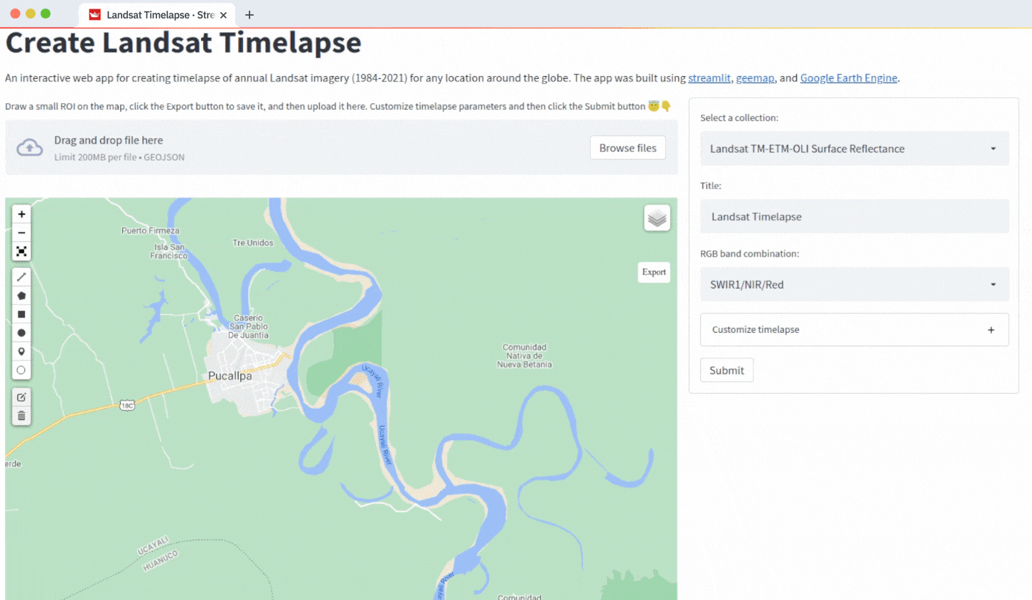
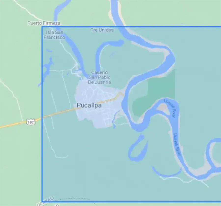
Dr. Qiusheng Wu just published a new blog post – Creating satellite timelapse with Streamlit and Google Earth Engine. Check it out. 

Blog: https://blog.streamlit.io/creating-satellite-timelapse-with-streamlit-and-earth-engine
Web App: https://streamlit.gishub.org
GitHub: https://github.com/giswqs/streamlit-geospatial

Filed Under: Department News, Featured News, GIST

Mapping COVID-19 in Space and Time book cover

Professor Shaw published a new book: Mapping COVID-19 in Space and Time

July 16, 2021

Professor Shaw published a new book: Mapping COVID-19 in Space and Time

Book jacket for Mapping COVID-19 in Space and Time

Professor Shih-Lung Shaw just published a new book titled “Mapping COVID-19 in Space and Time: Understanding the Spatial and Temporal Dynamics of a Global Pandemic”. It is co-edited by Dr. Daniel Sui.

Here is the link to the eBook: https://link.springer.com/book/10.1007%2F978-3-030-72808-3. The print version of the book https://www.springer.com/gp/book/9783030728076 will be available in about 2-3 weeks. Please feel free to contact Professor Shaw if you have any questions about this book. 

About this book:

This book describes the spatial and temporal perspectives on COVID-19 and its impacts and deepens our understanding of human dynamics during and after the global pandemic. It critically examines the role smart city technologies play in shaping our lives in the years to come. The book covers a wide-range of issues related to conceptual, theoretical and data issues, analysis and modeling, and applications and policy implications such as socio-ecological perspectives, geospatial data ethics, mobility and migration during COVID-19, population health resilience and much more.

With accelerated pace of technological advances and growing divide on political and policy options, a better understanding of disruptive global events such as COVID-19 with spatial and temporal perspectives is an imperative and will make the ultimate difference in public health and economic decision making. Through in-depth analyses of concepts, data, methods, and policies, this book stimulates future studies on global pandemics and their impacts on society at different levels.

Filed Under: Department News, GIST, Human Geography

Headshot photo

Professor Shih-Lung Shaw elected President of UCGIS

June 18, 2021

Professor Shih-Lung Shaw elected President of UCGIS

Dr. Shih-Lung Shaw

UTK Geography Professor Dr. Shih-Lung Shaw has been elected President-Elect of the University Consortium for Geographic Information Science (UCGIS), which is a non-profit organization that creates and supports communities of practice for GIScience research, education, and policy endeavors in higher education and with allied institutions. It is the professional hub for the academic GIS community in the United States, with partnerships extending this capacity abroad. 

It will be a three-year service and Dr. Shaw will serve as President-Elect, President, and Past President of UCGIS. We thank Dr. Shaw for his service and leadership in GIS. Congratulations!

Filed Under: Department News, GIST, Human Geography

Cumberland Scenic Byway Nomination Route Reference Map

UTK Geography Alum Emily Craig’s recognition

April 19, 2021

UTK Geography Alum Emily Craig’s recognition

Congrats to recent UTK Geography alum Emily Craig whose cartographic and GIS work helped establish the Cumberland Scenic Byway in East TN. Check out her maps at https://arcg.is/1Oi14n. More maps for the
conference are at https://tngic-map-gallery-enrgis.hub.arcgis.com

Cumberland Scenic Byway Nomination route reference map

Filed Under: Alumni News, Department News, GIST

Dr. Tran

Tran Receives Faculty Academic Outreach Research Award

February 4, 2021

Tran Receives Faculty Academic Outreach Research Award

Dr. Tran
Dr. Tran

Each year, Dean Theresa Lee and members of her cabinet, with help from department heads, recognize faculty in the College of Arts and Sciences for their excellence in teaching, research and creative activity, and lifetime achievements. 

Due to the ongoing pandemic, however, we were unable to host the annual awards banquet in-person. Each faculty member received a plaque and congratulations from the dean. We posted a video to the college YouTube channel here, which features each faculty award winner.

Liem Tran, professor of geography, received a Faculty Academic Outreach Research Award from the College of Arts and Sciences. The award recognizes extraordinary contributions of faculty to the public that occur as an outgrowth of academic pursuits and are related to the university’s academic mission. It recognizes faculty whose research and creative activities advance knowledge through the pursuit of their scholarly interests while simultaneously addressing community problems and issues and benefiting the scholar, the discipline, the university, and society. 

Tran conducts research built on creating strategic collaborative networks with government agencies, major research labs, and other community stakeholders and leveraging innovative geospatial analysis. A number of Tran’s measures and spatial models are widely used by the EPA across the US. Recently, he has collaborated with the EPA to develop the EnviroAtlas, an interactive web-based platform used by states, communities, and citizens that provides geospatial data, easy-to-use tools, and other resources related to ecosystem services, their chemical and nonchemical stressors, and human health. Tran has used his expertise in geospatial analysis to develop a series transmission models posted on the Tennessee State Data Center’s COVID-19 dashboard that estimates coronavirus reproduction rates and hotspots in the state. 

Tran is also actively involved in meaningful public communication of science. For example, he has interacted with media to explain the metrics to measure the spread of COVID-19 and authored a policy brief in partnership with the Baker Center to educate the public on COVID-19 modeling and forecasts. Well before engaging in important research outreach to COVID-19, Tran had begun focusing state of the art geospatial technologies, including Geographic Information Systems (GIS) and web-based applications, to combat the opioid crisis. 

“The award is very important not only to myself, but also to my students and colleagues who have been working diligently alongside with me in various research outreach activities,” Tran said. “It shows the commitment of faculty and students in the geography department to serve the great state of Tennessee and its people, especially during this difficult time due to the COVID-19 pandemic.”

Filed Under: Department News, GIST, Physical Geography, Sustainability

Opioids

Fighting the Opioid Crisis with Geospatial Technologies

September 17, 2020

Fighting the Opioid Crisis with Geospatial Technologies

Opioids

Opioid use disorder (OUD) is ravaging America, killing hundreds of thousands and affecting millions more. The impact of OUD is staggering in many other dimensions: higher healthcare costs, more drug-related crimes, reduced work productivity, more children in state custody, and infants born with symptoms of opioid withdrawal. When progress is made in one aspect, other issues emerge unpredictably.

A team of five UT geographers, Liem Tran (PI), Qiusheng Wu (co-PI), Nicholas Nagle (co-PI), Michael Camponovo (GIS expert), and Kurt Butefish (program coordinator, Tennessee Geographic Alliance), developed a project that uses cutting-edge geospatial technologies including Geographic Information Systems (GIS), spatial analysis tools, and web-based applications to combat the opioid crisis in a collaborative, proactive, and effective fashion. They are facilitating, enhancing, and integrating efforts among state and local governments, health and safety agencies, and community organizations in Tennessee to help our state put an end to this crisis. 

The project, “Orchestrating the efforts to fight the opioid crisis in Tennessee with geospatial technologies,” began July 2020 and will wrap up May 2022. With a budget of approximately $50,000, the team will:

  1. Gather and organize opioid-related data and information from disparate data sources into an integrated geodatabase, which can serve different stakeholders, such as government officials, community leaders, public health officials, human services, law enforcement, volunteers, the public, and researchers.
  2. Develop tools with the capability to collect data in real time, such as overdose data, drug trafficking, etc.
  3. Build GIS applications and map-based websites that communicate information and findings to a wide array of stakeholders.
  4. Provide real-time, data-driven tools to inform decision makers effectively, such as present information on the state of the crisis, financial allocation based on communities, and progress of tactics so that swift decisions can be made in real time.
  5. Develop tools with the capability to assist in deploying tactics and allocating resources. For example, authorities could quickly identify areas where activities are concentrated, current resources are located, and where to add additional services, such as clinics, medical services, drug drop-off boxes, etc.
  6. Widely distribute information to educate and to assist the public and constituents in preventing further substance abuse.

The extended team of the project includes Laurie Meschke and Kristina Kintziger from the Department of Public Health, Jennifer Tourville from the UT College of Nursing, Kaitlin I. Singer with the UT System’s Office of Institutional Research, Tiffany Carpenter, UT System vice president for communications and marketing,

View the Webapp here.

Filed Under: Department News, GIST

Studying the Impact of Social Distancing on COVID-19 Morbidity

September 17, 2020

Studying the Impact of Social Distancing on COVID-19 Morbidity

Nicholas Nagle, associate professor of geography, and Liem Tran, professor of geography, are part of the UT Coronavirus-19 Outbreak Response Experts (CORE-19) studying the impact of social distancing on Covid-19 morbidity in the early months (up to May 31) of the pandemic.

Using county-level COVID-19 data and social distancing metrics from tracked mobile devices, they investigated how social distancing influences the total number of confirmed COVID-19 cases in a county between when the state and the county first enacted social distancing measures through May 31, 2020.

They created a mixed-effects negative binomial model to assess the association between social distancing and the change in the total number of confirmed COVID-19 cases/100,000 people while controlling for covariates that might introduce bias to this relationship. Marginal effects at the means were also generated to further isolate the individual influence of social distancing on COVID-19 from other factors.

A 1% decrease in percentage of mobile devices leaving home between March-May 2020 corresponded with 5.8 fewer total confirmed COVID-19 cases/100,000 people in a county (95% confidence interval [CI]: 0.46-72.6) from the mixed-effects negative binomial while marginal effects revealed that a 1% decrease in percentage of mobile devices leaving home between March-May 2020 led to 14.5 fewer total confirmed COVID-19 cases/100,000 people in a county (95% CI: 7.82, 21.16).

Social distancing plays a key role in keeping the number of COVID-19 cases low in counties across the US and should be encouraged until a COVID-19 vaccine becomes readily available.

The Howard H. Baker Jr. Center for Public Policy published a policy brief, Understanding COVID-19 Models, in partnership with the Coronavirus-19 Outbreak Response Experts (CORE-19), July 1, 2020.

Daily outputs are used in the Tennessee State Data Center’s Covid-19 dashboard.

Filed Under: Department News, GIST, Human Geography

Headshot photo

Paying it Forward

September 17, 2020

Paying it Forward

Hannah Gunderman
Hannah Gunderman

At least once a week, Hannah Gunderman (’18) finds herself strategizing about ways she can engage with the UT Department of Geography. She is a proud alumna and makes it a priority to stay involved.

“It would be an understatement to say that I care about the geography department,” Gunderman said. “There was something really special about my experience that makes me want to continue being involved in any way that I can and pay it forward to students currently in the program.” 

Working with Professor Derek Alderman as her dissertation advisor, Gunderman earned her PhD in geography and decided to pursue a career in academic librarianship. She started down this path as a postdoc in the UT School of Information Sciences (SIS) in September 2018 and a year later, began working in her current role as a research data management consultant at Carnegie Mellon University. During her postdoc at UT, however, Gunderman could not get geography – or the Burchfiel geography building – off her mind.

“The postdoc in SIS changed my mental map of UT’s campus, which had previously been so rooted in the Burchfiel geography building that I found myself making excuses to pop over to Burchfiel whenever I could,” Gunderman said. “Needed a walk at lunch? I’d head over to Burchfiel! Needed some water? The water fountains in that building are the best! It was clear that, although my professional sphere at UT had shifted, my heart still remained with UT geography.”

Gunderman’s commitment to giving back to the department began during her internship at the Oak Ridge National Laboratory (ORNL) as a doctoral student in the former geographic information science and technology group. For several years, she served as a bridge between ORNL and the department. Gunderman connected students with information about opportunities at the lab and mentored several students on career development and professional growth, both as a doctoral student and in her role as a postdoc in SIS.

“I quickly learned how much I loved giving back to the department that provided so much for me as a student,” Gunderman said. “While my postdoc duties over in SIS kept me busy, I always made time for coffee chats at Golden Roast, my favorite Knoxville coffee shop, with UT geography students.”

Shortly before Carnegie Mellon and UT went fully online due to the coronavirus pandemic, Gunderman visited Knoxville for two information sciences conferences and saw an opportunity to conduct a data management workshop for UT geography students while she was in town. During the workshop, students drew from Pokémon to learn more about documentation and workflows, chatted through file naming schemes, and engaged in conversations on tools for storing and sharing geospatial information.

“It was an incredible experience to watch these students go through these activities and also see myself through a completely different lens being back in Burchfiel,” Gunderman said. “Conducting the workshop in the very same room where I used to write my dissertation, have committee meetings, and meet with students, I saw how I could continue to enrich the department as a faculty member at another institution.”

Hannah Gunderman Workshop Group Photo
Hannah Gunderman and UT students and staff after her workshop in February 2020.

Gunderman recently participated in a five-week career coaching program, led by GIS Outreach Coordinator, Michael Camponovo, where she learned techniques for growing her career and gained the opportunity to network, mentor, and connect with other UT geography alumni.

With the ongoing pandemic, Gunderman is not sure when she will be able to visit with UT geography students in person again, but she plans to continue her outreach in a virtual environment through guest lectures, data management workshops, and a Zoom-Side Chat with Michael Camponovo.

“I am always available to talk with any students or alumni who are interested in exploring the academic librarianship career route, for which geography is an excellent foundation,” Gunderman said. “I consider my outreach and engagement with UT geography to be one of the most important service activities of my career, and I hope to continue this for many more years to come.”

Filed Under: Alumni News, Department News, GIST

A female student in a graduation cap

Mapping Advocacy

September 17, 2020

Mapping Advocacy

The UT Center for Sport, Peace and Society (CSPS) is committed to creating a more stable, equitable, and inclusive world through sport-based social innovation. With a long-standing commitment to empowering groups of people who are often overlooked, CSPS works diligently to advance the rights of persons with disabilities, locally and across the world.

One of the greatest challenges participants of CSPS programs had previously cited is the need for a greater understanding of the international, regional, and national laws and policies designed to protect people with disabilities. Alumni express a pressing need to know what laws exist in their respective countries, as well as within their geographical regions, for the purposes of connecting prudent information directly to their efforts to create more inclusive grassroots and elite sports initiatives. It is out of this need that the idea for creating a one-of-a-kind interactive global map was born.

Veronica Allen

Veronica Allen (’20) began interning with CSPS in June 2019 under the direction of Carolyn Spellings, chief of evaluation, research, and accountability. She spent the summer researching laws and policies around the world that addressed gender equity, specifically in sport, as part of a project funded by the Stuart Scott Award from ESPN. After collecting a large data set on countries all over the world, there was a need to come up with an appropriate platform upon which to display the information. Allen suggested putting it all into an interactive global Esri Story Map and reached out to Liem Tran, professor of geography, for advice on how this would be possible. Tran suggested she take the GEOG420: GIS in the Community course and make this her penultimate project. With project partner Jordan Romero, Allen spent the semester putting the map together in collaboration with the CSPS and Tran. It was a success!

Allen continued to intern for CSPS during the 2020 spring semester. Due to the positive feedback on how the first map turned out, CSPS asked if she could produce another one, this time on laws and policies that protected persons with disabilities. This project was in celebration of the 30th anniversary of the Americans with Disabilities Act (ADA). Allen went through a similar process of data collection and discussions around what the map could look like. This time, CSPS wanted to highlight the legal framework, stats on persons with disabilities, Paralympic information, and alumni from their Sport for Community mentor program. Allen determined a Dashboard map would be the best fit for this project. Allen, another intern, and Spellings spent the semester and summer putting it together and making proper edits to ensure that it would become a valuable resource for their alumni and others in the sport community to view stats on protections for persons with disabilities with a sport context. The global map was just one small part of their newly launched website, sportandpeace.com, to advocate for persons with disabilities and celebrate the anniversary of the ADA. 

“The thing that stuck out to me most in these two projects is how dynamic GIS knowledge and capabilities can be. I was able to fuse two of my passions, GIS and sports, to create a meaningful resource for the Center. I was also fortunate to have Dr. Spellings as an advisor throughout the process,” said Allen, who now applies the things she learned during the process to her new job with the Tennessee Department of Transportation. “At UT, Dr. Tran and Michael Camponovo consistently provided advice and guidance. I am so thankful for my experience as an undergraduate student in the geography department.”

Filed Under: Department News, GIST, Human Geography

  • « Previous Page
  • 1
  • 2
  • 3

Recent Posts

  • Jack Swab, Derek Alderman in ‘The Conversation’: World maps get Africa’s size wrong: cartographers explain why fixing it matters
  • UT Professor Joins National Energy Workforce Board
  • Qiusheng Wu Earns Award for Workshop Collaboration
  • Geography Alumna Name Dean at Virginia Tech
  • The Conversation: ‘Trump moves to gut low-income energy assistance as summer heat descends and electricity prices rise’

Recent Comments

No comments to show.
an illustration of geographers engaged in research surrounding a globe

Geographers Engage With The World

Request More Information

Support The Department

Department of Geography and Sustainability

College of Arts and Sciences

Burchfiel Geography Building
1000 Phillip Fulmer Way
Room 304
Knoxville, TN 37996-0925
865-974-2418
utkgeog@utk.edu


Facebook Icon    X Icon    Instagram Icon    YouTube Icon

The University of Tennessee, Knoxville
Knoxville, Tennessee 37996
865-974-1000

The flagship campus of the University of Tennessee System and partner in the Tennessee Transfer Pathway.

ADA Privacy Safety Title IX