
Annual Awards Ceremony 2022
Annual Awards Ceremony 2022
Welcome slides
Award slides
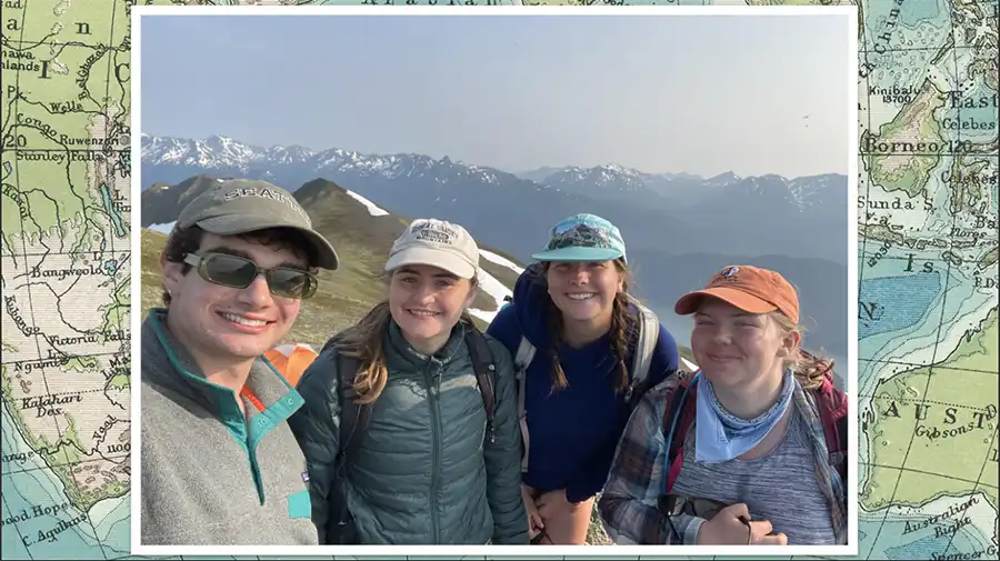
Awards Ceremony Photos
Welcome slides
Award slides
Awards Ceremony Photos

Congratulations to Ella Hunter, UTK Geography and Mathematics major, for receiving an NSF funded Research Experience Undergraduate (REU) internship at the University of Oklahoma this summer. Ella will utilize her concentration in Climate and Climate Change as part of the Real-World Research Experiences for Undergraduates in Atmospheric and Geographic Sciences within the National Weather Center under the supervision of Alex Marmo and Dr. Daphne LaDue. Ella will graduate in Spring 2024.
Website: https://www.caps.ou.edu/reu
Dear Students,
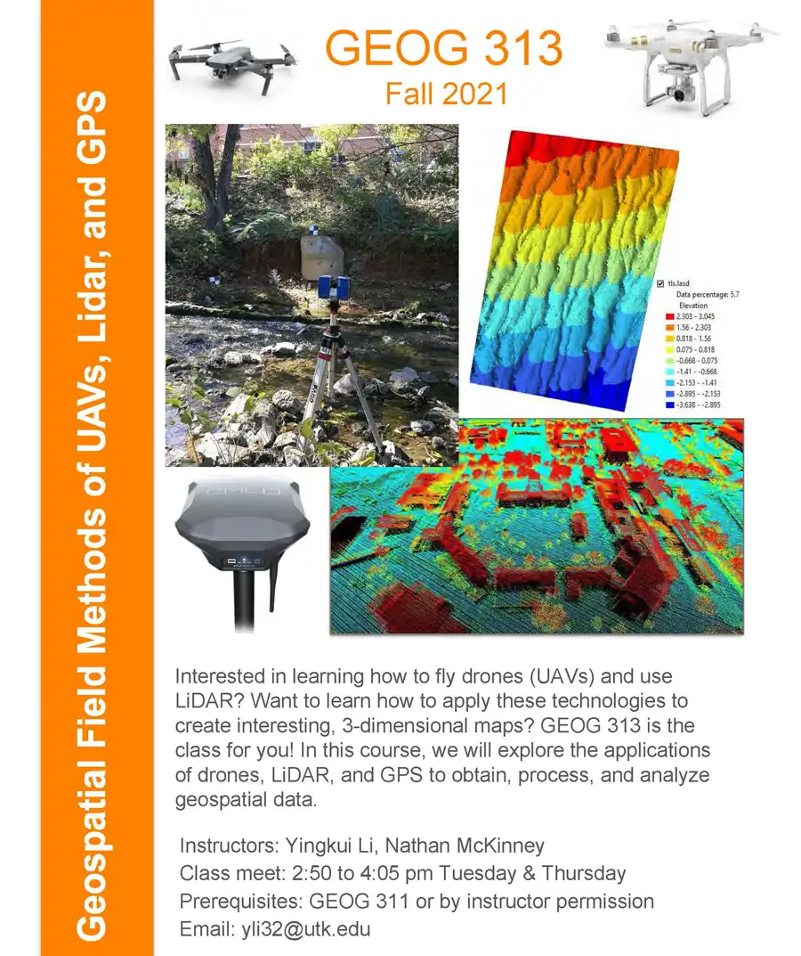
Professor Yingkui Li is offering two courses in Fall 2021 that may be of interest to you. Please see the flyers below. Feel free to email Professor Li if you have any questions.
Geospatial Field Methods of UAVs, Lidar, and GPS
Interested in learning how to fly drones (UAVs) and use LiDAR? Want to learn how to apply these technologies to create interesting, 3-dimensional maps? GEOG 313 is the class for you! In this course, we will explore the applications of drones, LiDAR, and GPS to obtain process, and analyze geospatial data.
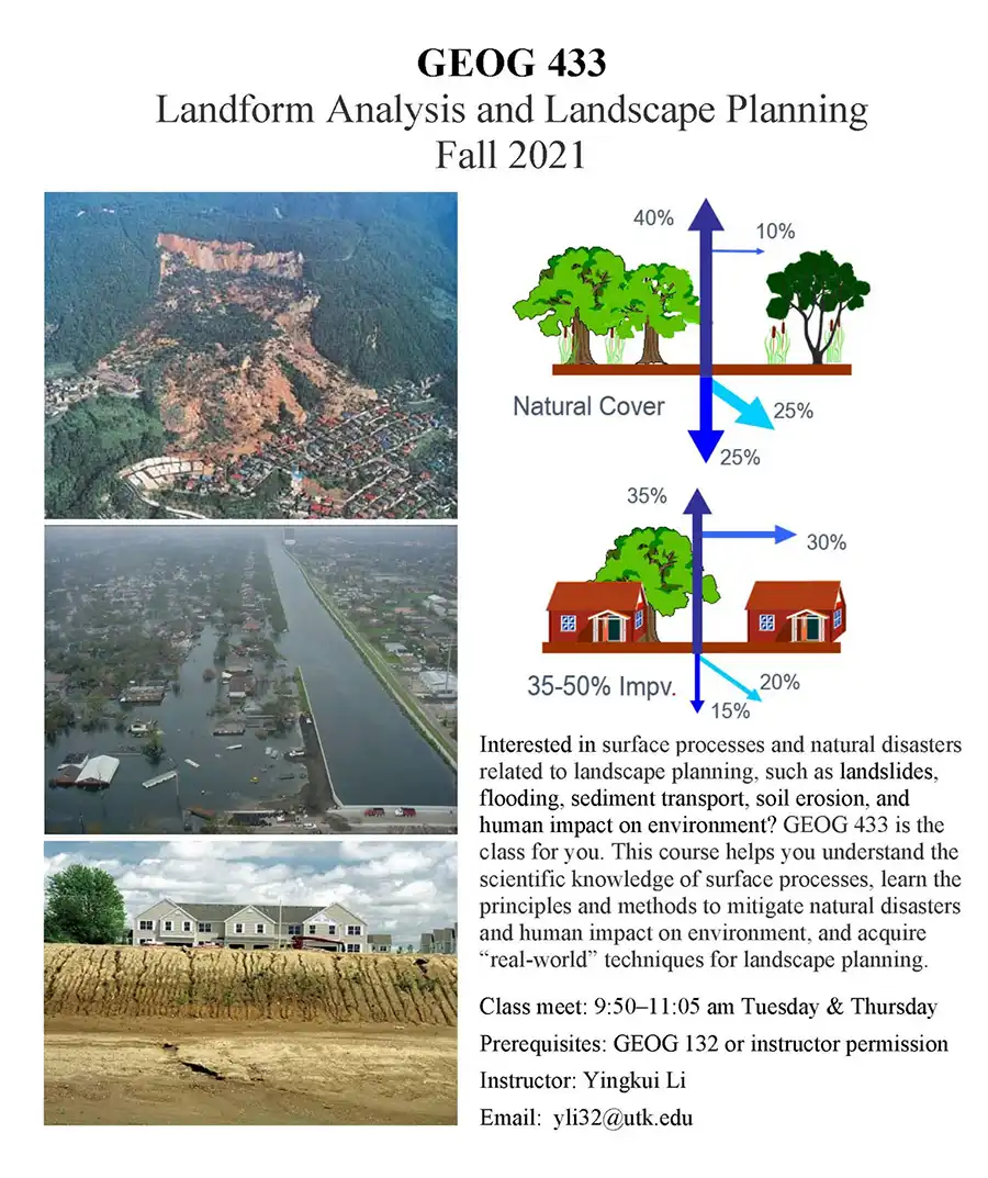
Landform Analysis and Landscape Planning
Interested in surface processes and natural disasters related to landscape planning, such as landslides, flooding, sediment transport, soil erosion, and human impact on environment? GEOG 433 is the class for you. This course helps you understand the scientific knowledge of surface processes, learn the principles and methods to mitigate natural disasters and human impact on environment, and acquire “real-world” techniques for landscape planning.
UTK Geography graduate student Jamie Alumbaugh received a research grant from the Paleoenvironmental Change specialty group at the April 2021 meeting of the American Association of Geographers. The grant will support her dissertation research using ancient sedimentary DNA along with other evidence in lake sediment cores to understand long-term patterns of environmental change and human-environment interactions in the Andes mountains of Ecuador.
UTK Geography Professor Sally Horn received the Karl and Elisabeth Butzer Award for Lifetime Achievement in the study of Paleoenvironmental Change at the April 2021 meeting of the American Association of Geographers. Presented to Sally by the Paleoenvironmental Specialty Group, this award is named after the late Karl Butzer, a geographer who specialized in the study of sedimentary and archaeological evidence of past environments, and his wife and research partner, Elisabeth Butzer, whose continuing research focuses on archival evidence of environmental change. Sally received the award in recognition of her efforts, along with dozens of collaborators and graduate and undergraduate students at the University of Tennessee and elsewhere, to document the long-term environmental history of the circum-Caribbean region, South America, and the southeastern U.S. based on lake sediments and other natural archives.
Source: http://news.aag.org/2020/12/2021-aag-honors
Dr. Carol Harden, the 2021 recipient of the AAG’s Lifetime Achievement Honors, is the quintessential field scientist, professional association leader, and effective science communicator. She has been at the forefront of advancing geography’s role in the natural sciences, whether in the AAG, National Research Council, National Geographic Society, or National Science Foundation. Over a half-century career, Harden has established herself as one of the leading figures in contemporary physical geography and environmental science. More broadly, she has had a tremendous influence across our entire discipline, owing to the many roles she has played at the University of Tennessee, AAG, National Research Council, and National Geographic Society, and as editor of Physical Geography.
Since the 1980s, Harden has done fieldwork in the Andes, including a year on a Fulbright to Ecuador. Her commitment to international fieldwork and diversity in geography and other field disciplines and her encyclopedic knowledge of physical geography allows her to evaluate critically, and advocate for support of, fieldwork, especially by diverse scholars from around the world. In addition to her Latin American research, she has generated a substantial body of research in the U.S., mainly in Appalachia, on soil erosion, watershed hydrology, water quality, and human impacts.
Harden is currently the Chair of the Geographical Sciences Committee and a Member of the Board on Earth Sciences and Resources, both for the National Academies of Science, Engineering, and Medicine (NASEM). She was recently a member of the prestigious and influential Committee on Research and Exploration of the National Geographic Society. She has also served as a member and Chair of the Nominations Committee, Geology, and Geology Section, American Association for the Advancement of Science (AAAS). Harden was a member (2017) and then Chair (2016-2020) of the Geographical Sciences Committee (GSC-NASEM). In 2010-2012, Harden served first as Vice President and then as President of the American Association of Geographers. She is a compassionate listener and a fair-minded leader. Harden is a mentor with an impact on cultivating new and early-career disciplinary leaders. She does this with a clear vision of geography’s role in science, higher education, and society, allowing her to see and realize new opportunities and build new initiatives. A strong sense of collegiality and caring has allowed her to engage in constructive and productive dialog across several disciplinary divides. For these qualities and achievements, the AAG recognizes Carol Harden as the 2021 recipient of the AAG Lifetime Achievement Honors.
Jennifer Weeks, The Conversation
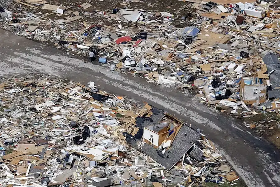
Springtime in the U.S. is frequently a season for thunderstorms, which can spawn tornadoes. These large storms are common in the South and Southeast in March and April, then shift toward the Plains states in May. Scientists have warned that 2021 could be an active tornado year, partly because of a La Niña climate pattern in the tropical Pacific Ocean. Past research has suggested that La Niña increases the frequency of tornadoes and hail by concentrating hot, humid air over Texas and other Southern states, which helps to promote storm formation.
These four articles from The Conversation’s archives explain how tornadoes form, why night tornadoes are more deadly, and how in rare cases thunderstorms can take a different but equally destructive form – a derecho. We also look at a neglected aspect of disaster response: disposing of massive quantities of waste.
Most tornadoes are spawned by large, intense thunderstorms called supercell thunderstorms. The key ingredients are rising air that rotates, and wind shear – winds at different altitudes blowing at different speeds, and/or from different directions.
Forecasters can’t always predict when or where a tornado may form, but they are very good at identifying the conditions that have the potential to support strong tornadoes. As Penn State university meteorologists Paul Markowski and Yvette Richardson explain,
“The National Weather Service’s Storm Prediction Center routinely predicts large outbreaks days in advance. ‘High-risk’ outlooks capture most major tornado events, and strong tornadoes rarely occur outside of tornado watches. We have less ability to forecast tornadoes in more marginal situations, such as within non-supercell storms.”
Tornado strikes are bad news at any time, but especially when they occur at night. Night tornadoes are more than twice as likely to be fatal as daytime twisters, for several reasons: They are harder for storm spotters to see, people may sleep through alerts, and victims are more likely to be in vulnerable structures such as mobile homes at night.
Night tornadoes are more common in the South because of regional atmospheric conditions there. University of Tennessee geographer Kelsey Ellis and Middle Tennessee State University geoscientist Alisa Hass write that communication challenges are a serious problem in their state, where nearly half of tornadoes strike at night.
“Experts in Tennessee recommend having multiple methods for receiving warnings at night,” they note. “This strategy allows for backup options when power goes out, cellphones go down or other unforeseen circumstances occur.”
What causes some supercell thunderstorms to become tornadoes?
In rare instances, weather systems can generate organized lines of thunderstorms called derechos, from the Spanish word for “straight ahead.” For a storm to qualify as a derecho, it has to produce winds of 57.5 mph (26 meters per second) or greater. And those intense winds must extend over a path at least 250 miles (400 kilometers) long, with no more than three hours separating individual severe wind reports.
Most areas of the Central and eastern U.S. may experience a derecho once or twice a year on average. They occur mainly from April through August, but they can also occur earlier in spring or later in fall. And they can inflict heavy damage. A derecho that swept across the Midwest in August 2020 generated over US$7.5 billion in damages – the nation’s most costly thunderstorm.
Derechos can be even harder to predict than tornadoes, and once they form, they can move very fast. As Colorado State University atmospheric scientist Russ Schumacher warns,
“Communities, first responders and utilities may have only a few hours to prepare for an oncoming derecho, so it is important to know how to receive severe thunderstorm warnings, such as TV, radio and smartphone alerts, and to take these warnings seriously. Tornadoes and tornado warnings often get the most attention, but lines of severe thunderstorms can also pack a major punch.”
Tornadoes and other natural disasters often leave huge quantities of debris behind – uprooted trees, splintered buildings, smashed cars and more. It can take communities months or even years to clean up, and the process typically is slow, expensive and dangerous.
Sybil Derrible of the University of Illinois–Chicago, Juyeong Choi of Florida State University and Nazli Yesiller of California Polytechnic State University study urban engineering, disaster management and planning, and waste management. They see a need for new technologies and strategies that officials can use to figure out what materials storm debris contains and find options for separating, reusing and recycling it.
“For example, drones and autonomous sensing technologies can be combined with artificial intelligence to estimate amounts and quality of debris, the types of materials it contains and how it can be repurposed rapidly. Technologies that allow for fast sorting and separation of mixed materials can also speed up debris management operations,” they write.
“Turning the problem around, creating new sustainable construction materials – especially in disaster-prone areas – will make it easier to repurpose debris after disasters.”
Editor’s note: This story is a roundup of articles from The Conversation’s archives.
[Get the best of The Conversation, every weekend. Sign up for our weekly newsletter.]
Jennifer Weeks, Senior Environment + Energy Editor, The Conversation
This article is republished from The Conversation under a Creative Commons license. Read the original article.

Each year, Dean Theresa Lee and members of her cabinet, with help from department heads, recognize faculty in the College of Arts and Sciences for their excellence in teaching, research and creative activity, and lifetime achievements.
Due to the ongoing pandemic, however, we were unable to host the annual awards banquet in-person. Each faculty member received a plaque and congratulations from the dean. We posted a video to the college YouTube channel here, which features each faculty award winner.
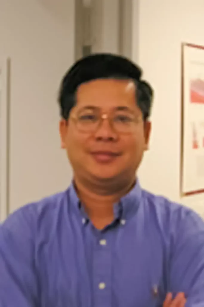
Liem Tran, professor of geography, received a Faculty Academic Outreach Research Award from the College of Arts and Sciences. The award recognizes extraordinary contributions of faculty to the public that occur as an outgrowth of academic pursuits and are related to the university’s academic mission. It recognizes faculty whose research and creative activities advance knowledge through the pursuit of their scholarly interests while simultaneously addressing community problems and issues and benefiting the scholar, the discipline, the university, and society.
Tran conducts research built on creating strategic collaborative networks with government agencies, major research labs, and other community stakeholders and leveraging innovative geospatial analysis. A number of Tran’s measures and spatial models are widely used by the EPA across the US. Recently, he has collaborated with the EPA to develop the EnviroAtlas, an interactive web-based platform used by states, communities, and citizens that provides geospatial data, easy-to-use tools, and other resources related to ecosystem services, their chemical and nonchemical stressors, and human health. Tran has used his expertise in geospatial analysis to develop a series transmission models posted on the Tennessee State Data Center’s COVID-19 dashboard that estimates coronavirus reproduction rates and hotspots in the state.
Tran is also actively involved in meaningful public communication of science. For example, he has interacted with media to explain the metrics to measure the spread of COVID-19 and authored a policy brief in partnership with the Baker Center to educate the public on COVID-19 modeling and forecasts. Well before engaging in important research outreach to COVID-19, Tran had begun focusing state of the art geospatial technologies, including Geographic Information Systems (GIS) and web-based applications, to combat the opioid crisis.
“The award is very important not only to myself, but also to my students and colleagues who have been working diligently alongside with me in various research outreach activities,” Tran said. “It shows the commitment of faculty and students in the geography department to serve the great state of Tennessee and its people, especially during this difficult time due to the COVID-19 pandemic.”
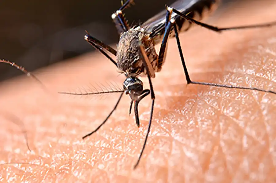
In 2018, under the leadership of Becky Trout Fryxel, associate professor of medical and veterinary entomology, a unique team of partners from the UT Departments of Plant Pathology, Geography, and Theory and Practice in Teacher Education, the Tennessee Geographic Alliance (TGA), and Brian Smith, a local middle school teacher, were successful in procuring a three-year grant from the US Department of Agriculture for the Medical Entomology & Geospatial Analyses: Bringing Innovation to Teacher Education & Surveillance Studies (MEGA:BITESS) project. It leverages medical entomology, geospatial techniques, and geographic pedagogies by providing professional development for grades 6-12 educators.
The project’s relevance to the East Tennessee community is its focus on La Crosse encephalitis, the leading pediatric arbovirus transmitted by mosquitoes in the continental United States. Independently, the fields of entomology and geospatial sciences are understaffed. When combined, the result is decreased surveillance and increased response times for pathogen detection, which puts human and animal health and food security at risk.
The project’s long-term goal is to develop an informed Science, Technology, Engineering, Arts, and Math (STEAM) teaching community that integrates inquiry-driven learning with community-needed service projects. To do this, the team developed a yearlong academy that includes three in-service workshops, classroom support for educator/student inquiry-driven surveillance programs, and student-developed educational material for the local community. The year-two cohort is currently implementing research protocols in their middle and high school classrooms.
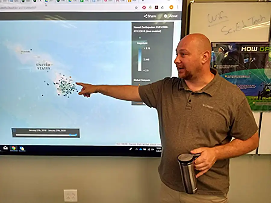
Brian Smith (’05), a social studies and GIS teacher at Jefferson Middle School in Oak Ridge, is key to the success of the program. For almost a decade now, Smith has designed and facilitated geospatial technologies teacher professional development programs for the Tennessee Geographic Alliance. Many of these have been in partnership with the UT Department of Geography. His unique skillset combines an ever-expanding understanding of geospatial software, how it can effectively be used in the K-12 classroom, and an engaging teaching style that highlights equal parts pedagogy and patience.
The MEGA:BITESS project is unique because it directly engages students in authentic scientific research in the field. Students prepare and set ovitraps in locations around their school to collect data weekly using egg papers and datasheets, and then record that data in a Google form that can combine the ovitraps’ geographic location and physical surroundings. Since this data is provided for analysis by the University of Tennessee Institute of Agriculture, students are excited about working with UT. It is also important to them since La Crosse encephalitis affects young people because they do not have the immune systems to fight off the disease, which is difficult to detect.
“In a very real way, students see this as a chance to make an impact in their community,” Smith said.
Smith assists Michael Camponovo, GIS outreach coordinator, in educating participating teachers how use and create geographic data with ArcGIS Online and GIS mapping applications like Survey123. He has also developed lessons for teachers to use to build their GIS skills they can share with their students.
“This is incredibly important since entomology and geospatial skills are not typically taught to preservice teachers; resulting in a critical need to increase the awareness of agricultural sciences and to develop students with the desire to pursue entomology and geospatial technologies as career pathways,” said Smith, who appreciates getting to work with Camponovo. “Not only does Mike lead the GIS skill sessions, he also brings in state and national leaders as speakers (Zoom and in-person) to demonstrate how GIS is used in a variety of STEAM-related fields.”
Smith credits the TGA with his growth as a teacher by providing leadership opportunities at regional geographic leadership institutes. Additionally, the two have recently worked together to provide teacher professional development using GIS, Google mapping tools, geographic themed inquiry-based learning, the Golden Age of Islam: (Human) Geography and Geometry Project, and the upcoming Mythical Cartography Workshop (2021) where participants will learn artistic techniques to share with their students to create hand-drawn maps.
“Working with the TGA has given me the opportunity to grow by learning and sharing with numerous geographers and teachers across the state.”
