• Request Info
  • Visit
  • Apply
  • Give
  • Request More Info
  • Visit
  • Apply
  • Give

Search

A-Z Index Map

Geography and Sustainability

  • About
    • Facilities
    • Alumni
    • Research & Community Partners
    • Geographic Links
  • Areas of Study
    • Physical Geography
    • GIST
    • Human Geography
    • Sustainability
  • People
    • Faculty
    • Staff
    • Graduate Students
    • Adjunct & Affliated Faculty
    • Alumni
    • Emeritus
  • Undergraduate
    • Where Can a Geography Degree Take You?
    • Majors
    • Minors
    • Certificates
    • Advising
    • Forms
    • Apply
  • Graduate
    • MS Program
    • PhD Program
    • Apply
    • Graduate Handbook
    • Forms
  • Student Engagement
    • Clubs
    • Community Engagement
    • Awards
    • Internship and Employment
    • Study Abroad
  • News & Events
    • Statements
    • Share Your News
    • Newsletters
    • News
    • Events
    • Geography Awareness Week
    • GeoSym
topography background

News

Department News

Statue of soldiers

Katrina Stack Published in ‘The Conversation’

December 8, 2023

Gettysburg tells the story of more than a battle − the military park shows what national ‘reconciliation’ looked like for decades after the Civil War
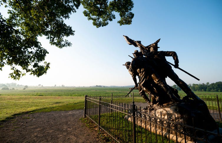
a war memorial statue
The North Carolina memorial stands in Gettysburg National Military Park on Aug. 10, 2020. Bill Clark/CQ-Roll Call, Inc via Getty Images

Katrina Stack, University of Tennessee and Rebecca Sheehan, Oklahoma State University


On Nov. 19, 1863, President Abraham Lincoln traveled to Gettysburg, Pennsylvania, to dedicate a cemetery at the site of the bloodiest battle of the Civil War. Four months before, about 50,000 soldiers had been killed, wounded or captured at the Battle of Gettysburg, later seen as a turning point in the war.

In his now-famous address, Lincoln described the site as “a final resting place for those who here gave their lives that (their) nation might live,” and called on “us the living” to finish their work. In the 160 years since, 1,328 monuments and memorials have been erected at Gettysburg National Military Park – including one for each of the 11 Confederate states.
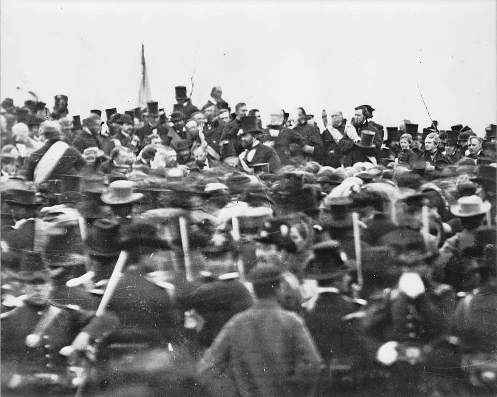
A black and white photo of a crowd of men in coats and stovepipe hats.
Abraham Lincoln, seated at center, before delivering the Gettysburg Address. Library of Congress/Getty Images

Confederate memorials in the American South have attracted scrutiny for years. In October 2023, a statue of Gen. Robert E. Lee was melted down in Charlottesville, Virginia, six years after plans to remove it spurred the violent “Unite the Right” rally.

Gettysburg has received relatively little attention, yet it occupies a unique space in these debates. The battlefield is one of the most hallowed historic sites in the country, and, unlike other areas with memorials to Confederate soldiers, is located in the North. The military park’s history offers a window into the United States’ attitude toward postwar reconciliation – one often willing to overlook racial equality in the name of national and political unity.

The ‘Mecca of Reconciliation’

Today, Gettysburg draws nearly a million visitors each year. In addition to visiting the museum, visitors can drive or walk among the monuments and plaques that cover the landscape, dedicated to both Union and Confederate troops. There are markers that explain the events of the battle, as well as monuments dedicated to individual people, military units and states.

As with any war memorial, particularly for a civil war, Gettysburg commemorates an event whose survivors held dramatically different views of its meaning. In his book “Race and Reunion,” historian David Blight identifies three main narratives of the Civil War. One emphasizes the “nobility of the Confederate soldier” and cause, while another focuses on the emancipation of slaves. The third is the “reconciliationist” view, with the notion that “all in the war were brave and true,” regardless of which side they fought for.

We are cultural geographers who study commemorative landscapes, with a focus on issues of race and memory. In our view, Gettysburg is a prime example of that reconciliation narrative: a site that aims to reconcile the North and the South more than it addresses the racial motivations of the conflict. The park’s own administrative history refers to Gettysburg as an “American Mecca of Reconciliation.”

No praise, no blame

From 1864 until 1895, the battlefield was under the administration of the Gettysburg Battlefield Memorial Association, which placed markers along military units’ battle lines.

Starting in 1890, the U.S. War Department began actively preserving Civil War battlefields. Congress approved the creation of a commission of Union and Confederate veterans to mark the armies’ positions at Gettysburg with tablets that each bore “a brief historical legend, compiled without praise and without censure.” These policies were also included in the Regulations for the National Military Parks, published in 1915.

This guiding idea – “without praise and without censure” – was also evident at ceremonies for the battle’s 50th anniversary in 1913. Reconciliation was central in speeches and formal photographs, many featuring elderly veterans from both sides shaking hands.
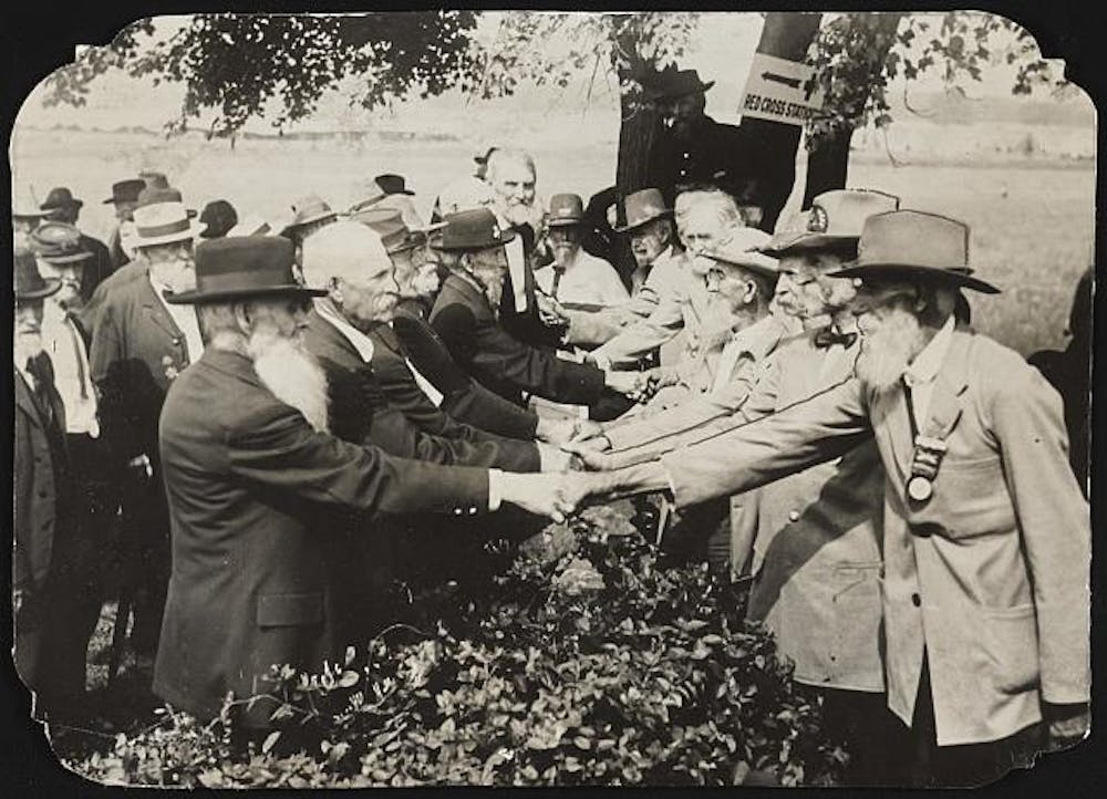
A black and white photo shows two rows of elderly men in suits -- one row in black, the other in light-colored fabric -- shaking hands.
Union and Confederate veterans pictured at 50th anniversary events in Gettysburg, Pa. Liljenquist Family Collection of Civil War Photographs/Library of Congress

At the time, there were no monuments to Confederate states; most markers, both for Union and Confederate troops, were for individual battle units.

State memorials

In 1912, the Virginia Gettysburg Commission had submitted plans for an equestrian statue of General Lee and other figures, with an inscription saying the state’s sons “fought for the faith of their fathers.” The chairman of the Gettysburg National Park Commission, however, had warned that such a statue would likely not be approved by the War Department because “inscriptions should be without ‘censure, praise or blame.‘” The chairman said that while “they fought for the faith of their fathers” might be true for Virginians, “it certainly opens the inscription to not a little adverse criticism.”

Eventually, the state commission agreed to inscribe simply, “Virginia to her sons at Gettysburg” – creating the first Confederate state monument.

But enforcement of the no praise, no blame policy was uneven.

Efforts to erect a monument for Mississippi, for example, began in the early 1960s. The state commission’s intended inscription read:

On this ground our brave sires fought for their righteous cause
Here, in glory, sleep those who gave to it their lives
To valor they gave new dimensions of courage
To duty, its noblest fulfillment
To posterity, the sacred heritage of honor.

The park superintendent pointed to two objections, however: first to the use of “righteous” and second to “here,” since Southern soldiers’ bodies were mostly relocated after the battle.

Mississippi Supreme Court Judge Thomas Brady, who collaborated on the inscription, wrote to the monument commission expressing his frustration over the objection to the “righteous cause” language. Even the “South’s most bitter critics … never questioned that the South felt that its cause was righteous,” he noted.

“The South has had the most to forgive in this matter and the South has forgiven,” Brady wrote. “Let us hope that the North has done likewise.”

In late 1970, a new superintendent was put in place at Gettysburg. Mississippi’s commission asked him to revisit the “righteous cause” wording – and expressed “genuine pleasure” that the new superintendent was a fellow Mississippian.

The monument was dedicated in 1973, with the “righteous cause” language included in its inscription.
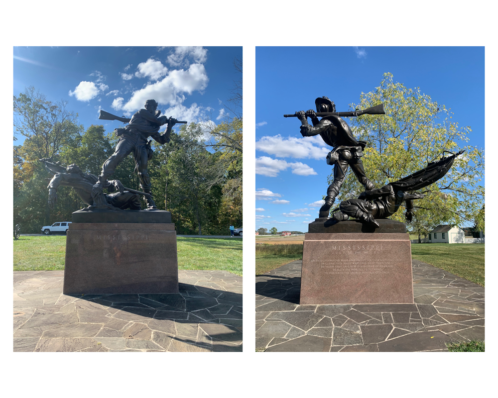
Two side-by-side photos of a statue on a pedestal, showing one man swinging a rifle as he steps over the other one.
The Mississippi state monument at Gettysburg today. Katrina Stack Finkelstein, CC BY-ND

‘Unfinished work’

From the start, the policies for monuments at Gettysburg called for a commemorative landscape that would recall the actions of those who fought and died on the battlefield. In reality, several monuments scattered over the landscape perpetuate the Lost Cause myth, which argues that the Confederate states’ chief goal was simply to protect the sanctity of state rights – whitewashing the atrocities of slavery and romanticizing the antebellum South.

In recent decades, however, the park has begun to do more to emphasize slavery in its historical exhibits and descriptions.

National Park management policy treats commemorative works as historic features reflecting “the knowledge, attitudes, and tastes of the persons who designed and placed them.” As a result, the monuments cannot be “altered, relocated, obscured, or removed, even when they are deemed inaccurate or incompatible with prevailing present-day values.”

The Gettysburg website notes that legislation and compliance with federal laws would be required to move many monuments.

When Lincoln traveled to Gettysburg, he called for Americans to dedicate themselves “to the unfinished work” of the Union dead, and to dedicate a portion of the battlefield to their memory. A century and a half later, however, the site also illustrates a messy postwar debate: the U.S.’s struggle to reconcile sharply opposed understandings of the Civil War.

This article has been updated to correct information about casualties at the Battle of Gettysburg.The Conversation

Katrina Stack, PhD Student, University of Tennessee and Rebecca Sheehan, Professor of Geography, Oklahoma State University

This article is republished from The Conversation under a Creative Commons license. Read the original article.
Filed Under: Department News, Featured News, Human Geography

Painting of a woman in a golden frame

Who Was Lillian Stimson?

October 21, 2023

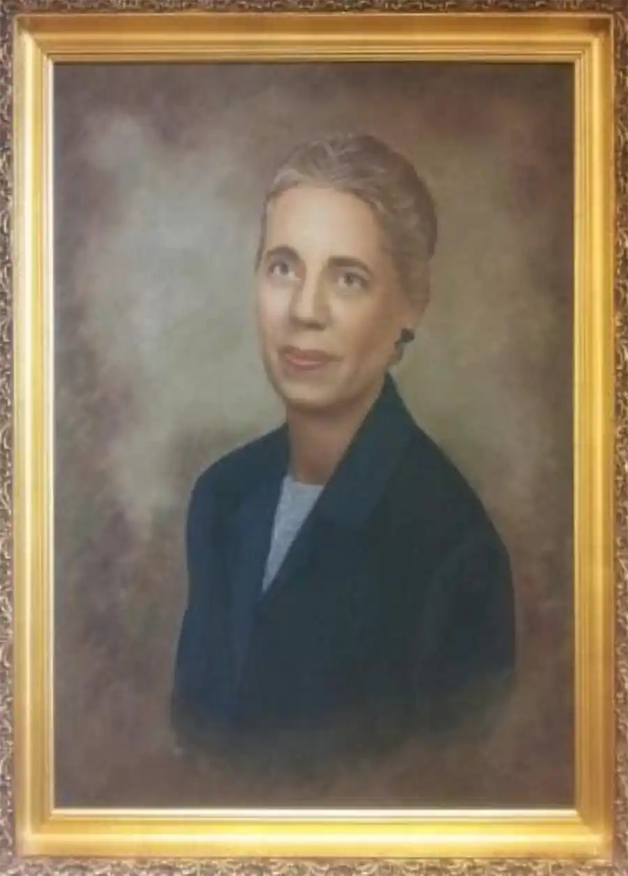
Portrait of Lillian Stimson

For many in the Department of Geography and Sustainability, the name “Lillian Stimson” probably does not immediately ring a bell, although her portrait hangs in Burchfiel 406, the geography main conference area. Lillian Worley Stimson was a faculty member in the department of Geography for many years and an important female voice in the academic discipline.

Professor Stimson joined UT in 1948 after teaching at Alabama College. She received a MA from University of Wisconsin in 1933 and a PhD from the University of North Carolina in 1949. Stimson was hired at UT as a result of the dramatic increase in student enrollment following World War II. She served on the faculty until the late 1960s. On May 17 of 1968, she died of injuries suffered in a car accident she had near Franklin, Tennessee, in 1966.

Stimson’s interests included geographic education, the American South, conservation, politics, and urban studies. In 1965, she hosted a National Defense Education Act (NDEA) Institute at UT. Long-time Department Head Sid Jumper noted that Stimson “spearheaded” Tennessee’s ties with the NDEA Fellowship Program, which later funded many graduate students in the program. A memorial statement written about Stimson indicated that she “was active in promoting the involvement of women in education and gave considerably of her time in Delta Kappa Gamma, an international honor society for women educators, and to the American Association of University of Women.”

Stimson was able to claim some important “firsts” within geography. She was the first female Chair/President of the Southeastern Division of the Association of American Geographers (SEDAAG), holding that position in 1949. Not until the early 1990s would SEDAAG elect another woman as President. In 1964, Stimson became the first (and thus far, the only) female editor of The Southeastern Geographer, the official peer-reviewed journal of the Southeastern Division of the AAG.

The role of women in the history of UT geography is not limited to Stimson. Julia Shipman was the first female with a Ph.D. to teach geography at UT. A graduate of Clark University, she taught in the 1920s when we were the Department of Geology, Geography, and Mineralogy. Shipman was the beginning of a series of important women geographers at UT who included Stimson and, more recently, Lydia Pulsipher (now emeritus), Sally Horn, and Carol Harden. Pulsipher is the author of a widely read world regional textbook.

A Chancellor’s Professor since 2008, Horn is one of the most accomplished faculty members on campus. Former Department Head Carol Harden served as President of the Association of American Geographers, becoming in 2009 the 10th female to be elected to that prestigious position. More recently, Harden and Horn were joined in the department by Madhuri Sharma, LaToya Eaves, Hannah Herrero, Karen King, Nikki Luke, Solange Muñoz, Anna Marshall, Tracey Norrell, Mayra Román-Rivera and Kelsey Ellis–who represent a new generation of innovative female scholars in geography.

Filed Under: Department News, Human Geography

Detroit Skyline Hart Plaza

Dr. Derek Alderman interviewed by Detroit’s NPR Station

July 31, 2023

Derek AldermanOur esteemed colleague, Dr. Derek Alderman, was recently interviewed by Detroit’s NPR Station to discuss the proposal to rename Hart Plaza in honor of Dr. Martin Luther King Jr. Detroit City Councilmember Mary Waters has put forth the proposal to rename the iconic plaza, and Dr. Alderman was invited to join Ms. Waters and other guests on the Detroit Today show to discuss the topic. In case you missed it, you can listen to Dr. Alderman’s insightful contribution to the conversation here (his interview begins at 43:43).

An image of the Detroit Skyline

Filed Under: Department News, Featured News, Human Geography

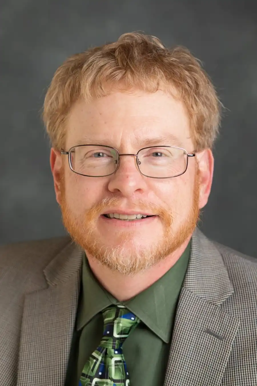
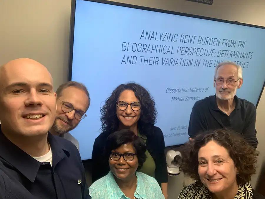
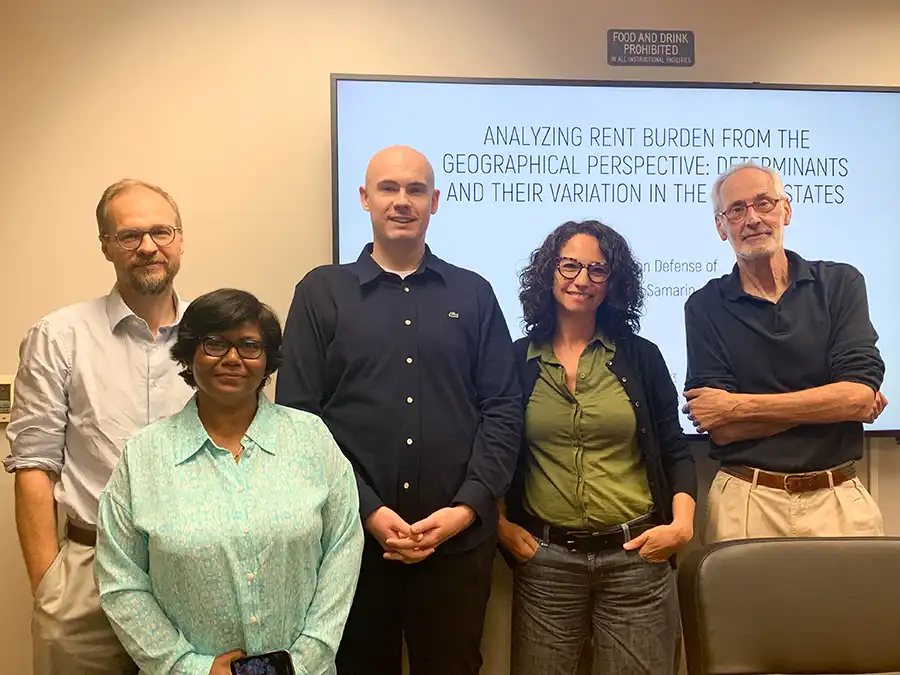
Dr. Mikhal Samarin with his committee members from Geography & Sustainability

Mikhail Samarin defended his dissertation

June 22, 2023

Mikhail Samarin defended his dissertation

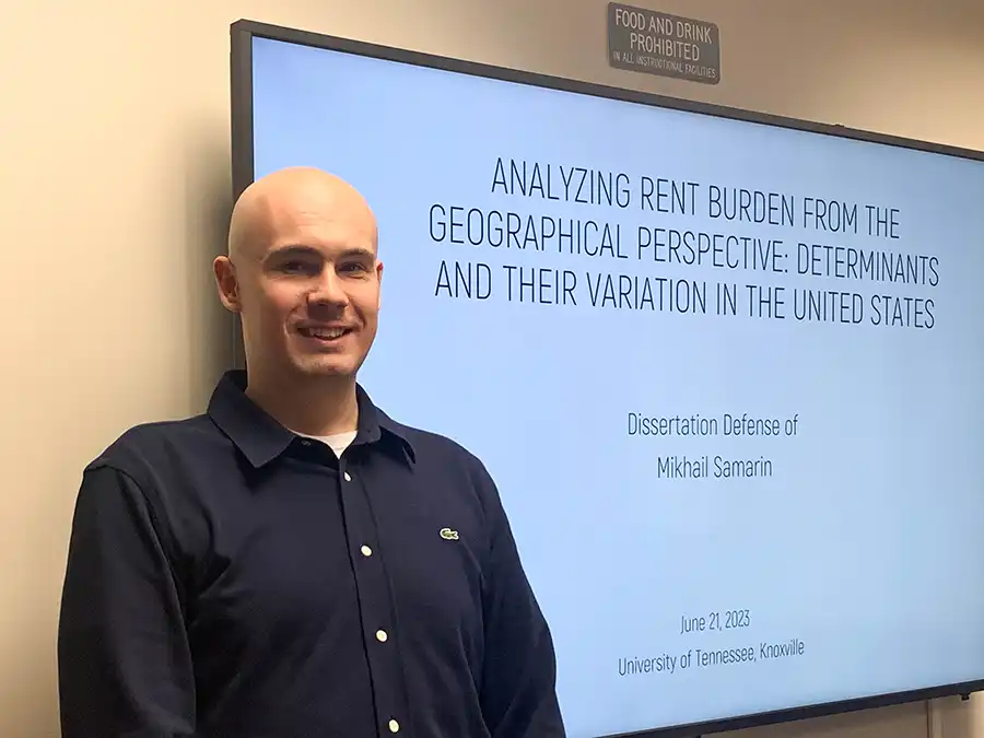
Congratulations to Dr. Mikhail Samarin who successfully defended his dissertation titled “Analyzing Rent Burden from the Geographical Perspective: Determinants and Their Variation in the United States” on 21st June 2023. His committee members comprise Dr. Nicholas Nagle, Dr. Solange Muñoz, Dr. Ronald Foresta, Dr. Avigail Sachs (College of Architecture & Design), and Dr. Madhuri Sharma (Chair of the committee). Dr. Samarin completed his Ph.D. in a record time of four years and during this time at the UTK, he has published seven manuscripts in highly ranked journals such as Growth & Change, GeoJournal, Geographical Review, International Journal of Applied Geospatial Research, and International Journal of Geospatial and Environmental Research, and his eight manuscript is currently under-review. He hopes to have a very productive academic career in the USA. Our best wishes to him!!

Dr. Mikhal Samarin
Dr. Mikhal Samarin
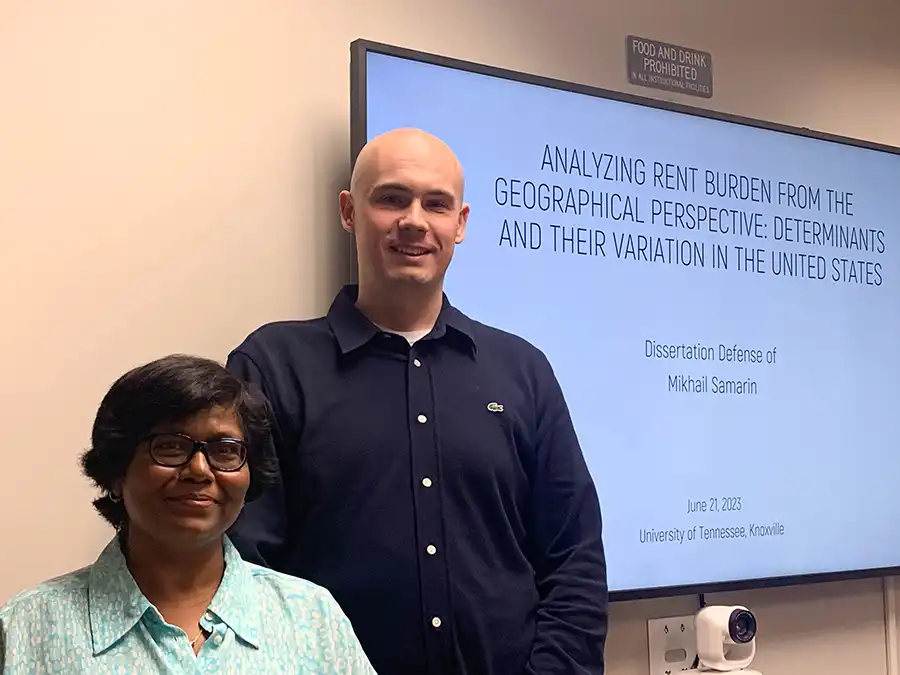
Dr. Mikhail Samarin with his advisor Dr. Madhuri Sharma
Dr. Mikhal Samarin with his committee members from Geography & Sustainability
Dr. Mikhail Samarin with his full committee members

Filed Under: Department News, Human Geography

Graceful introduction by Prof. Archana Roy, Dept. of Migration & Urban Studies, IIPS, Mumbai

Dr. Madhuri Sharma’s mapping of UTK’s Geography & Sustainability at a global platform

June 22, 2023

Dr. Madhuri Sharma’s mapping of UTK’s Geography & Sustainability at a global platform

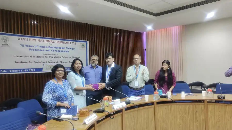
I was honored to be invited by several highly prestigious institutes in India during my Spring 2023 sabbatical semester. These included the International Institute for Population Sciences (IIPS)-Mumbai, the Institute for Social and Economic Change (ISEC) at Bengaluru, the Center for Study of Science, Technology and Policy (C-STEP), Bengaluru, School of Planning and Architecture-Bhopal, and University of Delhi, among others. I was proud and happy to represent our Department of Geography & Sustainability and disseminate knowledge, share and learn from the academic audience in India through these research presentations and workshops. Some of the most interesting events and photos are shown below.

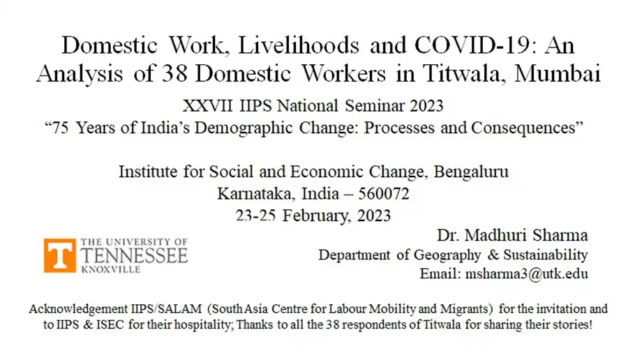
Event 1: Research presentation at the seminar co-organized and co-hosted by the IIPS and ISEC, at Bengaluru, India. The topic was: “Domestic Work, Livelihoods and COVID-19: An Analysis of 38 Domestic Workers in Titwala, Mumbai.” I also served as a Discussant for numerous sessions organized by the newly created South Asia Centre for Labour Mobility and Migrants (SALAM)-IIPS at this seminar.

Flyer for Domestic Work, Livelihoods, and COVID-19

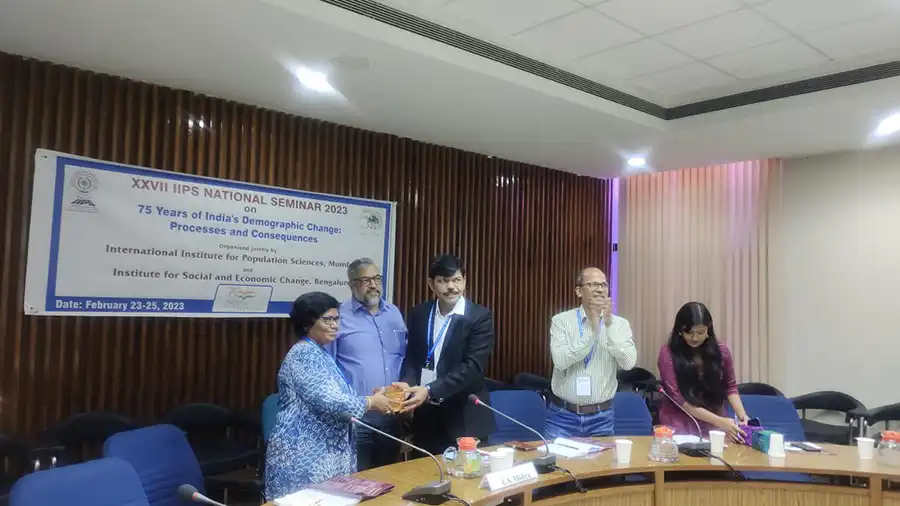
Few photos from this event where Dr. Sharma was honored to serve as a discussant for several sessions organized at this seminar, jointly co-organized by IIPS and ISEC at Bengaluru:

Receiving the memento from IIPS for serving as a Discussant on the sessions by the South Asia Centre for Labour Mobility and Migrants (SALAM) project (ISEC-IIPS jointly hosted Seminar, February 23-25, 2023)
Faculty and students from the South Asia Centre for Labour Mobility and Migrants (SALAM) project at the ISEC-IIPS jointly hosted Seminar, February 23-25, 2023

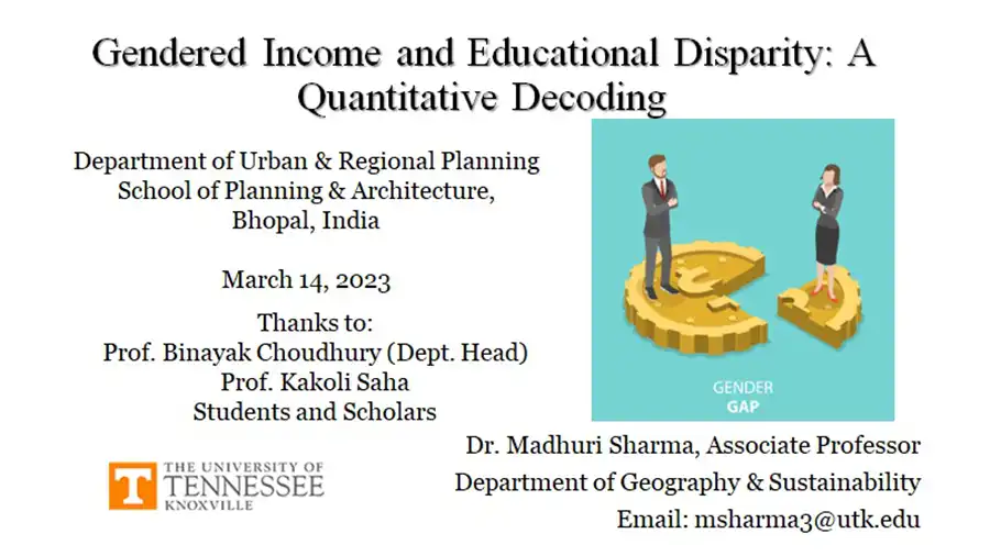
Event 2: School of Planning and Architecture, Bhopal, India: Honored to be invited by the School of Planning & Architecture, Bhopal, to demonstrate application of quantitative skills in social science research. I created a workshop-styled presentation for the MSs and B.Sc. students of SPA-Bhopal. This lecture was followed by an interactive SPSS demonstration for all participants. Proud of being a Vol abroad here in India.  

Gendered Income and Educational Disparity Flyer

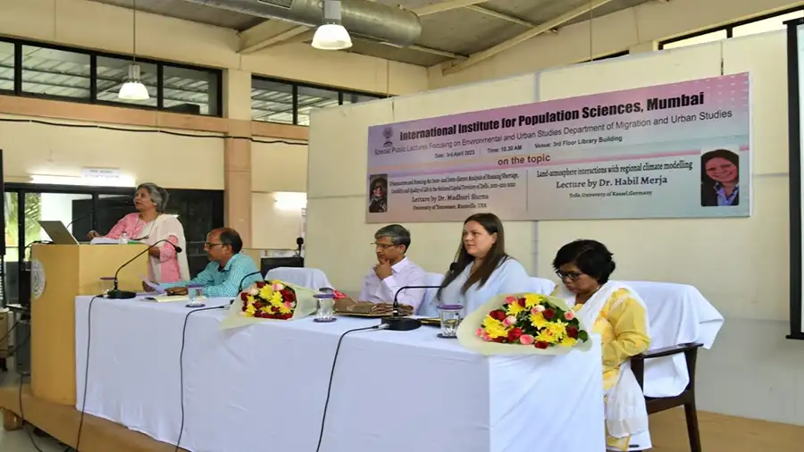
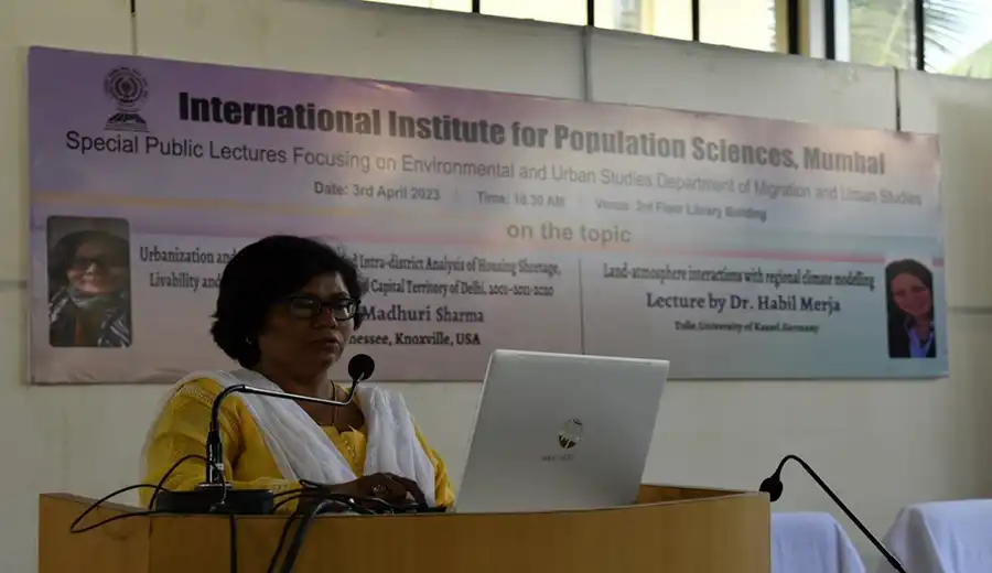
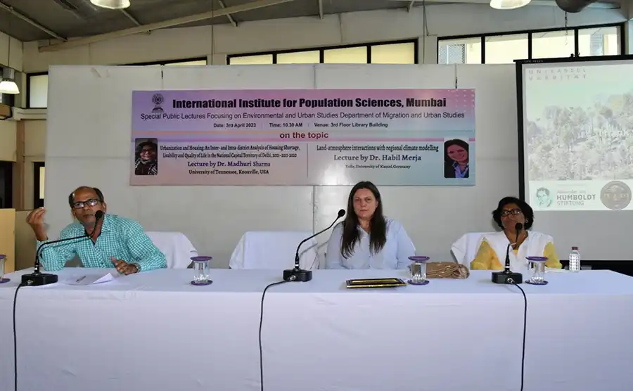
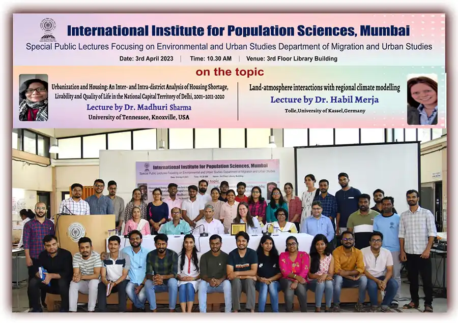
Event 3: Public Lecture at the International Institute for Population Sciences (IIPS), Mumbai: Honored to be invited to deliver a public lecture at the International Institute for Population Sciences (Mumbai) on 3rd April 2023. The topic was: Urbanization and Housing: An Inter- and Intra-district Analysis of Housing Shortage, Livability and Quality of Life in the National Capital Territory of Delhi, 2001–2011–2020. Few pics from this public event are below:

Graceful introduction by Prof. Archana Roy, Dept. of Migration & Urban Studies, IIPS, Mumbai
Dr. Sharma delivering the public lecture at IIPS, Mumbai, 3rd April 2023
Questions & Answers session after the public lecture on 3rd April 2023 at IIPS, Mumbai.
Faculty and Students of the Department of Migration and Urban Studies and SALAM, IIPS, Mumbai.

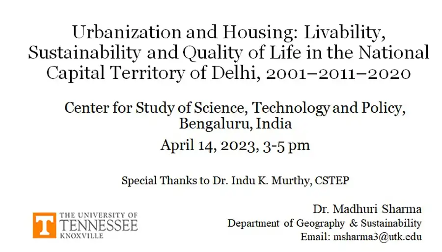
Event 4: Center for Study of Science, Technology and Policy (C-STEP), Bengaluru, India, 14 April 2023: I was very happy to deliver an invited research lecture at the C-STEP, Bengaluru. My topic was “Urbanization and Housing: Livability, Sustainability and Quality of Life in the National Capital Territory of Delhi, 2001–2011–2020.” This presentation was heard by a global audience of C-STEP from India and its branches in other countries of the world. This was a truly interactive long session wherein several new ideas emerged during the Q&A session.

A flyer for Urbanization and Housing

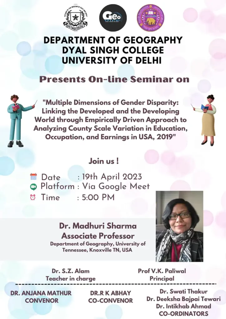
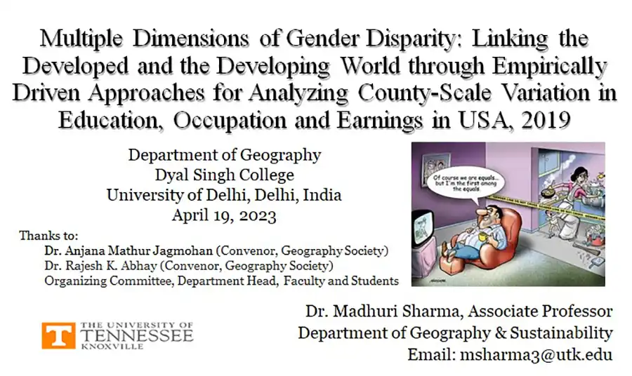
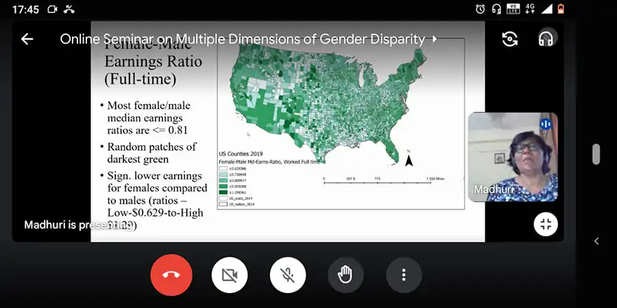
Event 4: An invited seminar for undergrads/grads at Univ. of Delhi. These students wanted to learn about my work on USA. So I presented about gender economic disparity and commonalities at global scale!!

A flyer for Multiple Dimensions of Gender Disparity

A flyer for Dimensions of Gender Disparity
Questions & Answers session after the conclusion of Madhuri Sharma's talk
Questions & Answers session after the conclusion of my talk

Filed Under: Department News, Featured News, GIST, Human Geography

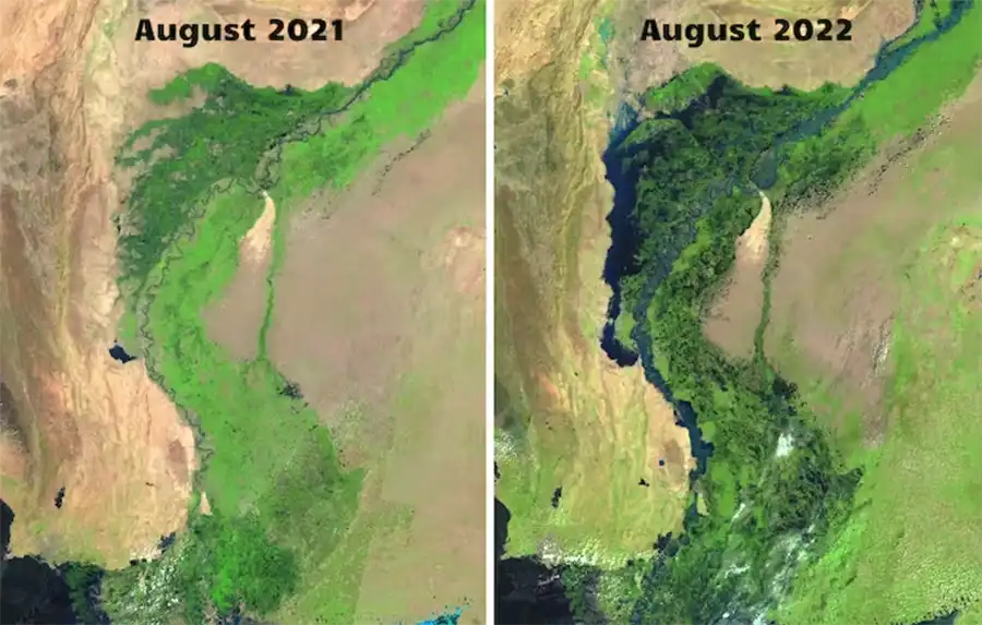
Landsat satellite images showing a side-by-side comparison of southern Pakistan in August 2021 (one year before the floods) and August 2022 (right), Images from The Conversation

How to use free satellite data to monitor natural disasters and environmental changes

March 21, 2023

How to use free satellite data to monitor natural disasters and environmental changes

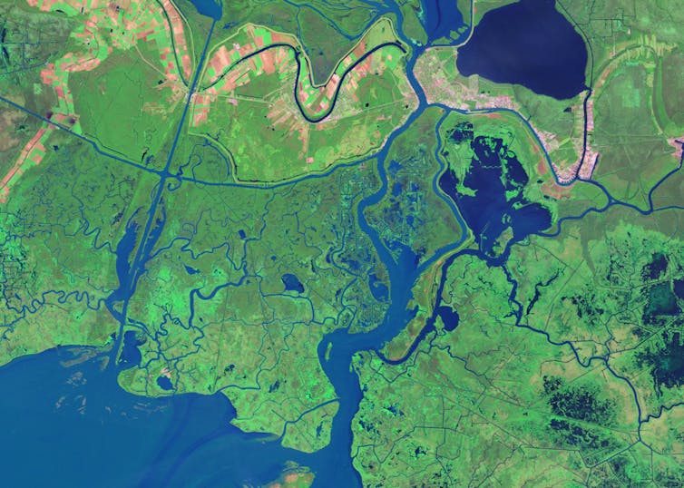
Satellite image of the Louisiana coast
Over 8,000 satellites are orbiting Earth today, capturing images like this, of the Louisiana coast.
NASA Earth Observatory

Qiusheng Wu, University of Tennessee

If you want to track changes in the Amazon rainforest, see the full expanse of a hurricane or figure out where people need help after a disaster, it’s much easier to do with the view from a satellite orbiting a few hundred miles above Earth.

Traditionally, access to satellite data has been limited to researchers and professionals with expertise in remote sensing and image processing. However, the increasing availability of open-access data from government satellites such as Landsat and Sentinel, and free cloud-computing resources such as Amazon Web Services, Google Earth Engine and Microsoft Planetary Computer, have made it possible for just about anyone to gain insight into environmental changes underway.

I work with geospatial big data as a professor. Here’s a quick tour of where you can find satellite images, plus some free, fairly simple tools that anyone can use to create time-lapse animations from satellite images.

For example, state and urban planners – or people considering a new home – can watch over time how rivers have moved, construction crept into wildland areas or a coastline eroded.

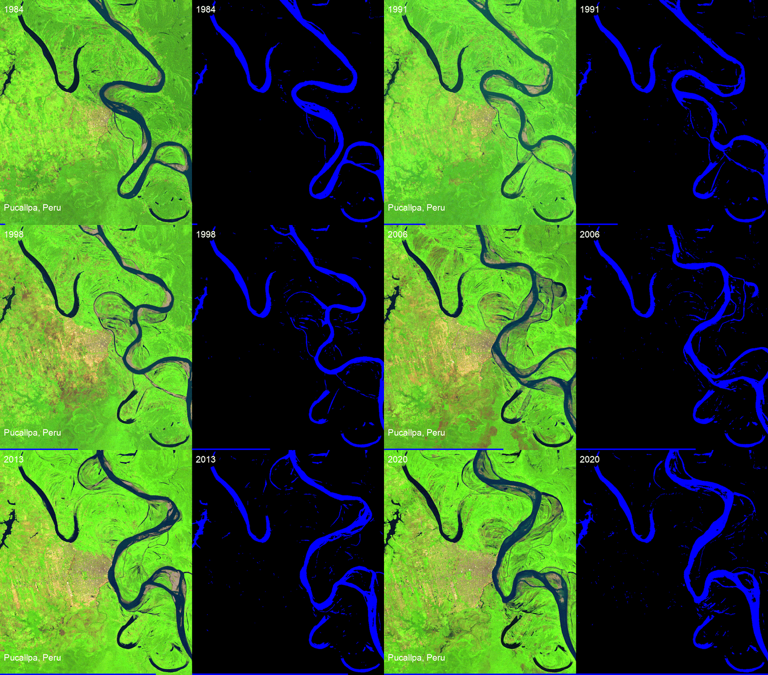
A squiggly river moves surprisingly quickly over time.
Landsat time-lapse animations show the river dynamics in Pucallpa, Peru.
Qiusheng Wu, NASA Landsat
Animation shows the shoreline shrinking.
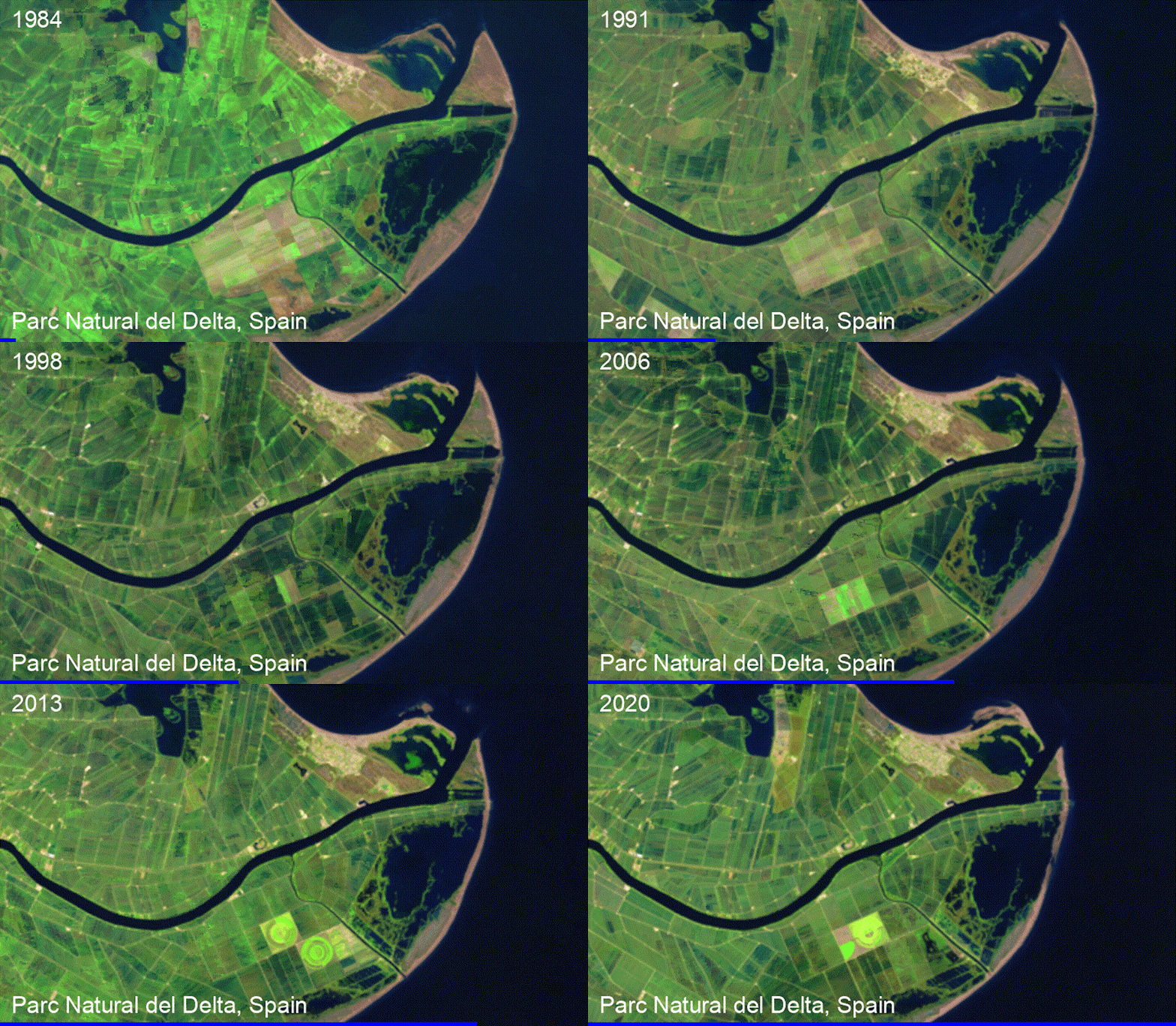
A Landsat time-lapse shows the shoreline retreat in the Parc Natural del Delta, Spain.
Qiusheng Wu, NASA Landsat

Environmental groups can monitor deforestation, the effects of climate change on ecosystems, and how other human activities like irrigation are shrinking bodies of water like Central Asia’s Aral Sea. And disaster managers, aid groups, scientists and anyone interested can monitor natural disasters such as volcanic eruptions and wildfires.

The lake, created by damming the river, has shrunk over time.
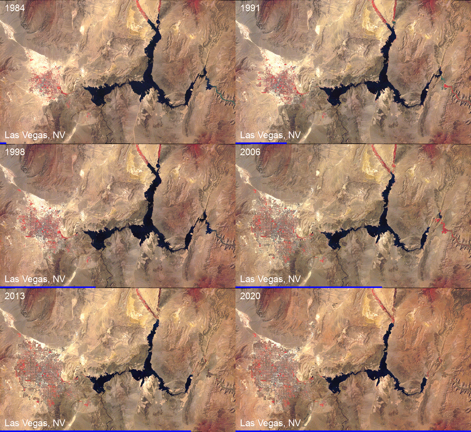
GOES images show the decline of the crucial Colorado River reservoir Lake Mead since the 1980s and the growth of neighboring Las Vegas.
Qiusheng Wu, NOAA GOES
A volcanic eruption bursts into view.
A GOES satellite time-lapse shows the Hunga Tonga volcanic eruption on Jan. 15, 2022.
Qiusheng Wu, NOAA GOES

Putting Landsat and Sentinel to work

There are over 8,000 satellites orbiting the Earth today. You can see a live map of them at keeptrack.space.

Some transmit and receive radio signals for communications. Others provide global positioning system (GPS) services for navigation. The ones we’re interested in are Earth observation satellites, which collect images of the Earth, day and night.

Landsat: The longest-running Earth satellite mission, Landsat, has been collecting imagery of the Earth since 1972. The latest satellite in the series, Landsat 9, was launched by NASA in September 2021.

In general, Landsat satellite data has a spatial resolution of about 100 feet (about 30 meters). If you think of pixels on a zoomed-in photo, each pixel would be 100 feet by 100 feet. Landsat has a temporal resolution of 16 days, meaning the same location on Earth is imaged approximately once every 16 days. With both Landsat 8 and 9 in orbit, we can get a global coverage of the Earth once every eight days. That makes comparisons easier.

Landsat data has been freely available to the public since 2008. During the Pakistan flood of 2022, scientists used Landsat data and free cloud-computing resources to determine the flood extent and estimated the total flooded area.

Images show how the flood covered about a third of Pakistan.
Landsat satellite images showing a side-by-side comparison of southern Pakistan in August 2021 (one year before the floods) and August 2022 (right)
Qiusheng Wu, NASA Landsat

Sentinel: Sentinel Earth observation satellites were launched by the European Space Agency (ESA) as part of the Copernicus program. Sentinel-2 satellites have been collecting optical imagery of the Earth since 2015 at a spatial resolution of 10 meters (33 feet) and a temporal resolution of 10 days.

GOES: The images you’ll see most often in U.S. weather forecasting come from NOAA’s Geostationary Operational Environmental Satellites, or GOES. They orbit above the equator at the same speed Earth rotates, so they can provide continuous monitoring of Earth’s atmosphere and surface, giving detailed information on weather, climate, and other environmental conditions. GOES-16 and GOES-17 can image the Earth at a spatial resolution of about 1.2 miles (2 kilometers) and a temporal resolution of five to 10 minutes.

Animation showing swirling clouds off the coast and the long river of moisture headed for California.
A GOES satellite shows an atmospheric river arriving on the West Coast in 2021.
Qiusheng Wu, GOES

How to create your own visualizations

In the past, creating a Landsat time-lapse animation of a specific area required extensive data processing skills and several hours or even days of work. However, nowadays, free and user-friendly programs are available to enable anyone to create animations with just a few clicks in an internet browser.

For instance, I created an interactive web app for my students that anyone can use to generate time-lapse animations quickly. The user zooms in on the map to find an area of interest, then draws a rectangle around the area to save it as a GeoJSON file – a file that contains the geographic coordinates of the chosen region. Then the user uploads the GeoJSON file to the web app, chooses the satellite to view from and the dates and submits it. It takes the app about 60 seconds to then produce a time-lapse animation.

TUTORIAL

INTERACTIVE WEB APP

How to create satellite time-lapse animations.

There are several other useful tools for easily creating satellite animations. Others to try include Snazzy-EE-TS-GIF, an Earth Engine App for creating Landsat animations, and Planetary Computer Explorer, an explorer for searching and visualizing satellite imagery interactively.The Conversation

Qiusheng Wu, Assistant Professor of Geography and Sustainability, University of Tennessee

This article is republished from The Conversation under a Creative Commons license. Read the original article.

Filed Under: Department News, Featured News, GIST, Physical Geography

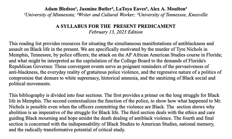
A Syllabus for the Present Predicament: A photo of the introductory text to the Syllabus

A Syllabus for the Present Predicament

February 14, 2023

A Syllabus for the Present Predicament

Adam Bledsoe¹, Jasmine Butler², LaToya Eaves³, Alex A. Moulton³

¹University of Minnesota; ²Writer and Cultural Worker; ³University of Tennessee, Knoxville 

A SYLLABUS FOR THE  PRESENT PREDICAMENT
February 13, 2023 Edition

This reading list provides resources for situating the simultaneous manifestations of antiblackness and assault on Black life in the present. We are specifically motivated by the murder of Tyre Nichols in Memphis, Tennessee, by police officers; the attack on the AP African American Studies course in Florida; and what might be interpreted as the capitulation of the College Board to the demands of Florida’s Republican Governor. These convergent events serve as poignant reminders of the pervasiveness of anti-blackness, the everyday reality of gratuitous police violence, and the regressive nature of a politics of compromise that demurs to white supremacy, historical amnesia, and the sanitizing of Black social and political movements.

This bibliography is divided into four sections. The first provides a primer on the long struggle for Black life in Memphis. The second contextualizes the function of the police, to show how what happened to Mr. Nichols is possible even when the officers committing the violence are Black. The  section shows why abolition is an imperative of the struggle for Black life. The third section deals with the ethics and care guiding Black mourning and hope amidst the death dealing of antiblack violence. The fourth and final section is concerned with the indispensability of Black Studies to American Studies, national memory, and the radically transformative potential of critical study. 

In addition to this syllabus, we encourage readers to consult the American Association of Geographers statements “On the Structural and Spatial Forces that Contribute to Police Brutality” and on “the targeting of diversity education and critical inquiry by U.S. States”.

Memphis Black History and Geographies

  • “I am a man!: Race, masculinity, and the 1968 Memphis sanitation strike.” Steve Estes
  • An Unseen Light: Black Struggles for Freedom in Memphis, Tennessee. Aram Goudsouzian and Charles McKinney (Eds.)
  • At the River I Stand. David Appleby, Allison Graham and Steven Ross (Directors). 
  • Beale Street Dynasty: Sex, Song, and the Struggle for the Soul of Memphis— Preston Lauterbach
  • This Ain’t Chicago : Race, Class, and Regional Identity in the Post-Soul South. Zandria F. Robinson.
  • Crusade for Justice : The Autobiography of Ida B. Wells, Second Edition. Ida B. Wells.
  • Chocolate Cities The Black Map of American Life Marcus Anthony Hunter, Zandria F. Robinson
  • Development Arrested: The Blues and Plantation Power in the Mississippi Delta – Clyde Woods
  • The South is Everywhere
  • Environmental justice activist leads fight against lead exposure in Black and brown communities – MLK50
  • ‘A victory for us’: Southwest Memphis residents elated as developers drop Byhalia Pipeline project – MLK50: Justice Through Journalism
  • Kellogg workers on why they went on strike for two months – Scalawag

Police, State Violence, and The Imperative of Abolition

  • “Cautionary Notes on Black Policing”. Adam Bledsoe
  • Policing the planet: Why the policing crisis led to Black Lives Matter.  Jordan T. Camp and Christina Heatherton (Eds.) 
  • Who do you serve, who do you protect?: Police violence and resistance in the United States. Alicia Garza
  • “Fatal Couplings of Power and Difference: Notes on Racism and Geography”. Ruth Wilson Gilmore.
  • “Abolition Geography and the Problem of Innocence” in Futures of Black Radicalism. Ruth Wilson Gilmore.
  • Abolition geography: Essays towards liberation. Ruth Wilson Gilmore.
  • We still here: Pandemic, policing, protest, & possibility. Marc Lamont Hill (Frank Barat, Ed.)
  • Race, media, and the crisis of civil society: From Watts to Rodney King. Ronald Jacobs. 
  • “On plantations, prisons, and a black sense of place”. Katherine McKittrick.
  • “Black police officers aren’t colorblind.” Rashad Shabazz
  • From #BlackLivesMatter to black liberation. Keeanga-Yamahtta Taylor
  • “Neoliberalisation of security, austerity and the ‘end of public policy’” Simone Tulumello.
  • Police: A field guide. David Correia and Tyler Wall
  • “Life after Death.”  Clyde A. Woods. 
  • “No humans involved”. Sylvia Wynter
  • Becoming Abolitionist: Police, Protests, and the Pursuit of Freedom Derecka Purnell
  • Some cities treat gun violence as a public health crisis. Should Memphis? – MLK50
  • Editorial: Resistance lives in the South
  • Where do the police come from?
  • The Struggle Continues: A report by Andrea J. Ritchie and Interrupting Criminalization

Black Mourning, Care, and Hope

  • Freedom is a constant struggle. Angela Y. Davis
  • “We Wear the Mask.” LaToya E. Eaves
  • Black Life Matter: Blackness, Religion, and the Subject. Biko Mandela Gray 
  • There is no healing in an antiblack world Da’Shaun Harrison
  • All about love: new visions. bell hooks
  • “Persevering almost killed one of Memphis’ most prominent artists: She doesn’t want you to make the same mistake – MLK50: Justice Through Journalism” Victoria Jones and  Jacob Steimer
  • Sister Outsider. Audre Lorde
  • “The ‘Radical’ Welcome Table: Faith, Social Justice, and the Spiritual Geography of Mother Emanuel in Charleston, South Carolina.” Priscilla McCutcheon.  
  • “A tribute to Orange Mound, where Blackness is celebrated every day – MLK50” Andrea Morales and Zaire Love
  • Beloved. Toni Morrison
  • “Black monument matters: Place‐based commemoration and abolitionist memory work” Alex Moulton
  • In the wake: On blackness and being. Christina Sharpe.
  • How we get free: Black feminism and the Combahee River Collective. Keeanga-Yamahtta Taylor (Ed.) 
  • On Witness and Respair: A Personal Tragedy Followed by Pandemic Jesmyn Ward
  • Memorial for Alton Sterling, Baton Rouge, Louisiana, 2016. Willie Jamaal Wright. 
  • “What we do when we don’t want to remember – MLK50: Justice Through Journalism” Nubia Yasin
  • “Worn Out” Katherine McKittrick

The Radical Promise of Black Studies beyond the AP African American Studies

  • “Everybody’s Protest Novel.” In Notes of a Native Son. James Baldwin.
  • Black Reconstruction in America: Toward a history of the part which black folk played in the attempt to reconstruct democracy in America, 1860-1880. W.E.B. Du Bois
  • “Meet the Southern librarians fighting for racial justice and truth-telling” Jason Christian
  • All the Women Are White, All the Blacks Are Men, But Some of Us Are Brave. Akasha (Gloria T.) Hull, Patricia Bell-Scott, and Barbara Smith. (Eds.)
  • We do this’ til we free us: Abolitionist organizing and transforming justice. Mariame Kaba.
  • Freedom dreams: The black radical imagination. Robin D.G. Kelley.
  • Vision and justice. A civic curriculum. Sarah Lewis.
  • Blackstudies. In The Collected Poems of Audre Lorde. Audre Lorde
  • South to America: A journey below the Mason-Dixon to understand the soul of a nation. Imani Perry.
  • “The Meaning of African American Studies” Keeanga-Yamahtta Taylor
  • The warmth of other suns: the epic story of America’s great migration. Isabel Wilkerson.
  • “W.E.B. Du Bois, Black History Month and the importance of African American studies” Chad Williams
  • “Do You Know What it Means to Miss New Orleans?: Katrina, Trap Economics, and the Rebirth of the Blues.” Clyde Woods
  • “On how we mistook the map for the territory, and reimprisoned ourselves in our unbearable wrongness of being, of desêtre: Black studies toward the human project.” Sylvia Wynter
  • “But What Does Wonder Do? Meanings, Canons, too? On literary Texts, Cultural Contexts, and What it’s Like to be One/Not One of Us.” Sylvia Wynter.

Download the Syllabus

Filed Under: Department News, Featured News, Human Geography

Headshot photo

Spring colloquium on Feb. 2, 2023

January 30, 2023

Spring colloquium on Feb. 2, 2023

Joe Tuccillo

UrbanPop: A Spatial Microsimulation Framework for Exploring Demographic Influences on Human Dynamics

Speaker: Joe Tuccillo, PhD, Geospatial Science and Human Security Division, Oak Ridge National Laboratory

DATE: THURSDAY, FEBRUARY 2, 2023 | TIME: 4:05-5:20 PM

AUDITORIUM: NURSING EDUCATION BUILDING (NEB) 302 (OPEN TO THE PUBLIC)

Abstract: Human dynamics models, which address how people live, move, and interact, are critical to promote effective and equitable public service delivery, develop policy interventions, and provide responses to natural and technological hazards at the neighborhood and community scales. The UrbanPop spatial microsimulation framework developed at Oak Ridge National Laboratory (ORNL) supports human dynamics modeling by generating high-fidelity representations of individual demographics during the nighttime and daytime using synthetic populations derived from public-use American Community Survey (ACS) data.

In this talk, Dr. Tuccillo will provide a survey of research highlights from various applications of UrbanPop, including estimating social vulnerability, understanding healthcare access among underserved populations during the COVID-19 pandemic, and assessing environmental justice issues related to urban extreme heat events. Additionally, Dr. Tuccillo will discuss efforts to develop Likeness, a new Python software stack for UrbanPop designed to increase the framework’s reproducibility for a variety of research aims, as well as expand modeling capabilities to real-world transportation networks and building occupancy characteristics.

Colloquium Flyer (PDF)

Filed Under: Department News, GIST, Human Geography

Headshot photo

Eaves Named AAG 2023 Fellow

January 14, 2023

Eaves Named AAG 2023 Fellow

LaToya Eaves headshot photo

LaToya Eaves, assistant professor in the Department of Geography and Sustainability, was named a 2023 Fellow of the American Association of Geographers (AAG). Eaves is one of 16 geographers in a variety of practice areas recognized for their contributions to geographic research, advancement of practice, and careers devoted to strengthening the field of geography, including teaching and mentoring. The honorary title of AAG Fellow is conferred for life.

Her research interest is at the intersections of race, gender, diaspora, critical geography and queer studies. Eaves explores the geographic imaginaries of Blackness, gender, and queerness by bringing critical approaches to the social transformation of places, the nuances of region, and lived experiences under rights-based progress narratives. 

Her research has been published in Geoforum, Dialogues in Human Geography, Gender, Place & Culture, The Professional Geographer, and Journal of Geography in Higher Education, among other journals and edited volumes. 

She has received numerous accolades within geography, including but not limited to the UT Department of Geography’s Outstanding Faculty Teaching Award, Academic Advancement Award by the Tennessee LGBT+ College Conference, the Ronald F. Abler Distinguished Service Honors by the AAG, and the Enhancing Diversity Award by the AAG.

AAG Fellows serve the AAG as an august body to address, contribute to, and at times create initiatives to advance the discipline. Fellows also advise AAG on strategic directions and challenges, and mentor early- and mid-career faculty. The Fellows will be formally recognized in March at the AAG 2023 annual meeting.

Contributions to the Field of Geography

Eaves has established a record of transformative research, dynamic teaching, and dedicated mentoring in the field of geography. Her contributions to the fields of Black Geographies, Black feminism, queer geographies, and the US South are particularly noteworthy. Eaves’s rigorous and accessible scholarship pushes geography as a discipline to engage with the importance of Black geographic thought and practices in the production of space and place. Her scholarship provides accessible entry points for students to engage with Black Geographies, and she has contributed foundational texts for scholars doing work within Black Geographies literature.

One of the founders of the Black Geographies Specialty Group, Eaves’s organization and caring mentorship has transformed the discipline of geography and provided a space and academic home for Black scholars and scholars of Black Geographies. She is a generous and caring mentor as well. Her reputation within the geography community broadly and within the Black Geographies community specifically speaks to her generous mentorship of students and junior scholars, much of which is invisible, uncompensated, and unrecognized work in institutional settings. She has been committed to recognizing and honoring senior Black scholars, organizing panels, special issues of journals, and award applications to assure that these senior scholars are recognized for their foundational contributions.  

Beyond the subfield of Black Geographies, Eaves has served the AAG in the roles of national councilor, treasurer and chair of the Finance Committee. She also contributed to the AAG Harassment Free Task Force and the AAG Task Force on Diversifying the Curriculum in Geography, and she co-chaired the AAG New Orleans Featured Theme Committee. She has served as an editor for Dialogues in Human Geography and on numerous editorial boards.

Background information republished from the AAG website.

Filed Under: Department News, Featured News, Human Geography

Dr. Shaundra Cunningham with her advisor Dr. Madhuri Sharma at UTK Geography Commencement
Geography at the Fall 2022 Commencement Ceremony

December 18, 2022

Geography at the Fall 2022 Commencement Ceremony

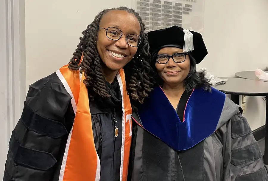
On December 16, our geography faculty and students attended the Fall 2022 Commencement Ceremony. Congratulations to Dr. Shaundra Cunningham and Dr. Heather Davis for their graduation! Below are some photos taken at the Commencement Ceremony.

Dr. Shaundra Cunningham hooded by her advisor Dr. Madhuri Sharma.

Dr. Shaundra Cunningham with her advisor Dr. Madhuri Sharma.

Dr. Shaundra Cunningham with her dad Rev. Cunningham.

Dr. Heather Davis with her advisor Solange Muñoz.

Filed Under: Department News

  • « Previous Page
  • 1
  • 2
  • 3
  • 4
  • 5
  • 6
  • …
  • 11
  • Next Page »

Recent Posts

  • Place‑name politics: Why outrage alone won’t erase Trump’s name
  • Research Shows Disparity in Indian Healthcare Access
  • Hurricanes devastated Florida’s East Coast – then seagrass made an unexpected comeback
  • As renaissance fairs become big business, can they retain their counterculture roots?
  • The Department of Geography and Sustainability is pleased to announce the S. David Freeman Sustainability Scholarship, applications now open!

Recent Comments

No comments to show.
an illustration of geographers engaged in research surrounding a globe

Geographers Engage With The World

Request More Information

Support The Department

Department of Geography and Sustainability

College of Arts and Sciences

Burchfiel Geography Building
1000 Phillip Fulmer Way
Room 304
Knoxville, TN 37996-0925
865-974-2418
utkgeog@utk.edu


Facebook Icon    X Icon    Instagram Icon    YouTube Icon

The University of Tennessee, Knoxville
Knoxville, Tennessee 37996
865-974-1000

The flagship campus of the University of Tennessee System and partner in the Tennessee Transfer Pathway.

ADA Privacy Safety Title IX